
Christmas Tree Trail
View Photos
Christmas Tree Trail
Difficulty Rating:
The Christmas Tree Trail is a moderate route in Flagstaff that runs along the base of Elden Mountain. It’s very easy to get to from the city and it’s suitable for most skill levels. This hike can be done on its own, or you can use the Christmas Tree Trail to access other routes in the extensive network of trails that lie below Elden Mountain. This route sees moderate traffic
Getting there
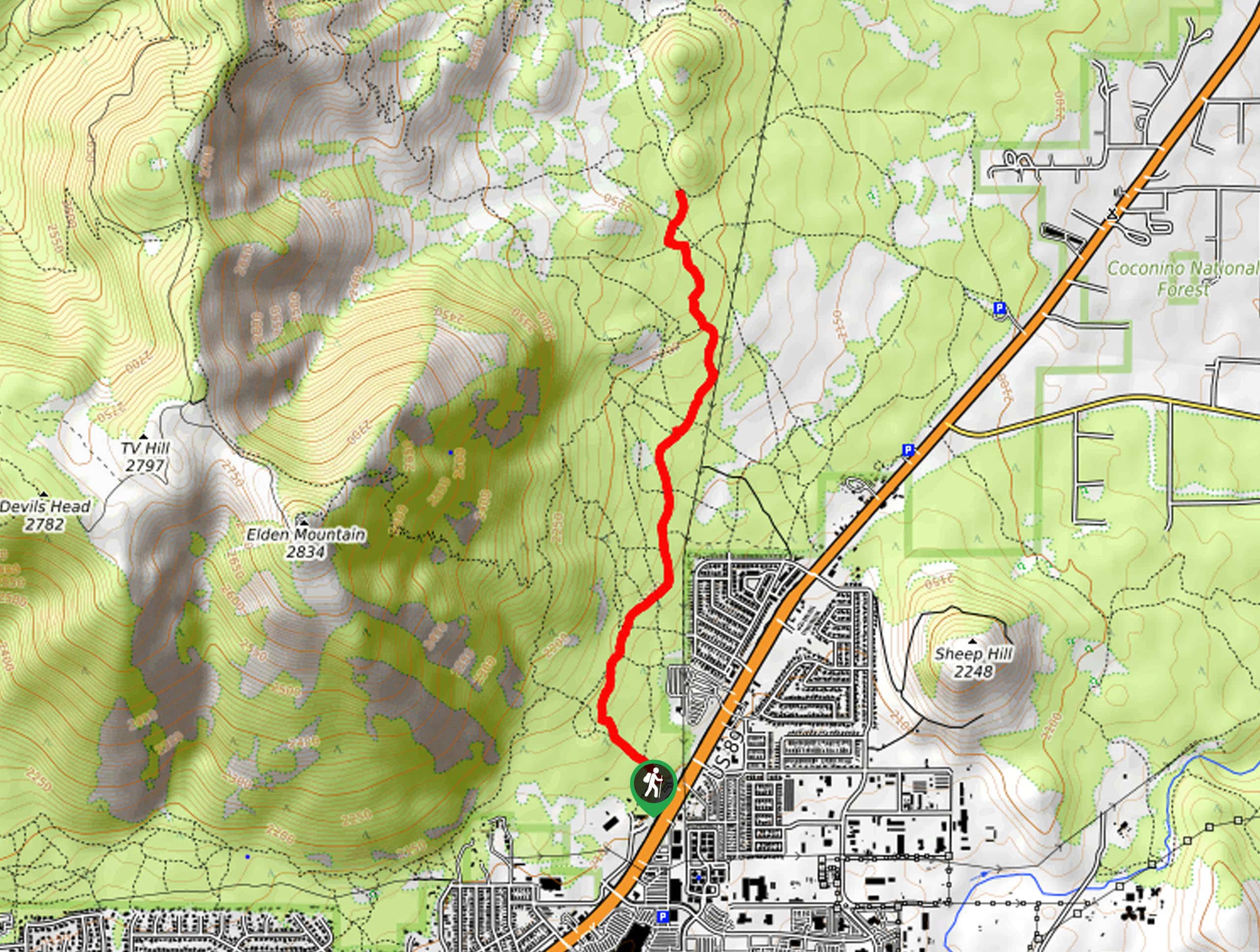
The trailhead for the Christmas Tree Trail is off US-89.

About
| Backcountry Campground | No |
| When to do | March-October |
| Pets allowed | Yes - On Leash |
| Family friendly | Yes |
| Route Signage | Average |
| Crowd Levels | Moderate |
| Route Type | Out and back |
Christmas Tree Trail
Elevation Graph
Weather
Christmas Tree Trail Description
The Christmas Tree Trail is a pleasant moderate hike that’s easy to get to from Flagstaff. It runs along the eastern base of Elden Mountain, and it can be hiked on its own or used as part of a longer adventure thanks to the network of trails in this area. This route can be used by hikers and mountain bikers.
You’ll have to deal with a bit of road noise to begin with, but the further you go down the trail, the more you’ll be able to appreciate nature without those distractions. Some users report relying on GPS navigation on parts of the trail affected by washout, so consider downloading your route.
From the trailhead, take Elden Lookout Trail towards the mountain, then bear right onto Fatman’s Loop Trail. At the 3-way junction, continue straight, then go right onto Christmas Tree Trail. Follow this path as it runs north, looking to your left for views of Elden Mountain. The route terminates in front of a hill, from where you’ll turn around and retrace your steps to the trailhead.
Similar hikes to the Christmas Tree Trail hike

Fay Canyon Loop
Fay Canyon is one of several main canyons in the Walnut Canyon National Monument. This loop hike explores part of…

Sandy Steps, Heart, and Upper Oldham Trail
The Sandy Steps, Heart, and Upper Oldham hike makes use of several different trails to create a hike that stretches…

Fisher Point via Fay Canyon
Fisher Point is one of the best viewpoints into the gorgeous Walnut Canyon. This route leads you to the point…
Comments