
Fort Valley Trail
View Photos
Fort Valley Trail
Difficulty Rating:
The Fort Valley Trail is a moderate route in the Fort Valley area north of Flagstaff, Arizona. There is a huge network of trails in this area, so you could easily spend the whole day adventuring out here. If you’re staying at the campsite near the trailhead, this route is an easy pick. It’s moderately difficult, but know that there is a bit of a prolonged uphill climb that might be tough for very young kids.
Getting there
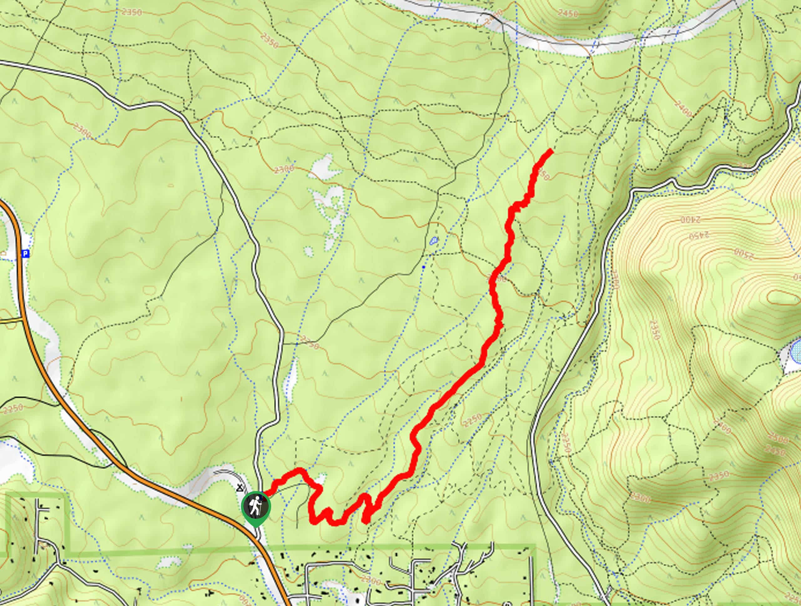
The trailhead for the Fort Valley Trail is on Fort Valley Road.

About
| Backcountry Campground | Flagstaff Forest Free Camping |
| When to do | March-November |
| Pets allowed | Yes - On Leash |
| Family friendly | Yes |
| Route Signage | Good |
| Crowd Levels | Low |
| Route Type | Out and back |
Fort Valley Trail
Elevation Graph
Weather
Fort Valley Trail Description
The Fort Valley Trail is a great adventure in the Fort Valley area north of Flagstaff, Arizona. This route is shared by hikers and mountain bikers and tends to be in very good condition. There are many, many trails that interconnect in this area, so you could easily spend a whole day adventuring if you wanted to.
This route sees light traffic, so expect to have a lot of it to yourself. While we rate it as moderate, keep in mind that there’s a longer uphill section that might be tough for very young children, and there’s not much shade, which can make hot days difficult. Bring water! Sturdy boots are also a good idea as parts of the trail are very rocky.
From the trailhead near the camping area, take the Moto Trail as it weaves its way between creeks and near trees. The route travels northeast, and most of the junctions are well-signed. Enjoy the quiet scenery. The route ends near the junction with the Arizona Trail, but you could easily keep hiking further if you wanted to. When you’re ready, turn around and retrace your steps.
Similar hikes to the Fort Valley Trail hike

Fay Canyon Loop
Fay Canyon is one of several main canyons in the Walnut Canyon National Monument. This loop hike explores part of…

Sandy Steps, Heart, and Upper Oldham Trail
The Sandy Steps, Heart, and Upper Oldham hike makes use of several different trails to create a hike that stretches…

Fisher Point via Fay Canyon
Fisher Point is one of the best viewpoints into the gorgeous Walnut Canyon. This route leads you to the point…
Comments