Hart Prairie Loop Trail
View Photos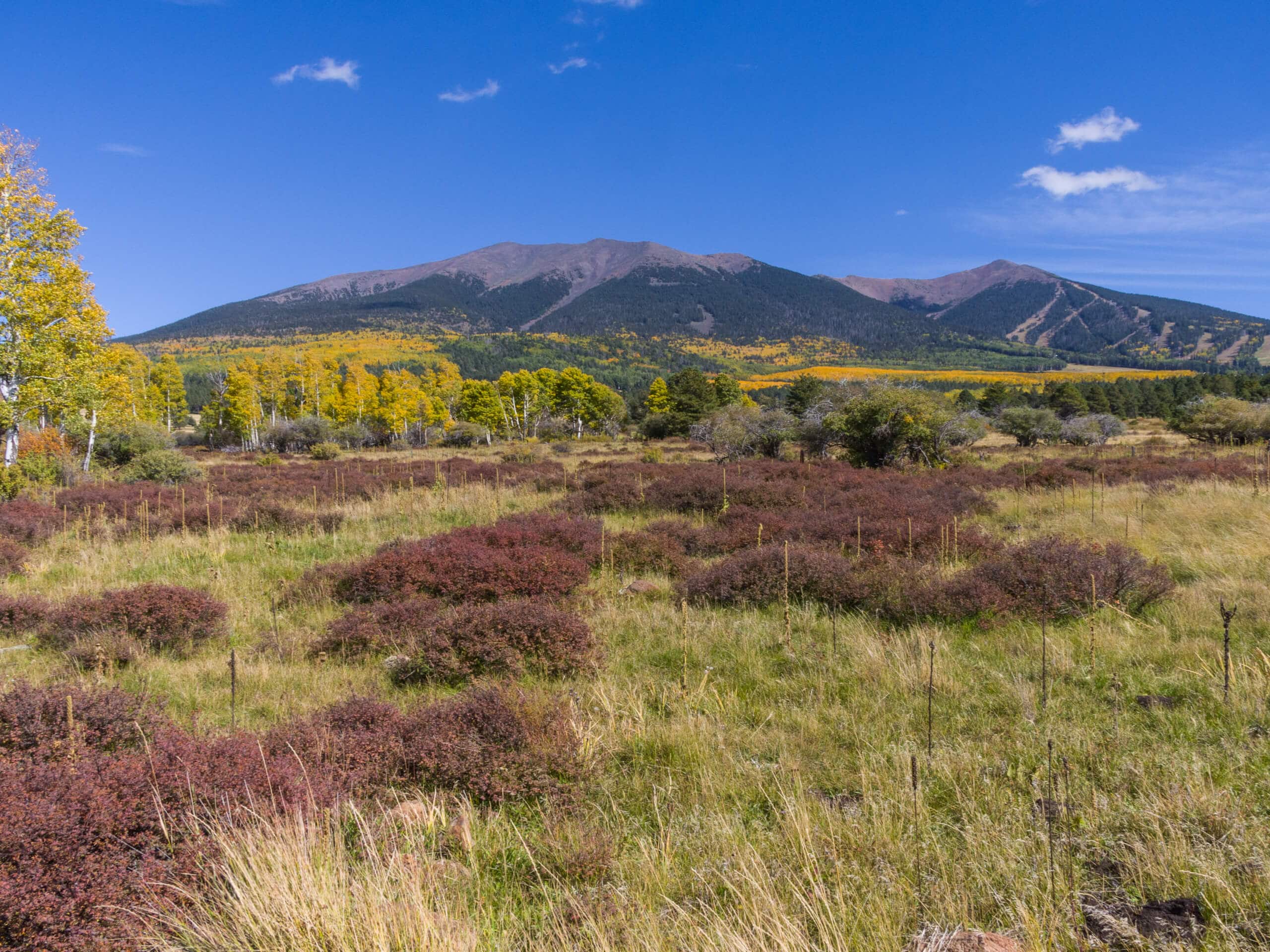
Hart Prairie Loop Trail
Difficulty Rating:
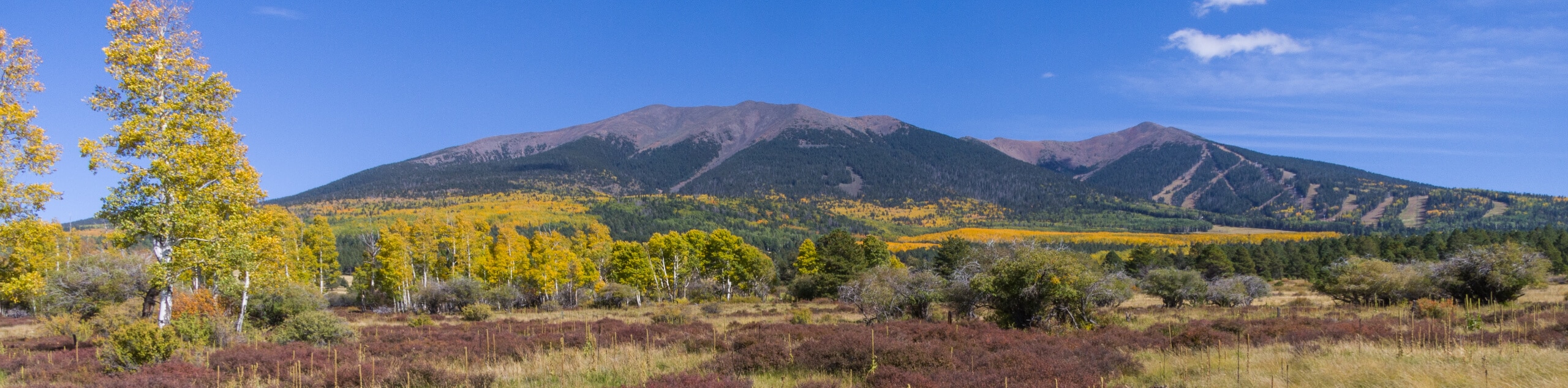
The Hart Prairie Loop is definitely an underappreciated hike. With views like this, it’s a wonder it sees such light traffic. Give this adventurous hike a go and you’ll find the climbing and distance is worth it for the mountain views and blissfully calm aspen forest. It can be used by hikers and mountain bikers alike. This is a hard 14.6mi hike that you can expect light traffic on.
Getting there
The trailhead for the Hart Prairie Loop Trail is on Hart Prairie Road.

About
| Backcountry Campground | No |
| When to do | March-November |
| Pets allowed | Yes - On Leash |
| Family friendly | No |
| Route Signage | Average |
| Crowd Levels | Low |
| Route Type | Loop |
Hart Prairie Loop Trail
Elevation Graph
Weather
Hart Prairie Loop Trail Description
The Hart Prairie Loop is a special hike with fabulous views. The real perk is that you likely won’t share this route with many others as it’s a very lightly trafficked trail. This hike travels near the mighty mountains of the Kachina Peaks Wilderness, passing through beautiful aspen forests (at their best in autumn) and clearings with excellent mountain views.
This route is a long one, so bring lots of water. Dress in layers and consider poles. If you’re hiking in shoulder season, microspikes could come in handy.
From the trailhead, take Hart Prairie Road towards Fern Mountain. Skirt the base of the mountain, then take a left off the road to pick up the trail. Just after the tank, go left again to take Arizona Trail-San Francisco Peaks. This will lead you beside the San Francisco Peaks and back towards the trailhead, leading you down switchbacks and then east back to the starting point.
Similar hikes to the Hart Prairie Loop Trail hike

Fay Canyon Loop
Fay Canyon is one of several main canyons in the Walnut Canyon National Monument. This loop hike explores part of…

Sandy Steps, Heart, and Upper Oldham Trail
The Sandy Steps, Heart, and Upper Oldham hike makes use of several different trails to create a hike that stretches…

Fisher Point via Fay Canyon
Fisher Point is one of the best viewpoints into the gorgeous Walnut Canyon. This route leads you to the point…
Comments