
Fisher Point and Walnut Canyon via Arizona Trail
View Photos
Fisher Point and Walnut Canyon via Arizona Trail
Difficulty Rating:
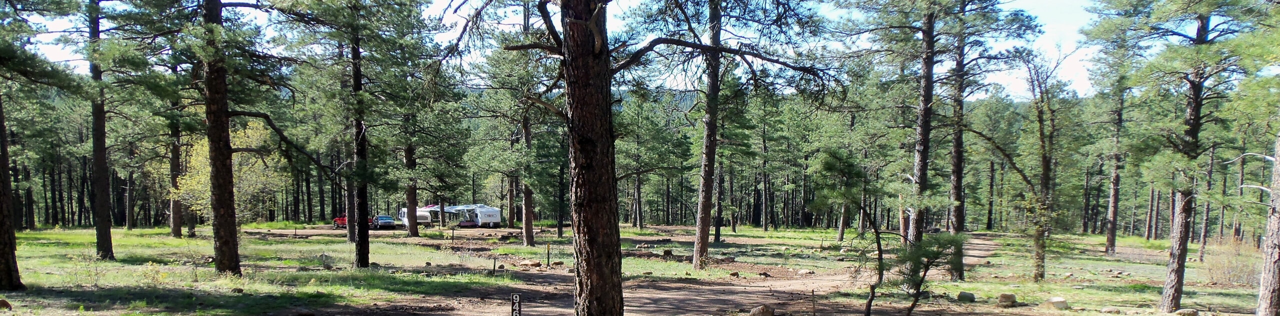
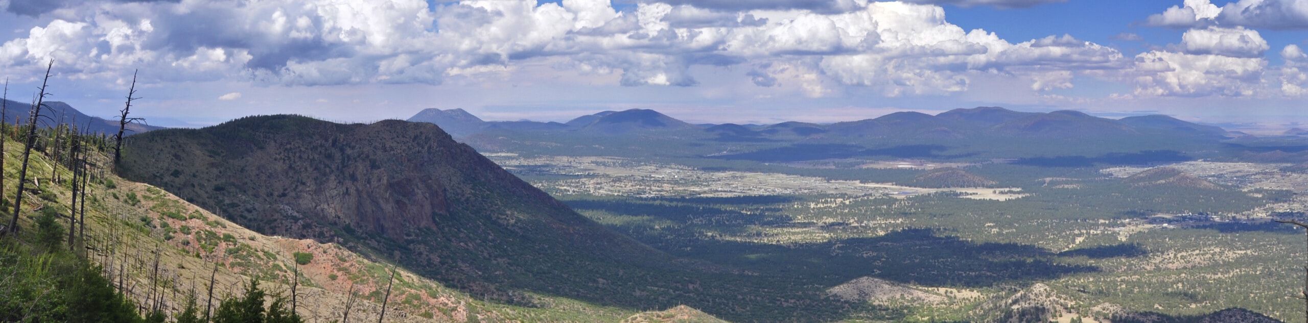
Fisher Point is one of the best viewpoints of Walnut Canyon. If you want to take a less direct scenic route there, the hike there on the Arizona Trail is a great pick, leading you through the canyon to this epic viewpoint. This is one of the longer approaches you can take to Fisher Point, but hiking through the incredible rock layers of the canyon makes for a rewarding trek. Expect moderate traffic on this route.
Getting there
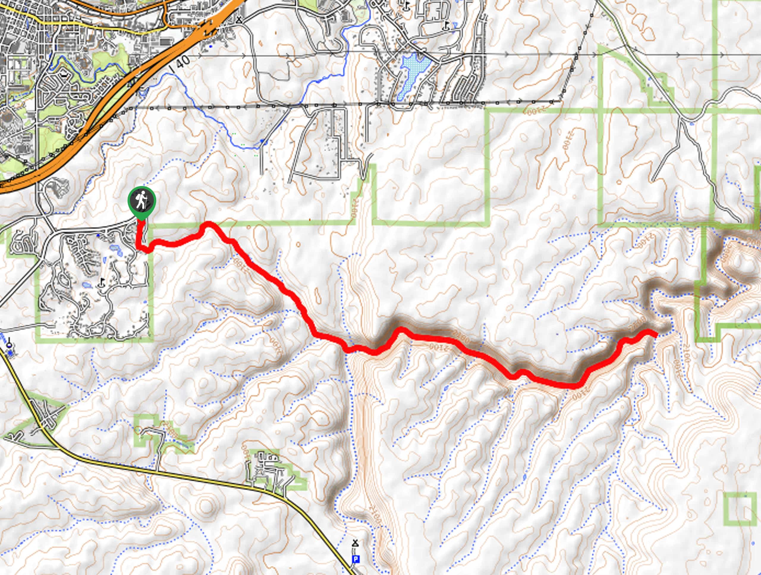
The trailhead for Fisher Point and Walnut Canyon via Arizona Trail is on Telluride Drive.

About
| Backcountry Campground | No |
| When to do | March-November |
| Pets allowed | Yes - On Leash |
| Family friendly | Older Children only |
| Route Signage | Average |
| Crowd Levels | Moderate |
| Route Type | Out and back |
Fisher Point and Walnut Canyon via Arizona Trail
Elevation Graph
Weather
Fisher Point and Walnut Canyon via Arizona Trail Description
Fisher Point is a viewpoint over Walnut Canyon, not far outside of Flagstaff in the Coconino National Forest. Walnut Canyon is very beautiful, and you can appreciate the layers of rock visible in the canyon walls while you hike, which are the same layers you can observe in the nearby Grand Canyon. Also, appreciate that there used to be a thriving pueblo community in this canyon!
This route to the canyon is longer than most of the other approaches to Fisher Point, but it involves an extended stretch of trail in the canyon itself, so it’s rewarding if you have the time. Note that the route can get hard to follow in the canyon, so we recommend referring to your GPS if needed.
From the trailhead, start hiking on Fisher Point Trail. Go straight through a junction onto AZT-Fisher Point. Hiking through Skunk Canyon, you’ll come up on Fisher Point on your left. Our route doesn’t go up to the viewpoint, but it’s a quick side trip if you want the elevated view. Otherwise, follow Walnut Canyon for the rest of the outbound trip. When you hit the end of the route (or when it becomes too difficult to follow, whichever comes first), turn back and retrace your steps to the trailhead.
Similar hikes to the Fisher Point and Walnut Canyon via Arizona Trail hike

Fay Canyon Loop
Fay Canyon is one of several main canyons in the Walnut Canyon National Monument. This loop hike explores part of…
Pumphouse Nature Trail
Pumphouse Nature Trail is a short and pleasant walk in Kachina Village, Arizona. This route is only 1.1mi…
Doney Mountain Trail
Doney Mountain Trail is a short hike in the far northeastern corner of Sunset Crater Volcano National Monument. This route…
Comments