
Freidlein Prairie Trail
View Photos
Freidlein Prairie Trail
Difficulty Rating:
The Freidlein Prairie Trail is a 5.0mi out and back trail in Coconino National Forest outside of Flagstaff. This route is rated as moderate and is suitable for active kids, families, dogs on leash, and strong beginner hikers. This hike gives you glimpses of Arizona's tallest mountain peaks through the forest. You may also be able to see wildlife on this trail. Expect moderate traffic.
Getting there
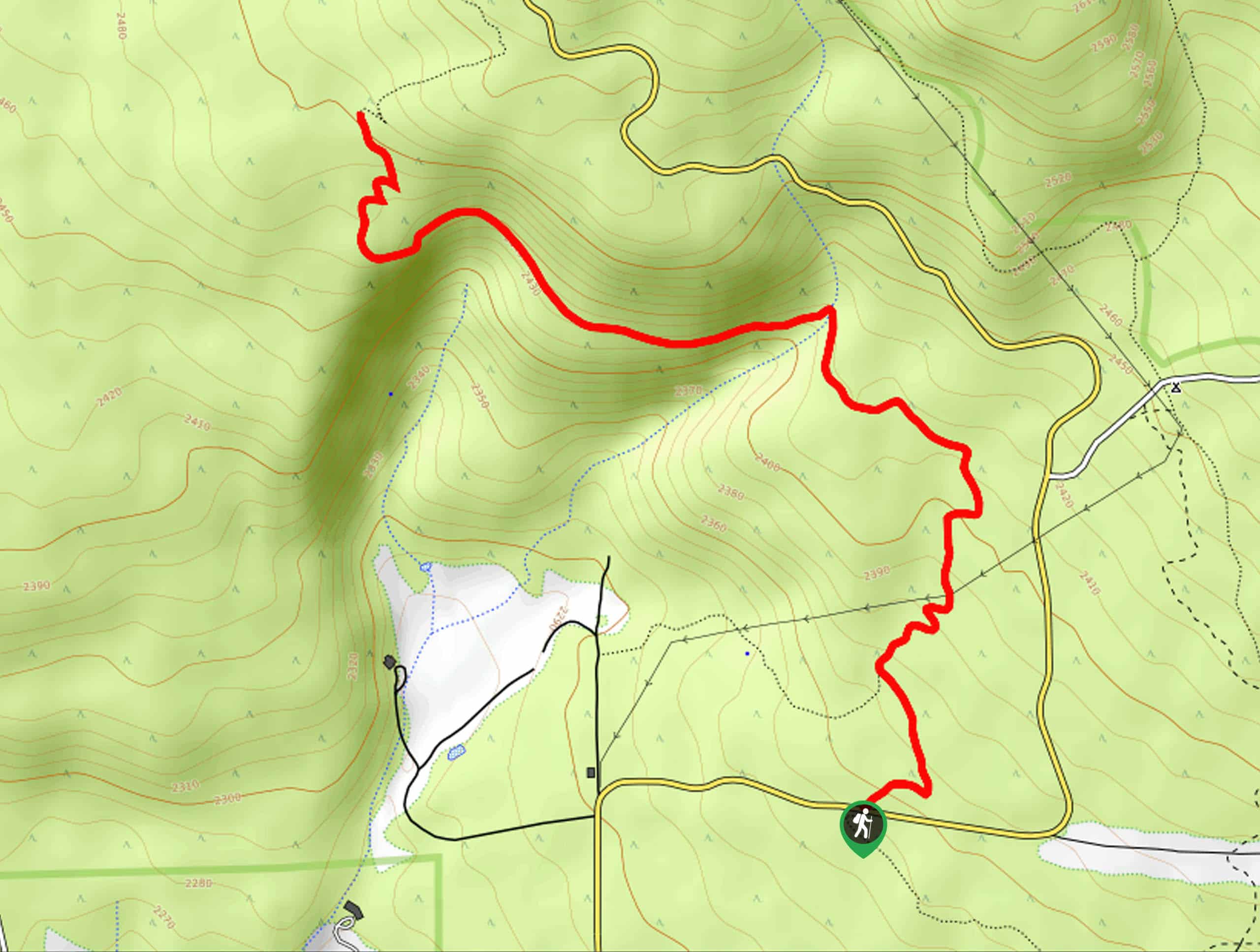
The trailhead for Freidlein Prairie Trail is on N Snow Bowl Road.

About
| Backcountry Campground | Freidlein Prairie Dispersed Camping |
| When to do | March-October |
| Pets allowed | Yes - On Leash |
| Family friendly | Yes |
| Route Signage | Average |
| Crowd Levels | Moderate |
| Route Type | Out and back |
Freidlein Prairie Trail
Elevation Graph
Weather
Freidlein Prairie Trail Description
The Freidlein Prairie Trail is a route that climbs below the San Francisco Peaks in northern Arizona. This hike mostly shows off the beautiful ponderosa pine forest, with its wildlife and its (seasonal) wildflowers. This hike gives you peekaboo views of the tallest mountains in Arizona as you go. It’s a moderately difficult hike that should be enjoyable for strong beginners and better.
There is no signage at the beginning or end of this trail that specifically states Freidlein Prairie Trail. You’ll be following part of the Arizona Trail. Our route ends at a given point, but feel free to turn around earlier or later on the hike.
From the trailhead, hike north, taking a set of switchbacks up atop the short cliffside. You’ll cross over a canyon and then traverse across the cliffside. There’s a nice viewpoint about 100 feet to the left of the trail about the two-mile mark. Follow the markers in the first that say “Trail” as you go. Where our route ends, there is a trail that continues on, so you can keep hiking if you’d like, or you can retrace your steps to the trailhead.
Similar hikes to the Freidlein Prairie Trail hike

Fay Canyon Loop
Fay Canyon is one of several main canyons in the Walnut Canyon National Monument. This loop hike explores part of…

Sandy Steps, Heart, and Upper Oldham Trail
The Sandy Steps, Heart, and Upper Oldham hike makes use of several different trails to create a hike that stretches…

Fisher Point via Fay Canyon
Fisher Point is one of the best viewpoints into the gorgeous Walnut Canyon. This route leads you to the point…
Comments