Yellow Pine Trail
View Photos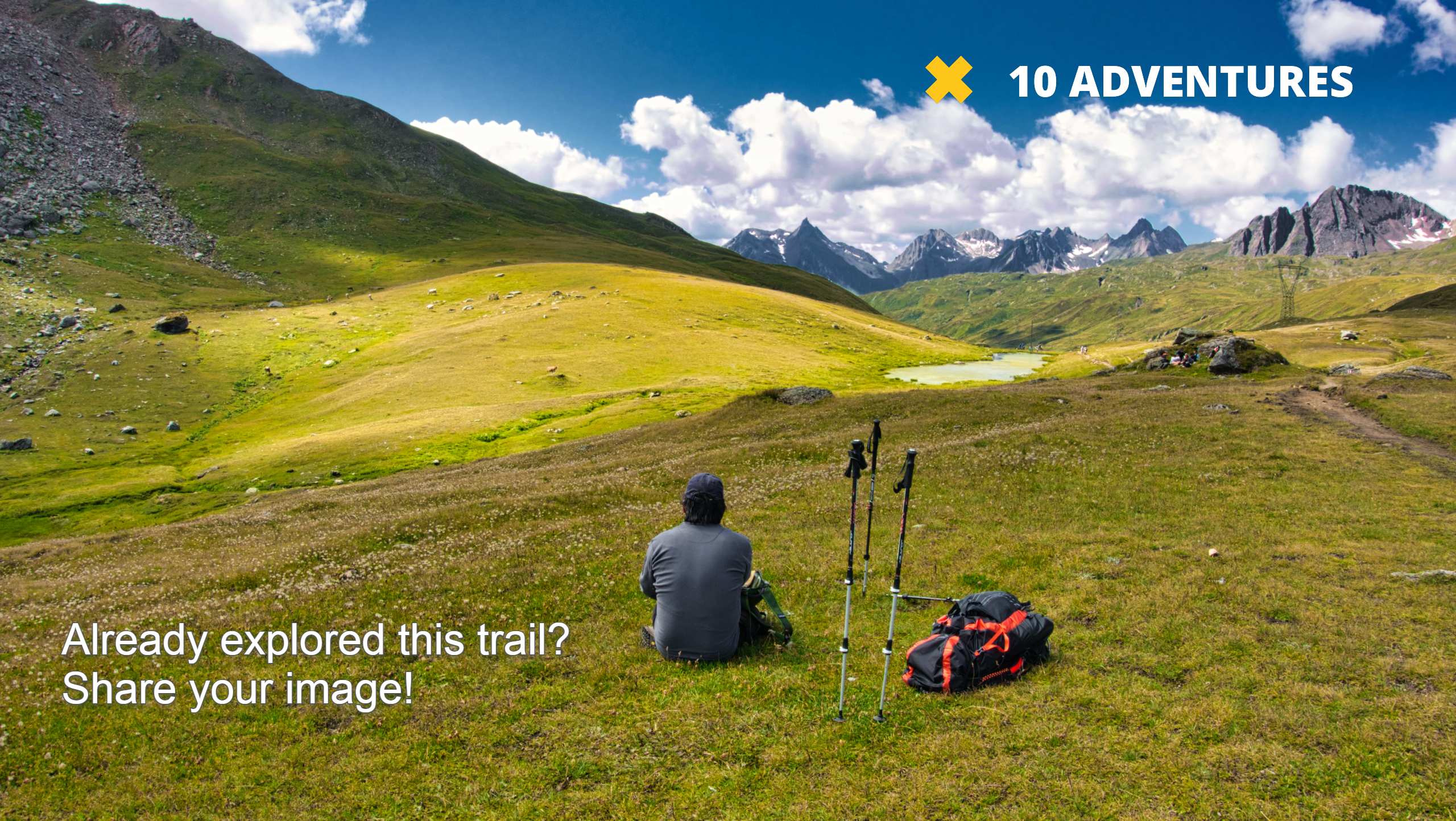
Yellow Pine Trail
Difficulty Rating:
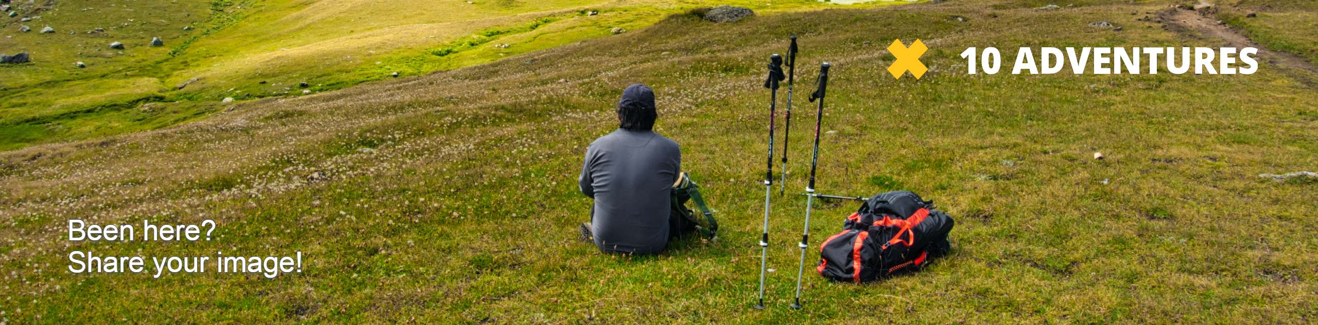
The Yellow Pine Trail is a wonderful trail just east of Kamas, Utah. This route is a popular hiking and trail running route in the summer, and an excellent snowshoeing trail in the winter. Dogs are welcome on the Yellow Pine Trail but must be kept on leash at all times.
Getting there
From Kamas, Utah, head east on Highway 150 for 6.0mi and look for the Yellow Pine Trailhead on the north side of the road.

About
| Backcountry Campground | Yellow Pine Campground |
| When to do | May to October |
| Pets allowed | Yes - On Leash |
| Family friendly | No |
| Route Signage | Average |
| Crowd Levels | High |
| Route Type | Out and back |
Yellow Pine Trail
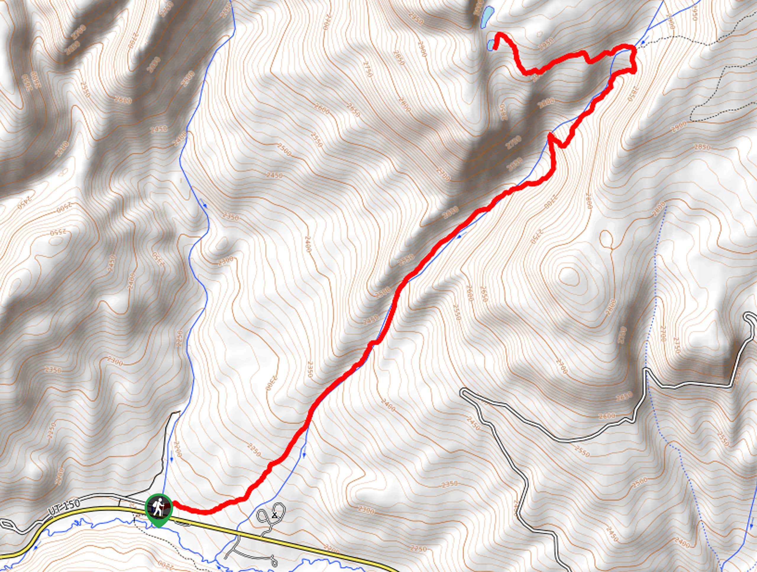
Elevation Graph
Weather
Yellow Pine Trail Description
The Yellow Pine Trail is a beautiful route just outside of Kamas, Utah. This trail is rocky with a steady climb the whole way. Be sure to wear proper, supportive hiking shoes and bring lots of snacks and water to fuel your adventure. We recommend bringing along a set of hiking poles on this trail to aid in your ascent and save your knees some strain on the way back down. The Yellow Pine Trail is a dog-friendly route, but dogs need to be kept on a leash at all times due to area wildlife. No matter what time of year you visit, the Yellow Pine Trail always delivers stunning views and a memorable adventure in the Utah wilderness.
Beginning at the Yellow Pine Trailhead, follow the path northeast along Yellow Pine Creek. Approximately three and a half miles in, the trail will divide. At the divide, take the path on your left to hike westward for a short distance to Upper and Lower Yellow Pine Lake.
Take a rest on the lakeside and cool your feet in the alpine waters before turning back and retracing your steps to the Yellow Pine Trailhead, where you began.
For a variation on this route, check out the Castle Peak Trail or the Castle Lake Trail.
Similar hikes to the Yellow Pine Trail hike

Willard Creek Waterfall Trail
The Willard Creek Trail is an adventurous yet beautiful hike on the eastern edge of Willard, Utah. This trail is…

Skull Crack Trail
Despite the foreboding name, the Skull Crack Trail is a fantastic hike in the Uinta-Wasatch-Cache National Forest. This trail follows…

Box Elder Creek Trail
The Box Elder Creek Trail is a lovely hike northeast of Salt Lake City. This trail is used by both…
Comments