
Pine Valley Trail
View Photos
Pine Valley Trail
Difficulty Rating:
The Pine Valley Trail is a wonderful route just southeast of Kamas, Utah. This trail is a lovely hike in the summer and a gorgeous snowshoeing route in the winter. Adventure pups are welcome to join you on the Pine Valley Trail, but must be kept on leash at all times.
Getting there
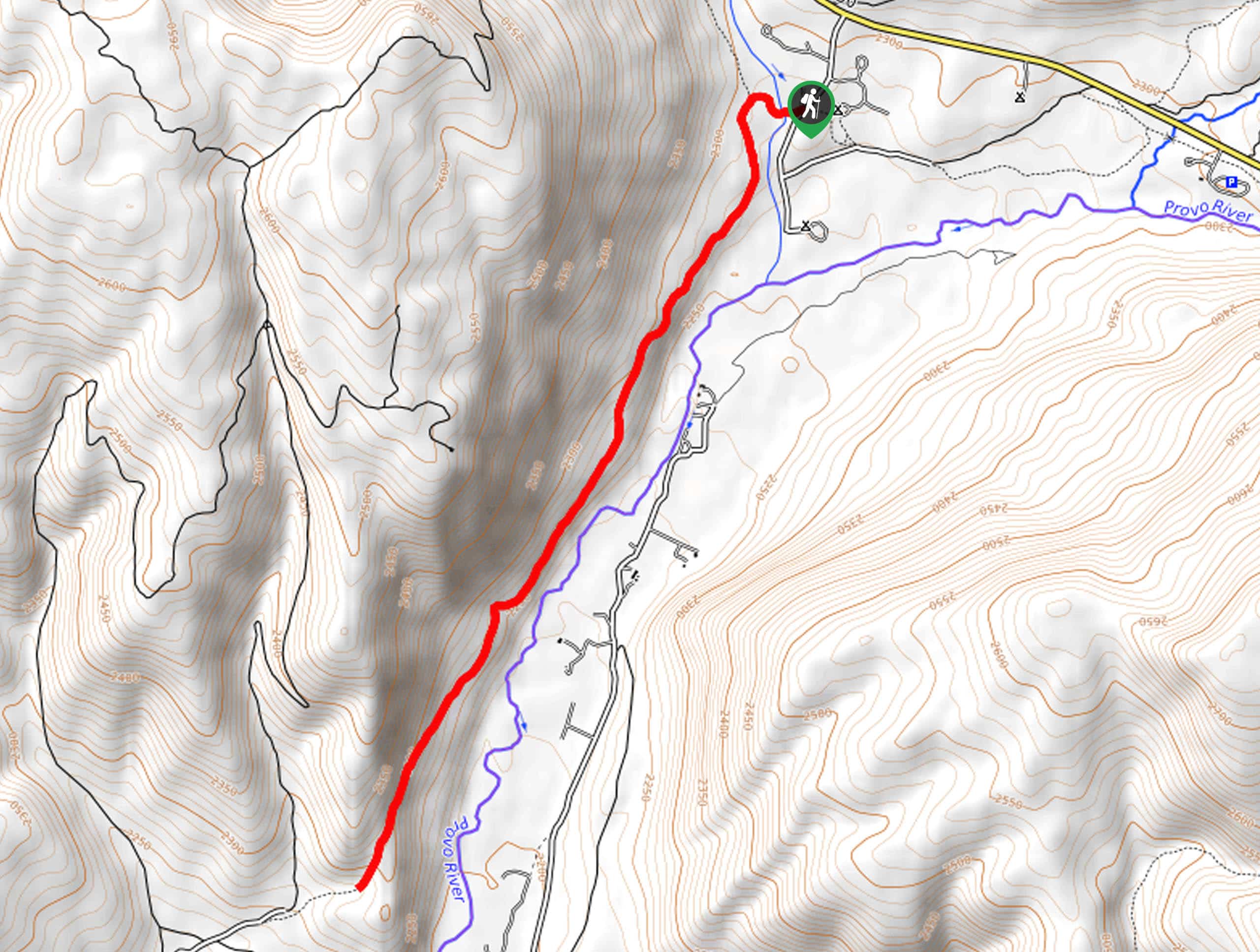
This route begins at the Pine Valley Campground on the south side of Highway 150 approximately 10.7mi east of Kamas, Utah.

About
| Backcountry Campground | Pine Valley Campground, Lower Provo River Campground |
| When to do | Year-round |
| Pets allowed | Yes - On Leash |
| Family friendly | Older Children only |
| Route Signage | Average |
| Crowd Levels | Low |
| Route Type | Out and back |
Pine Valley Trail
Elevation Graph
Weather
Pine Valley Trail Description
The Pine Valley Trail is a gorgeous route east of Kamas, Utah. This trail begins with a creek crossing over Shingle Creek, a tributary of the Provo River. This crossing can be sketchy in the early spring when Shingle Creek swells with the spring runoff. Exercise caution and use good judgment on your creek crossing. If conditions are not within your comfort zone, revisit this trail later in the summer when the water level drops down.
Whether you are staying at one of the campgrounds nearby or looking for an adventure close to town, the Pine Valley trail is a fantastic hike in the western Uintas. This trail is a great place to get out and do some exploring in the Utah wilderness with friends, family, or your favorite adventure pup.
To hike the Pine Valley Trail, begin at the Pine Valley Campground. Cross over Shingle Creek and then follow the west bank of the Provo River south through Pine Valley. Approximately 2.0mi in, the trail will climb up to a high point. Head up to the overlook to earn some incredible views before turning around and heading back the way you came.
If you are looking for more to explore in the area, check out the North Fork Loop just across the road.
Similar hikes to the Pine Valley Trail hike

Willard Creek Waterfall Trail
The Willard Creek Trail is an adventurous yet beautiful hike on the eastern edge of Willard, Utah. This trail is…

Skull Crack Trail
Despite the foreboding name, the Skull Crack Trail is a fantastic hike in the Uinta-Wasatch-Cache National Forest. This trail follows…

Box Elder Creek Trail
The Box Elder Creek Trail is a lovely hike northeast of Salt Lake City. This trail is used by both…
Comments