Ruth Lake, Jewel Lake, Cutthroat Lake, and Teal Lake Trail
View Photos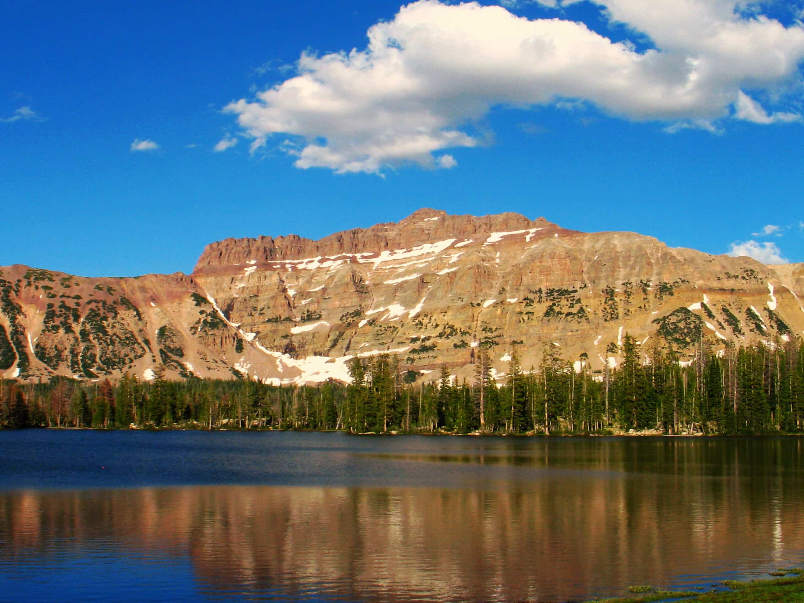
Ruth Lake, Jewel Lake, Cutthroat Lake, and Teal Lake Trail
Difficulty Rating:
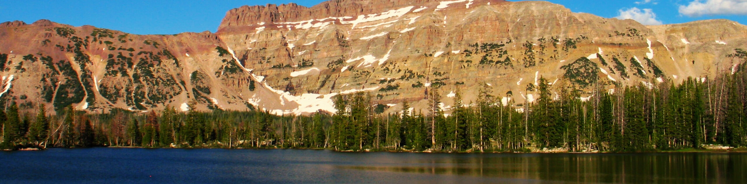
The Ruth Lake, Jewel Lake, Cutthroat Lake, and Teal Lake Trail is a gorgeous hiking circuit east of Park City Utah. This trail is moderately challenging and a perfect hike for families with older children or folks who want to bring their dog on an adventure in the mountains. With stunning views throughout, the Ruth Lake, Jewel Lake, Cutthroat Lake, and Teal Lake Hiking Circuit is a fantastic way to spend the day exploring the Utah wilderness.
Getting there
From Kamas, Utah, head east out of town on highway 150. Stay on highway 150 for 34.0mi and look for the Ruth Lake parking area on the west side of the highway, just past the Butterfly Lake Campground. The Ruth Lake, Jewel Lake, Cutthroat Lake, and Teal Lake hiking circuit begins here.

About
| Backcountry Campground | Primitive Camping at each lake |
| When to do | May to September |
| Pets allowed | Yes |
| Family friendly | Older Children only |
| Route Signage | Poor |
| Crowd Levels | Moderate |
| Route Type | Lollipop |
Ruth Lake, Jewel Lake, Cutthroat Lake, and Teal Lake Trail
Elevation Graph
Weather
Ruth Lake, Jewel Lake, Cutthroat Lake, and Teal Lake Trail Description
The hike to Ruth Lake, Jewel Lake, Cutthroat Lake, and Teal Lake is a fantastic, adventurous route in the Western Uinta Mountains. This trail is well marked and well maintained up until Ruth Lake. Past Ruth Lake, the path becomes unclear, and some creative route finding is required. If you are not experienced in route finding, we recommend bringing along a map and/or GPS unit. You will also want to bring along a camera; this trail is absolutely stunning.
From the parking lot, follow the trail west as it winds along Hayden Fork to a divide. Stay right at the divide to make your way to Ruth Lake. Follow the path along the north shore of Ruth Lake. Just west of Ruth Lake, look for the rugged trail that branches off to your right. Go along this trail northwest for 0.4 miles to Jewel Lake. From the north end of Jewel Lake, head southwest through the meadows of wildflowers to Cutthroat Lake. From Cutthroat Lake, make your way north to Teal Lake before heading back southeast to Jewel Lake.
Once you find yourself back at Jewel Lake, retrace your footsteps back to the parking area where you began.
Similar hikes to the Ruth Lake, Jewel Lake, Cutthroat Lake, and Teal Lake Trail hike

Willard Creek Waterfall Trail
The Willard Creek Trail is an adventurous yet beautiful hike on the eastern edge of Willard, Utah. This trail is…

Skull Crack Trail
Despite the foreboding name, the Skull Crack Trail is a fantastic hike in the Uinta-Wasatch-Cache National Forest. This trail follows…

Box Elder Creek Trail
The Box Elder Creek Trail is a lovely hike northeast of Salt Lake City. This trail is used by both…
Comments