Bald Mountain Trail
View Photos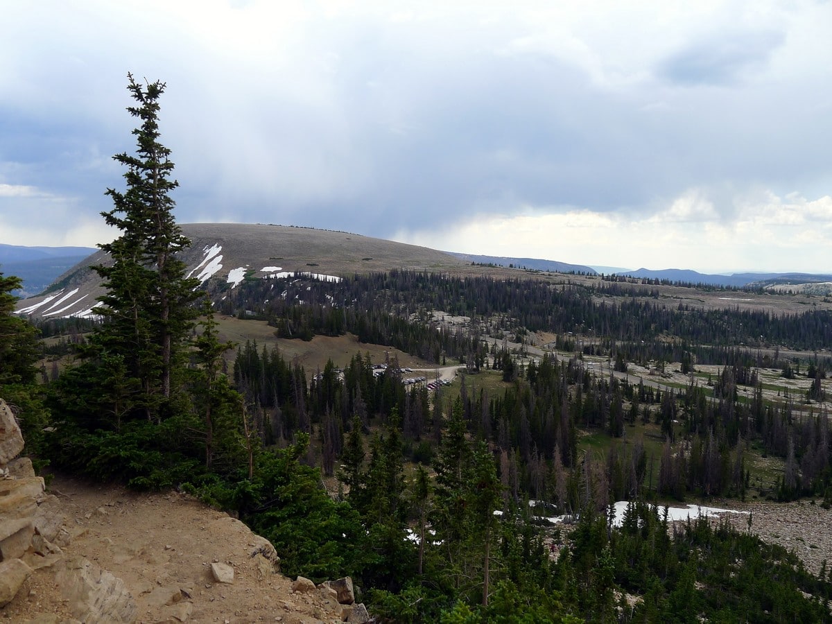
Bald Mountain Trail
Difficulty Rating:
Though short, this extremely steep hike is quite a grueling climb. One of the classic climbs, this walk takes you to the incredibly high 11940ft Bald Mountain. It should go without saying that you can see a lot of Utah from this height.
Getting there
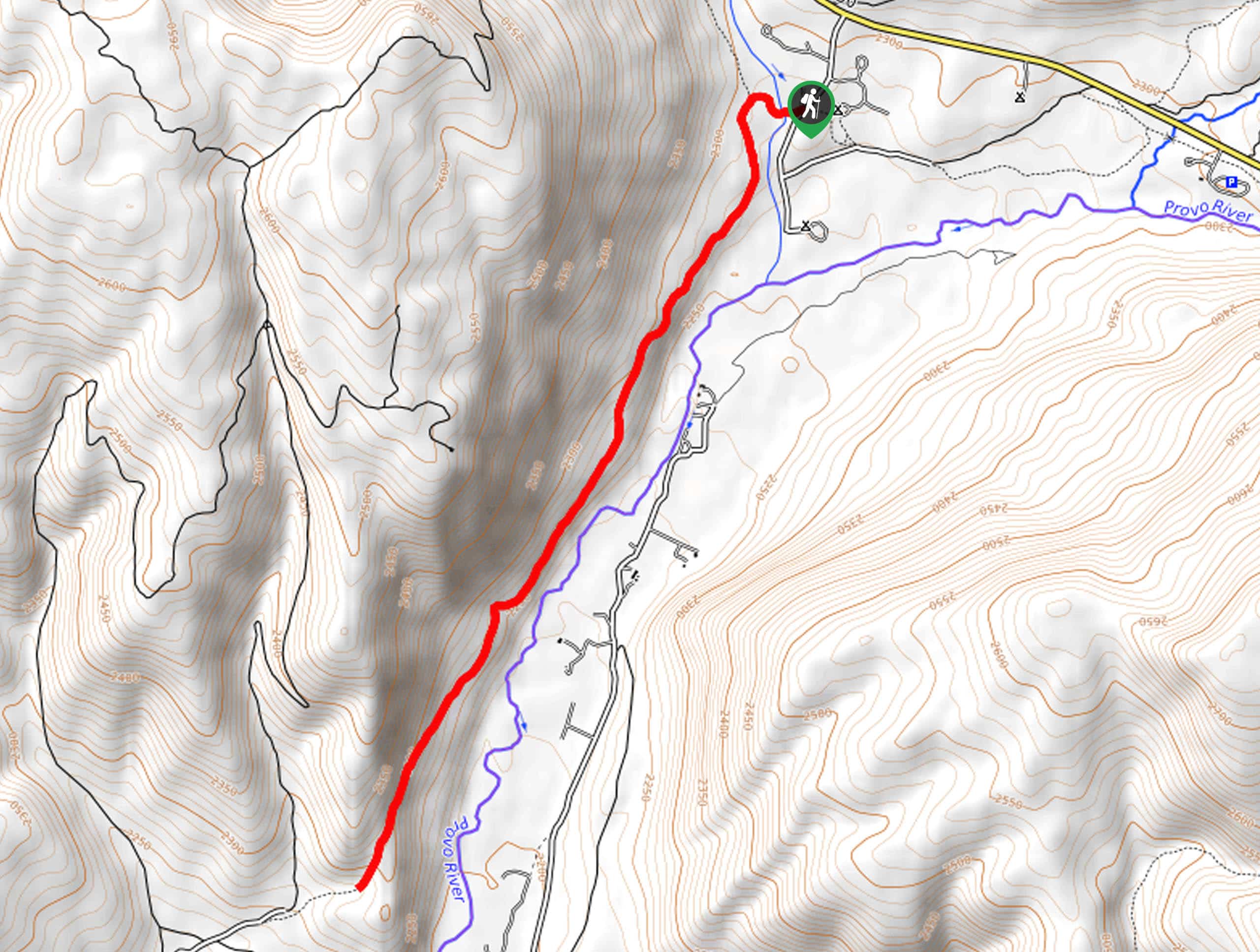
To reach the Bald Mountain hike, start from Kamas and head along Utah 150 for 29.1mi. After seeing signs for Bald Mountain Pass, watch out for a trailhead sign to your left, signed as the Bald Mountain Picnic Area.

About
| When to do | Late June through September |
| Backcountry Campsites | None on this trail, but many nearby |
| Toilets | Yes, at trailhead |
| Family friendly | No |
| Route Signage | Average |
| Crowd Levels | High |
| Route Type | Out and back |
Bald Mountain Trail
Elevation Graph
Weather
Bald Mountain Trail Description
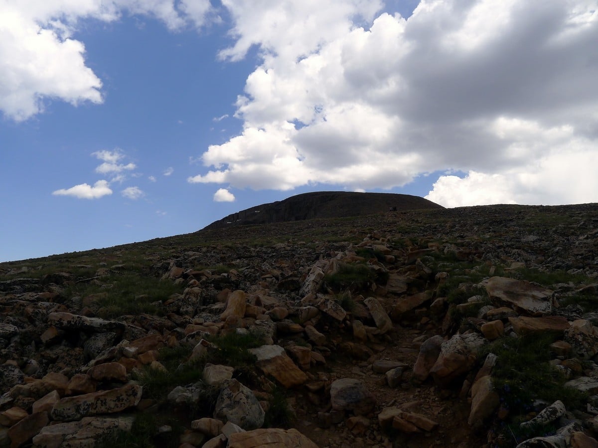
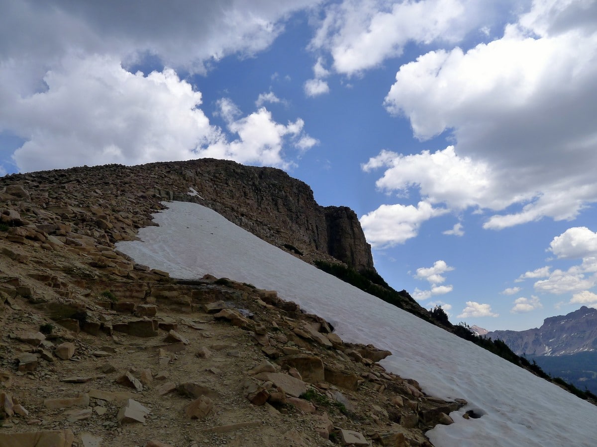
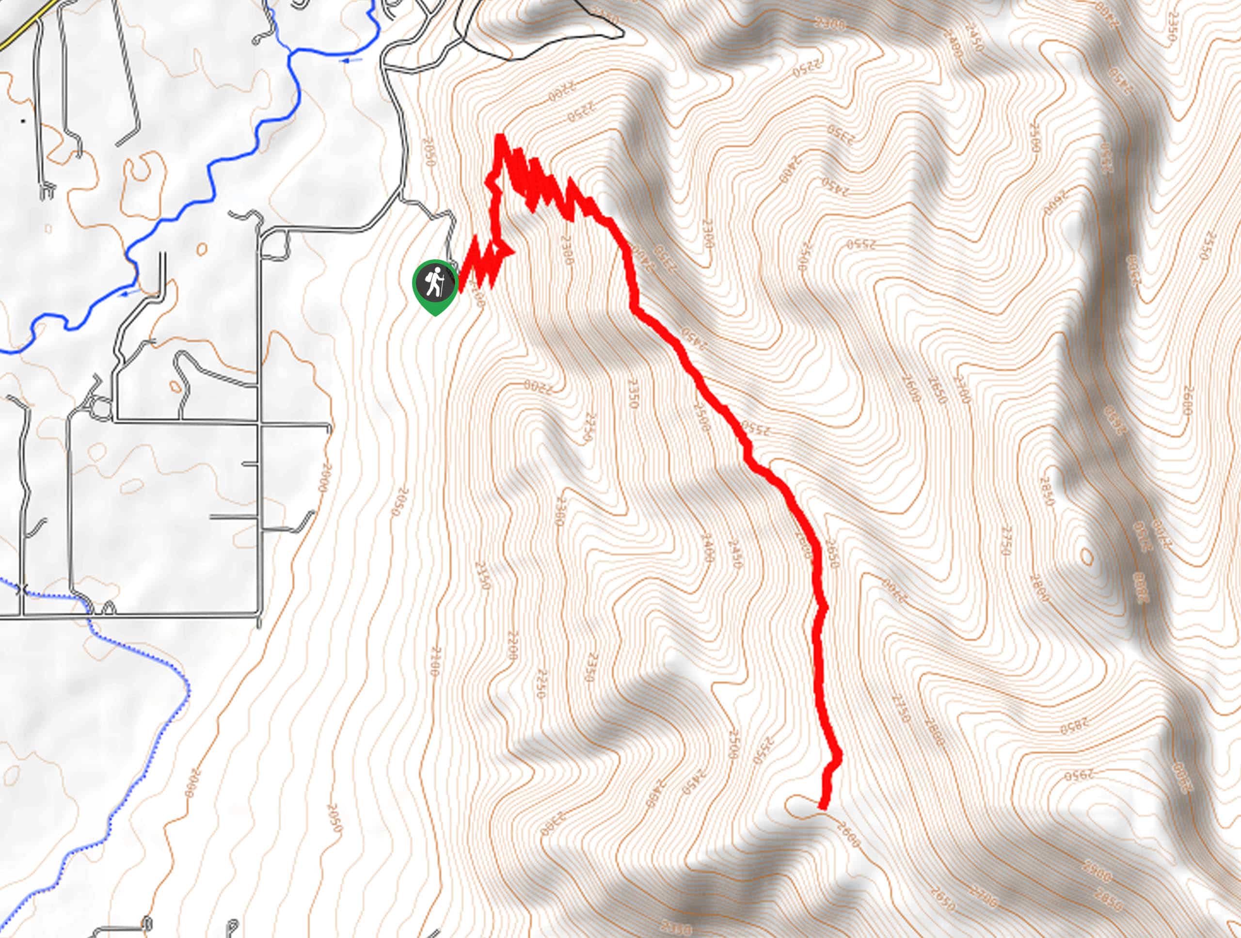
There is not much to the Bald Mountain hike! Simply start past the outhouse and keep right at the first junction. Then, almost immediately, you’ll start climbing. The trail initially starts switchbacking, then veers left (west) as you traverse towards the plateau along the Southwest flank of the mountain.
As you climb along the wooded ridge it is very easy to lose the path. That being said, as long as you continue heading up towards the northeast you will eventually leave the small wooded area and the path will be easily visible from most of the ridge.
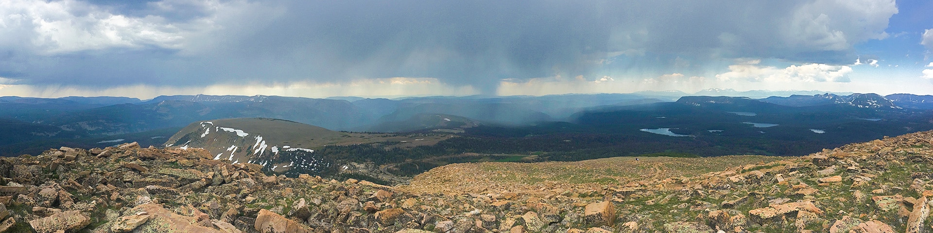
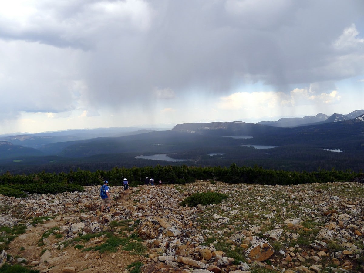
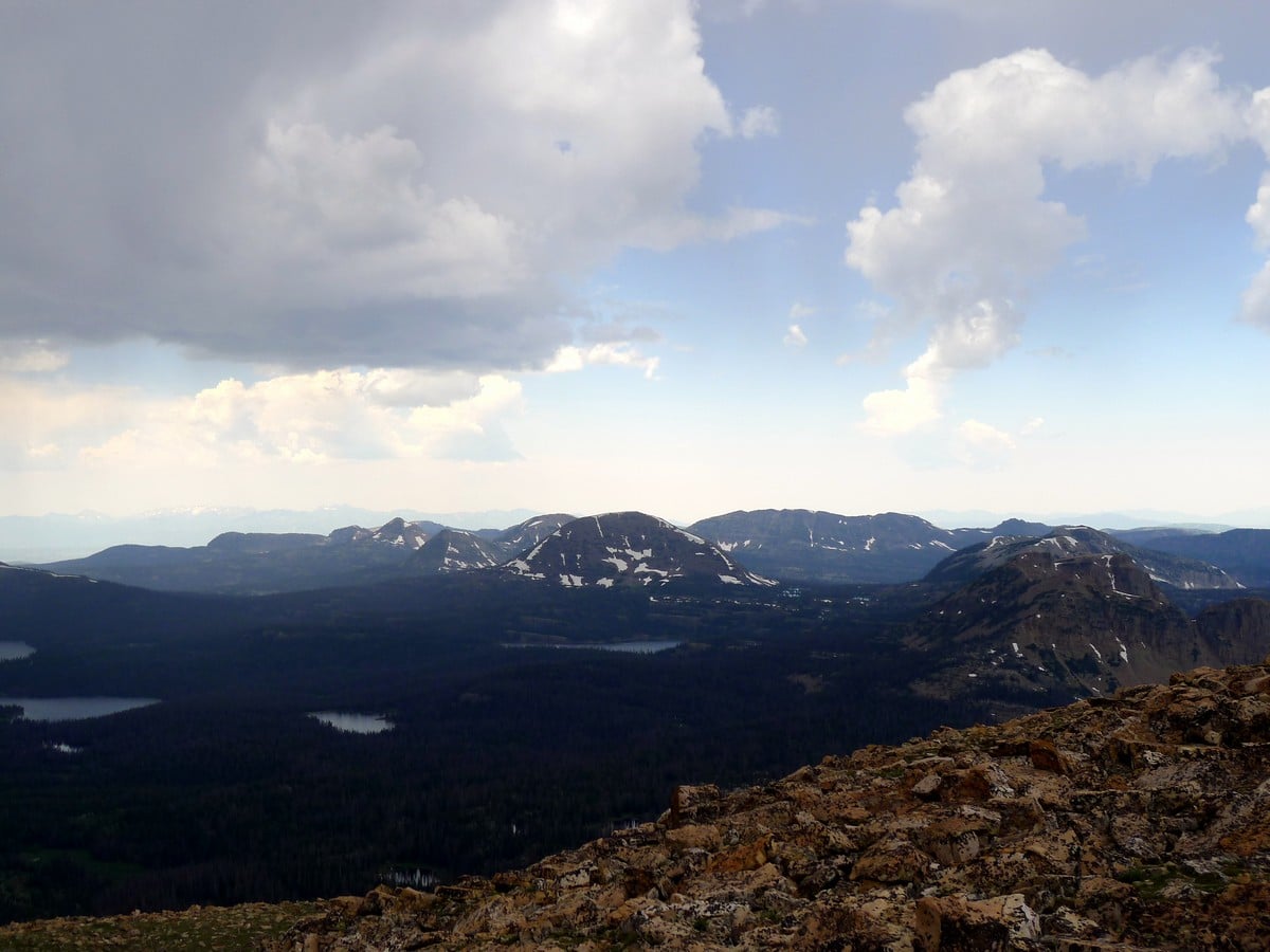
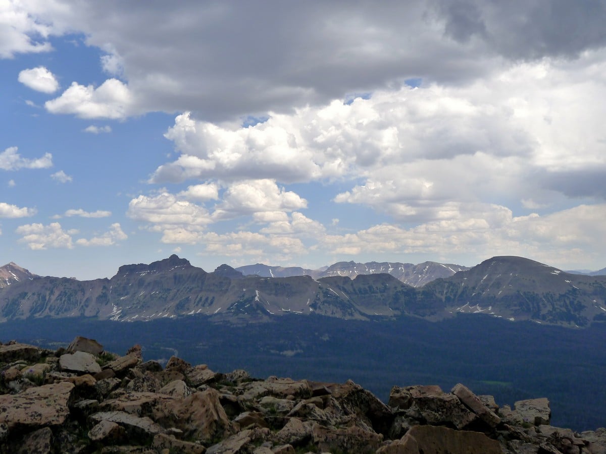
The obvious path will lead up past several false summits before the actual summit. From the top, the entire wilderness of the Uintas will fall out below you. To the west you will be able to see Notch Mountain and Mount Watson, to the north Mount Marsell and Hayden Peak, and to the east Mount Agassiz.
After relishing the views from the top of Bald Mountain, return the way you came.
Hiking trail highlights
Bald Mountain
To hike one of the highest peaks in the western Uinta Mountains, you’ll want to conquer Bald Mountain. While the hike can be steep, the switchbacks make for a fun challenge on the way to the top. The reward calls hikers names as they ascend with the promise of taking in not one, but four of Utah’s major watersheds.
The elevation will take you to 11,943ft above sea level and once at the tip top, look out to spot some of the landmark lakes in the area, spanning from Provo to Weber Rivers. On the east side, you can also enjoy views over Mount Agassiz and Hayden Peak and even the winding Mirror Lake Highway.
Find more great hikes in the Uinta Mountains:
Insider Hints
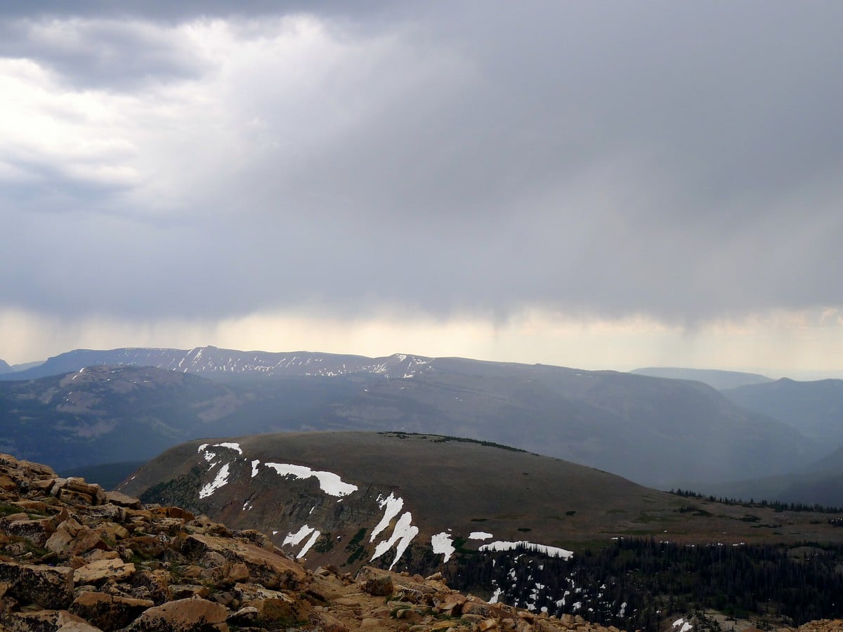
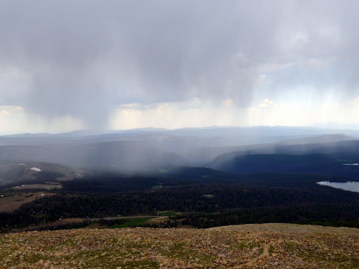
Be on the lookout for the common afternoon thunderstorms that sweep through the Uintas in the summer months. On our last trip up Bald Mountain, imposing thunder forced us to tuck tail and run down after getting to the final summit ridge. Scary stuff!
A recreation pass is required to park in the National Forest, which can be purchased throughout the park; however, a National Parks Pass is also accepted.

Similar hikes to the Bald Mountain Trail hike

Skull Crack Trail
Despite the foreboding name, the Skull Crack Trail is a fantastic hike in the Uinta-Wasatch-Cache National Forest. This trail follows…
Pine Valley Trail
The Pine Valley Trail is a wonderful route just southeast of Kamas, Utah. This trail is a lovely hike in…
Oakley Ridge Trail
The Oakley Ridge Trail is a gorgeous route just east of Oakley, Utah. This trail is moderately challenging with steep…
Sammy L. 4 years ago
The last visit was years ago and it was a super fun trail to hike and beautiful views up top
Meadow M. 5 years ago
A challenging hike that rewards you with a scenic view of Utah. The trail is initially steep so be careful.
Queenie 5 years ago
A fun trail to do. Stunning views at the top.
Ithinkimgettingbald 5 years ago
This hike was really crowded. Did not help with the climb. Nice views from the top.
Annie Smith 5 years ago
Great hike Bald Mountain.
Flying Dutch 5 years ago
This hike was really steep and you had to climb a lot. Amazing scenery from the top
SteffWilk 5 years ago
The Bald mountain was a lot more challenging than I was hoping for. A strenuous climb.