Strawberry River Trail
View Photos
Strawberry River Trail
Difficulty Rating:
The Strawberry River Trail is a beautiful trail in the Western Uintas. This trail is family-friendly and great for kids of all ages. Dogs are welcome to join you on this trail, but must be kept on leash at all times.
Getting there
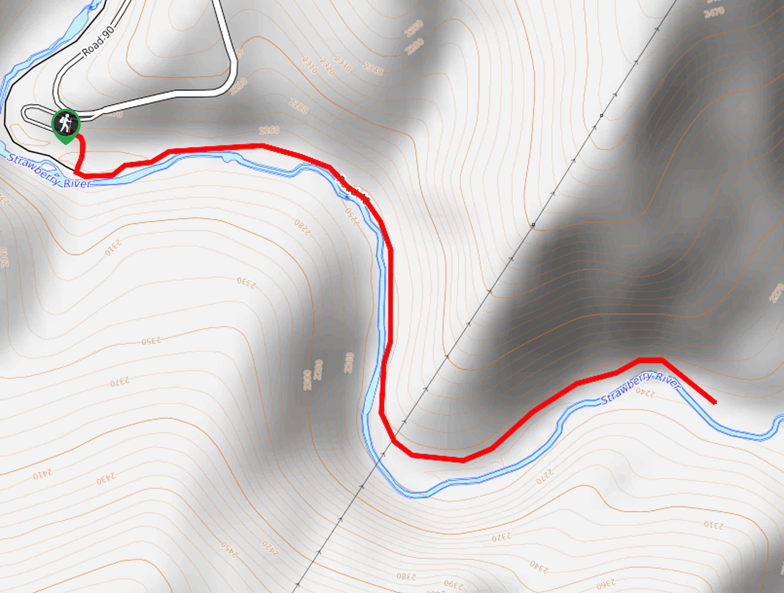
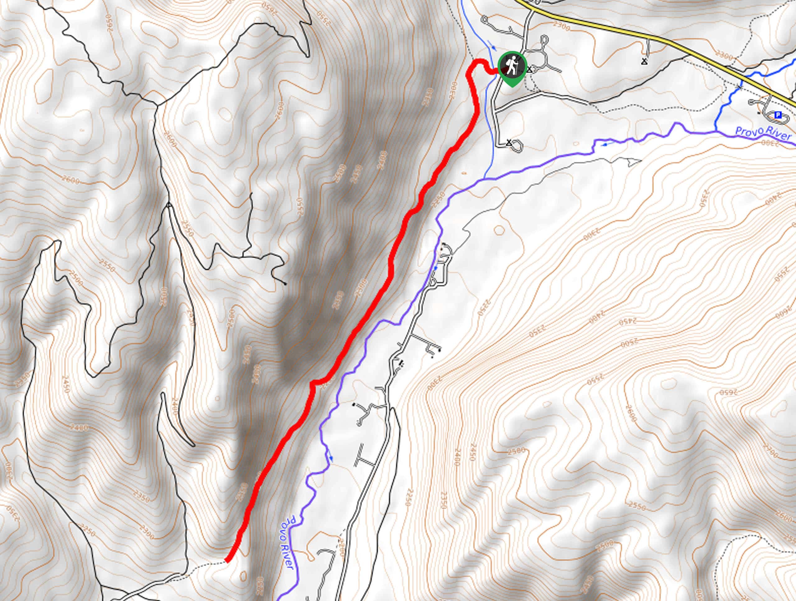
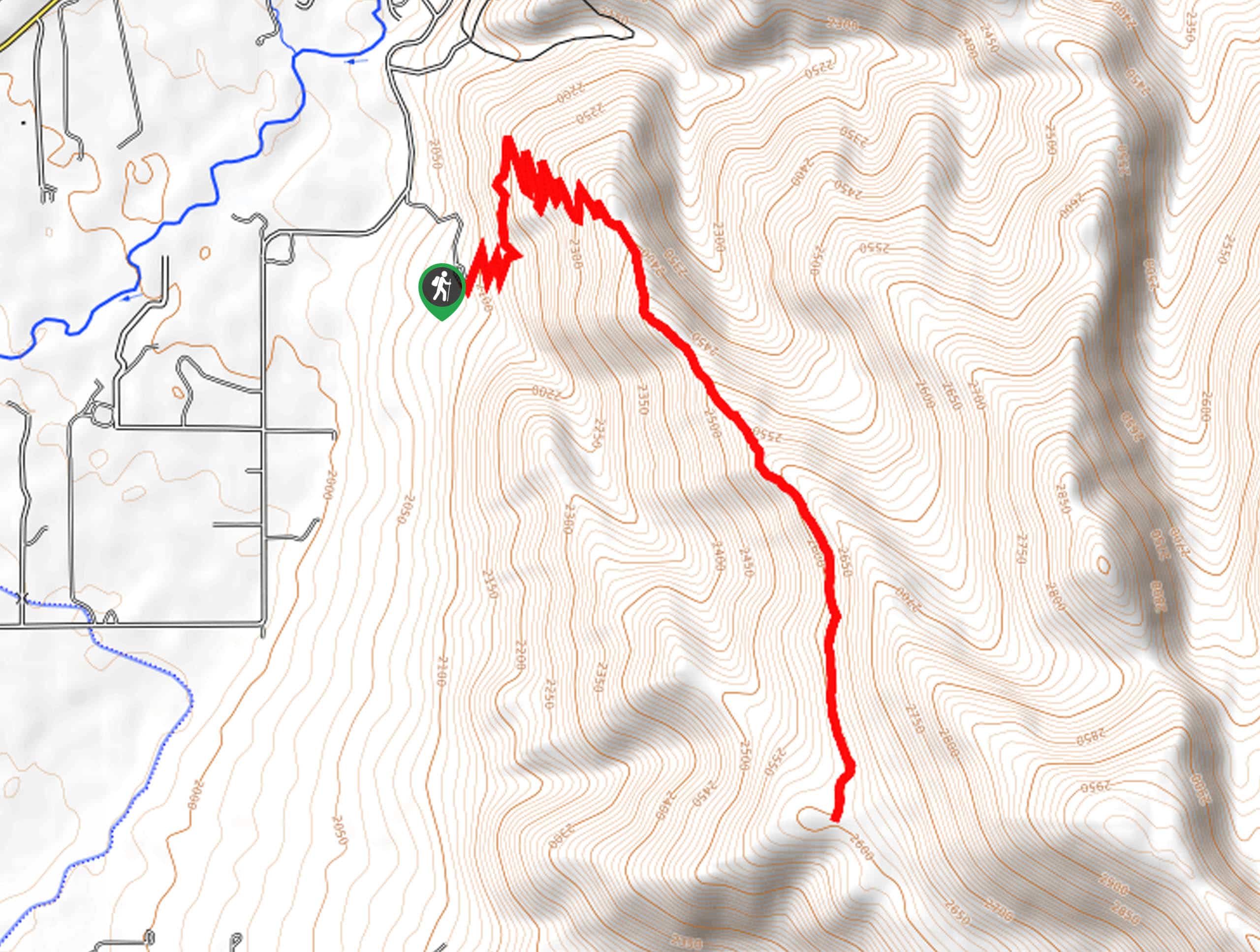
This hike begins at the south end of Road 90 just east of the Aspen Grove Campground on the Strawberry Reservoir.

About
| Backcountry Campground | Aspen Grove Campground nearby |
| When to do | Year-round |
| Pets allowed | Yes - On Leash |
| Family friendly | Yes |
| Route Signage | Average |
| Crowd Levels | Low |
| Route Type | Out and back |
Strawberry River Trail
Elevation Graph
Weather
Strawberry River Trail Description
The Strawberry River trail is a hidden gem of a hike in the western Uintas. This trail is a bit rugged, so be sure to wear proper hiking shoes and leave the flip-flops at home. The Strawberry River Trail is a great family-friendly destination with excellent fishing and so much to explore. This trail is easy enough for kids of all ages and hikers of all skill levels. Adventure pups are also welcome to join you on this route though they must be kept on a leash at all times.
From the parking lot at the end of Road 90, head east along the north shore of the Strawberry River. Follow along the river for approximately one mile to the trail’s end. Once you reach the end of the trail, simply turn back and retrace your steps back to the trailhead where you began.
If you are looking for more to explore in the area, check out Foreman Hollow Nature Trail nearby.
Similar hikes to the Strawberry River Trail hike

Skull Crack Trail
Despite the foreboding name, the Skull Crack Trail is a fantastic hike in the Uinta-Wasatch-Cache National Forest. This trail follows…
Pine Valley Trail
The Pine Valley Trail is a wonderful route just southeast of Kamas, Utah. This trail is a lovely hike in…
Oakley Ridge Trail
The Oakley Ridge Trail is a gorgeous route just east of Oakley, Utah. This trail is moderately challenging with steep…
Comments