
The Dry Canyon Trail
View Photos
The Dry Canyon Trail
Difficulty Rating:
The Dry Canyon Trail is a fantastic hike just northeast of Logan Utah. This trail is steep and strenuous and is appropriate for experienced hikers only. With incredible views at the top, this route will give you a serious workout and a rich reward.
Getting there
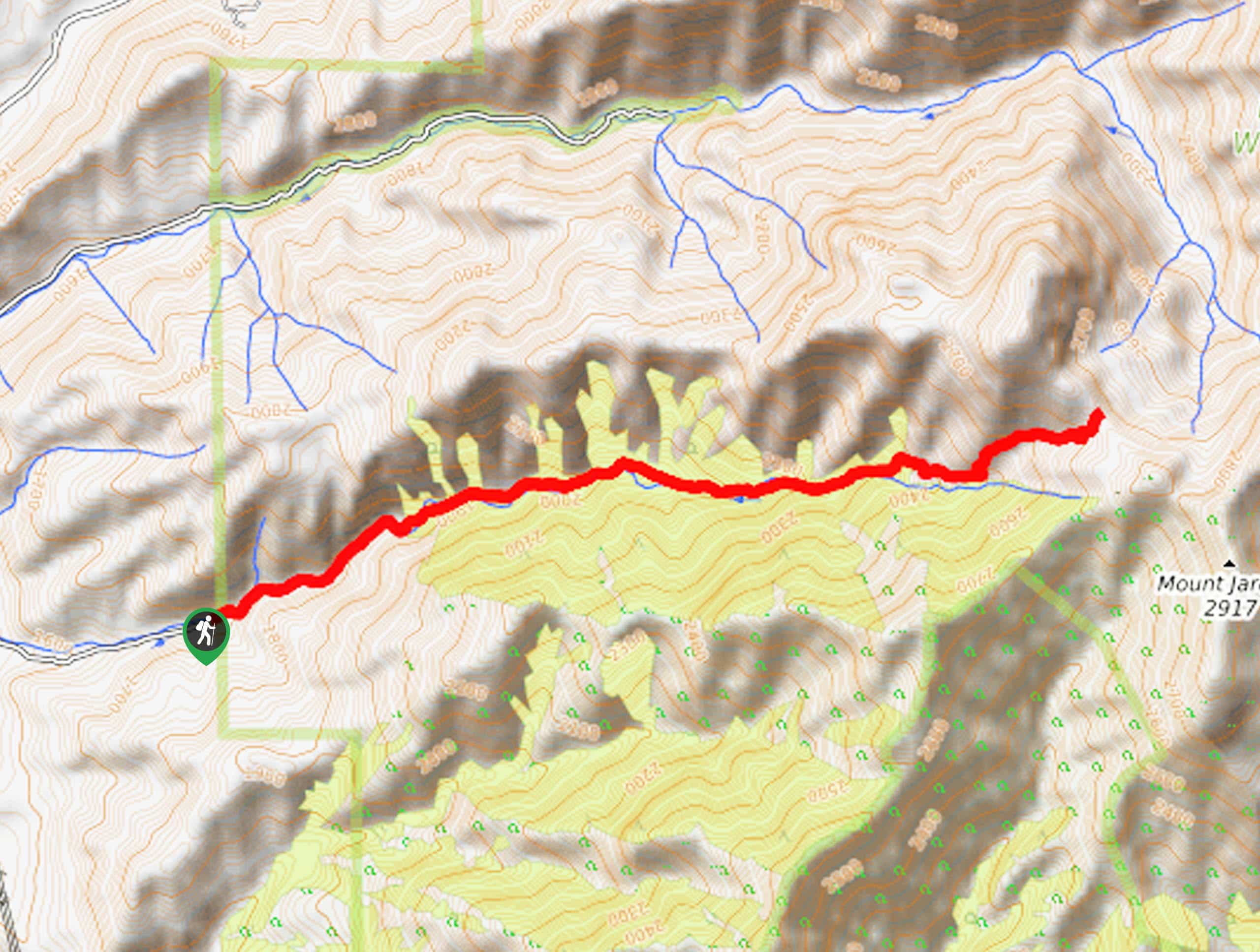
This hike begins at the end of Dry Canyon Road on the eastern edge of Smithfield, Utah.

About
| Backcountry Campground | No |
| When to do | April to October |
| Pets allowed | Yes |
| Family friendly | No |
| Route Signage | Average |
| Crowd Levels | Moderate |
| Route Type | Out and back |
The Dry Canyon Trail
Elevation Graph
Weather
The Dry Canyon Trail Description
The Dry Canyon Trail is an excellent challenge for experienced hikers. This trail is a consistently steep climb the whole way up. Hikers should arrive for a strenuous day with proper hiking footwear, lots of water, and lots of snacks. Though this trail is only 7.7mi long, this hike may take you longer than expected; be sure to arrive early in the day so you can really take your time and enjoy your adventure. The views from the top of Dry Canyon are entirely worth the effort to get there. With incredible panoramic views of the Utah wilderness, the Dry Canyon Trail will leave you speechless.
From the trailhead, follow the path east up Birch Creek to a divide. This split is the turn-around point for most hikers. If you are feeling ambitious, you can continue along the trail to your left to head to the top of Mount Jardine.
On the descent from the top of Dry Canyon, be sure to take your time and watch your step on the steep sections to arrive safely back at the trailhead where you began.
Similar hikes to the The Dry Canyon Trail hike

Willard Creek Waterfall Trail
The Willard Creek Trail is an adventurous yet beautiful hike on the eastern edge of Willard, Utah. This trail is…

Skull Crack Trail
Despite the foreboding name, the Skull Crack Trail is a fantastic hike in the Uinta-Wasatch-Cache National Forest. This trail follows…

Box Elder Creek Trail
The Box Elder Creek Trail is a lovely hike northeast of Salt Lake City. This trail is used by both…
Comments