
Alexander Lake Trail
View Photos
Alexander Lake Trail
Difficulty Rating:
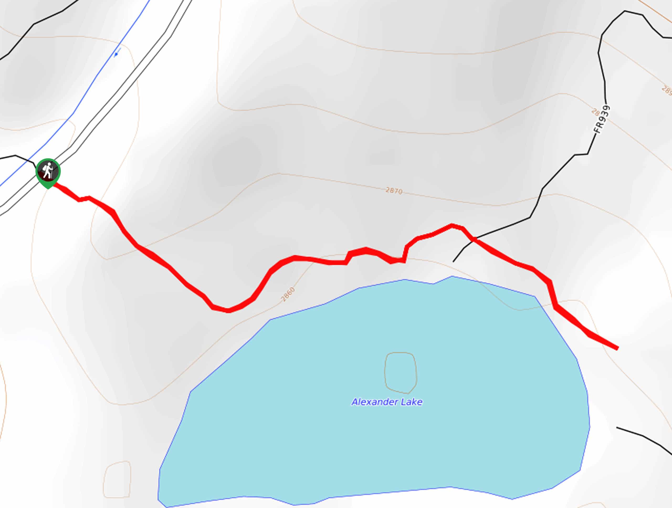
The Alexander Lake Trail is a short and sweet hike to access Alexander Lake in the Western Uintas. Alexander Lake is a gorgeous, pristine alpine lake with primitive campsites and lots of places to swim and fish. The Alexander Lake Trail is a good hike for folks looking for a place to kick back and relax in the beautiful Utah wilderness.
Getting there
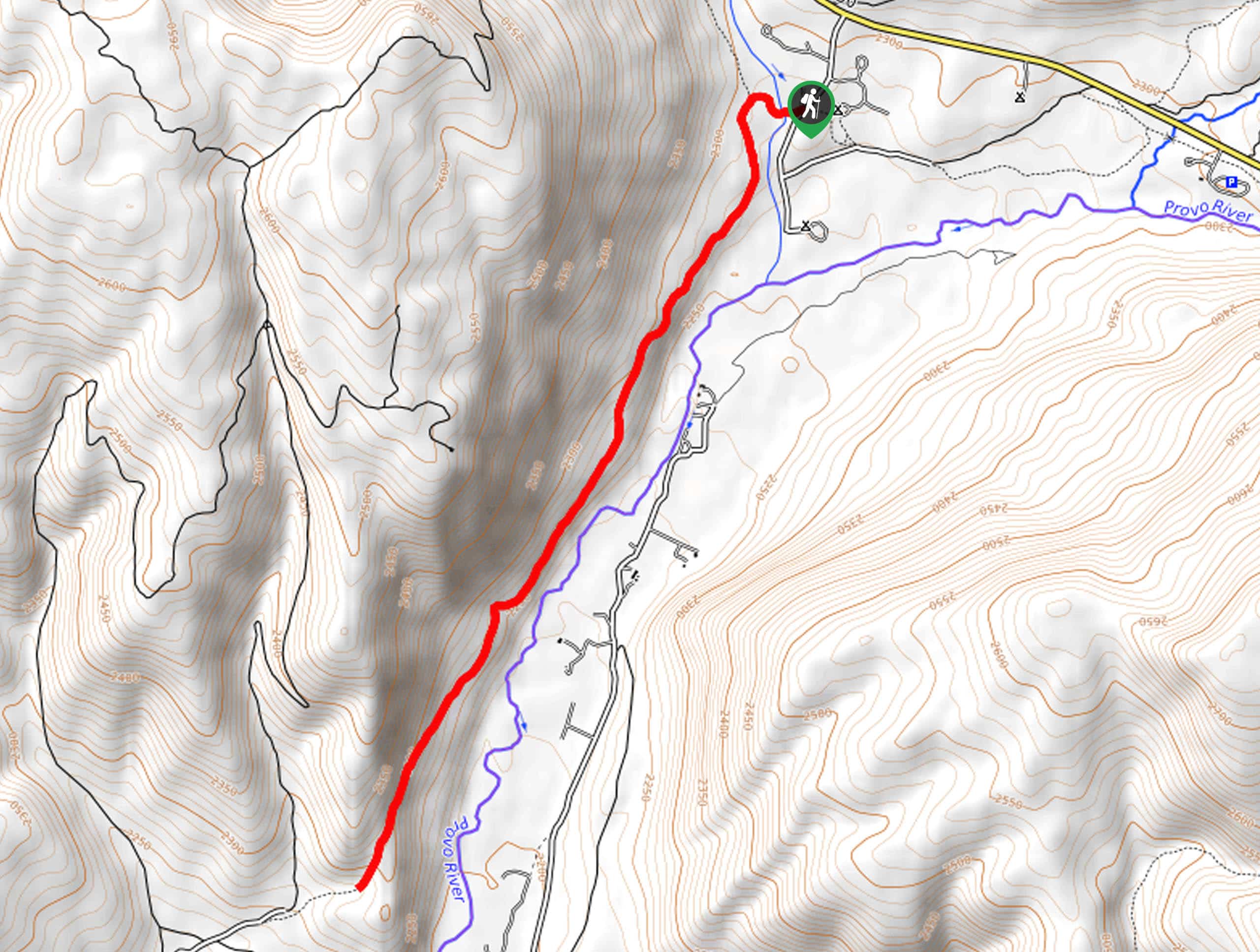
From Kamas, Utah, head east on highway 150 for 17.8mi then turn left onto Forest Road 041. Follow Forest Road 041 for 2.8mi to a pull off parking area on the left side of the road.

About
| Backcountry Campground | Primitive camping at Alexander Lake |
| When to do | April to October |
| Pets allowed | Yes |
| Family friendly | Yes |
| Route Signage | Poor |
| Crowd Levels | Low |
| Route Type | Out and back |
Alexander Lake Trail
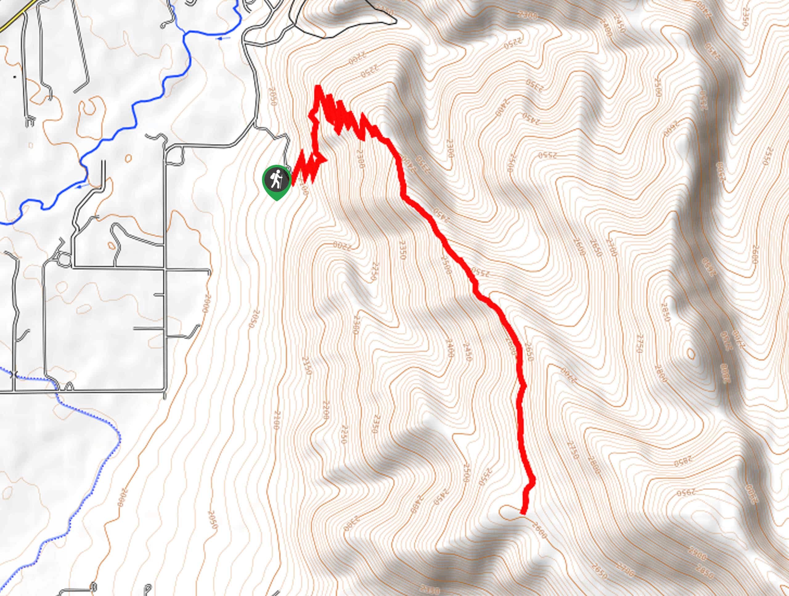
Elevation Graph
Weather
Alexander Lake Trail Description
The Alexander Lake Trail is a short and sweet hike to a pristine alpine lake. This trail is rugged, not clearly marked and requires some creative route finding. If you are not experienced in route finding, we recommend downloading a map beforehand. To access the trail, you must drive along an unmaintained Forest Road; doing this drive with a 4WD, high-clearance vehicle is best. The trail may not be much to write home about, but Alexander Lake sure is. With crystal clear water, and lots of spots to camp and picnic, Alexander Lake is a gorgeous little destination in the Uinta wilderness.
From the parking pull off, cross over Forest road 041 and make your way southeast to Alexander Lake.
Once you reach the water’s edge, set up your tent or your picnic blanket and enjoy a day of fun in the sun on the shores of Alexander Lake.
Similar hikes to the Alexander Lake Trail hike

Skull Crack Trail
Despite the foreboding name, the Skull Crack Trail is a fantastic hike in the Uinta-Wasatch-Cache National Forest. This trail follows…
Pine Valley Trail
The Pine Valley Trail is a wonderful route just southeast of Kamas, Utah. This trail is a lovely hike in…
Oakley Ridge Trail
The Oakley Ridge Trail is a gorgeous route just east of Oakley, Utah. This trail is moderately challenging with steep…
Comments