Pinnacle Peak Saddle Trail
View Photos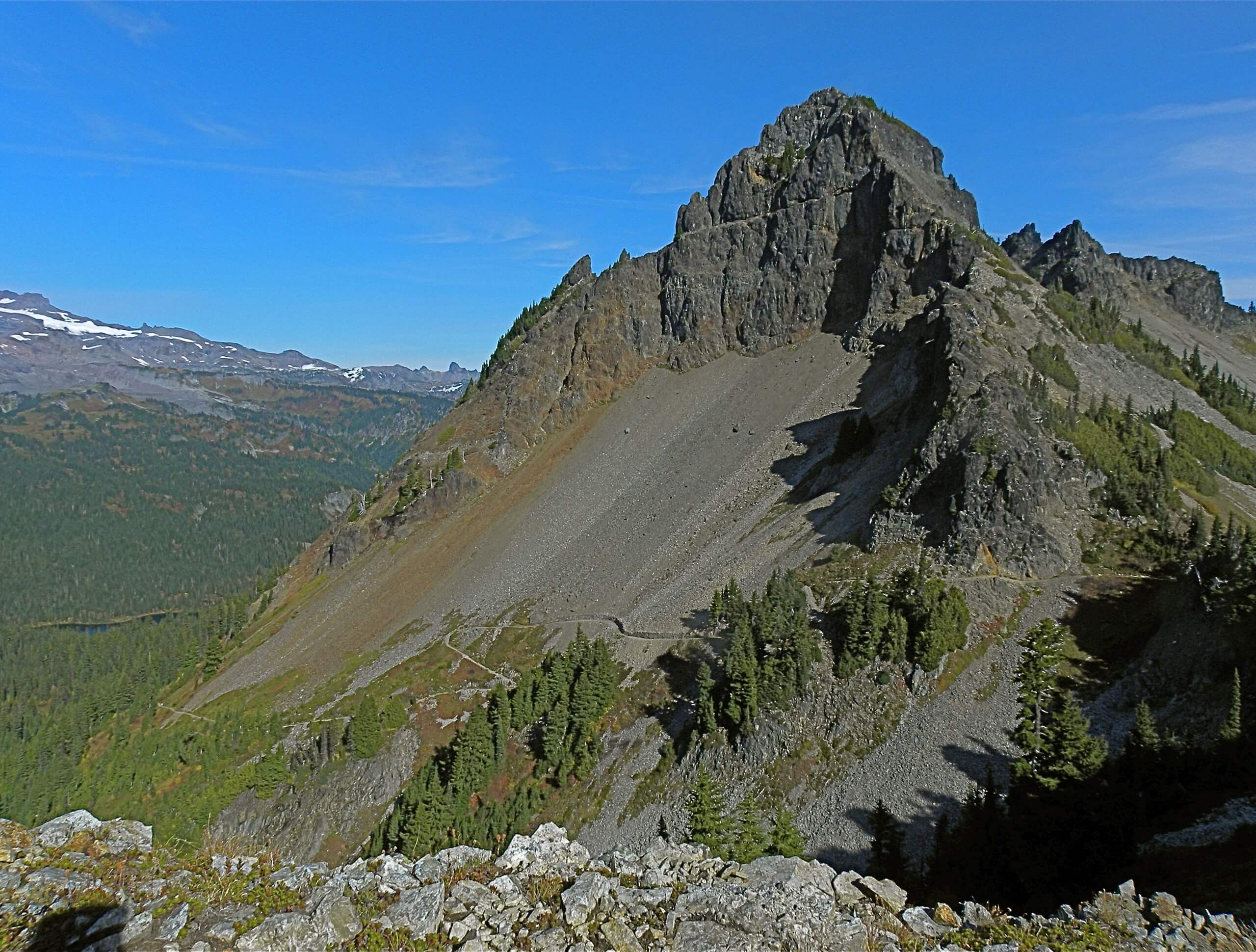
Pinnacle Peak Saddle Trail
Difficulty Rating:
The Pinnacle Peak Saddle trail offers a lofty viewpoint over the Paradise area with only moderate effort required. With no technical challenges and a consistent steady incline, it offers a great quick workout with views of Mount Rainier and Mount Adams to reward you.
The Pinnacle Peak Saddle trail is a great way to access a network of trails in the area- just look for the interconnecting tracks at the summit, or continue further along the ridge from the pinnacle of this hike.
Getting there
To reach the Pinnacle Peak Saddle trailhead from the west entrance to Mount Rainier National Park, drive 15.0mi on State Route 706 to a junction with Stevens Canyon Road. Go right, then continue 1.5mi to the parking area for Reflection Lakes. The trailhead is across the road from the largest lake.
If you’re coming from the east entrance, take Stevens Canyon Road west for 18.0mi to the parking area.

About
| When to do | May-October |
| Backcountry Campsites | No |
| Pets allowed | No |
| Family friendly | Older Children only |
| Route Signage | Average |
| Crowd Levels | High |
| Route Type | Out and back |
Pinnacle Peak Saddle Trail
Elevation Graph
Weather
Pinnacle Peak Saddle Trail Description
The Pinnacle Peak Saddle hike is a fantastic outing in Mount Rainier National Park that only takes a few hours and rewards hikers with views of Mount Rainier itself. This hike offers the chance to continue from the summit along other trails in the area to further explore the Pinnacle area.
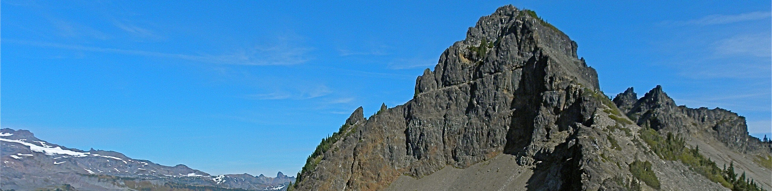
The insects can be bothersome on this trail, especially during summer, so we advise a generous application of bug spray before departing. Begin from the signed trailhead across the road from the biggest Reflection Lake. The trail climbs at a steady, moderate grade through a patchy forest. Once you’ve hiked about a 0.5mi, take a look for partial views of Mount Rainier through the trees. You’ll walk beside a stream at 0.6mi and then break out of the trees at 0.7mi.
Continue along the rocky trail, hiking underneath cliffs at 0.9mi and beginning to switchback at 1.0mi. Continue towards the obvious saddle. At 1.3mi, you’ll crest the saddle, earning views of open meadows, Mount Adams, and Mount Rainier on clear days. Mount Adams, like Mount Rainier, is a stratovolcano that is not yet considered extinct, making the views that much more interesting. The wide saddle leads to other trails through the area, so if you’re keen to keep exploring and have a map or GPS at the ready, you can extend your day along these paths.
When you’re ready, simply return the same way you came.
Hiking Route Highlights
Mount Adams
Mount Adams, known by some Native American tribes as Pahto or Klickitat, is a potentially active volcano in the Cascade Range of Washington State. Although Adams has not erupted in more than 1,000 years, it is not considered extinct. It is the second-highest mountain in Washington after Mount Rainier.
Insider Hints
If you continue along the ridge a bit, you can follow the network of trails that cover this area. We recommend having GPS at the ready if you choose to do this.
The Reflection Lakes parking area only accommodates about 35 cars, so arrive early.
There are no facilities in the parking lot.
Users report bothersome bugs on this trail during the summer months. Bring bug spray!
Hiking poles are helpful for some of the rockier sections of this hike.
Similar hikes to the Pinnacle Peak Saddle Trail hike

Paul Peak Trail
The Paul Peak Trail is a 6.3mi lightly trafficked out and back trail in Mount Rainier National Park…

Narada Falls to Mazama Ridge Loop
The Narada Falls to Mazama Ridge loop is an 7.4mi moderately trafficked route in Mount Rainier National Park…

Camp Summerland via Wonderland Trail
The hike to Camp Summerland on the Wonderland Trail is a 8.4mi moderately trafficked out and back trail…
Comments