Tahoma Creek Suspension Bridge and Emerald Ridge Loop
View Photos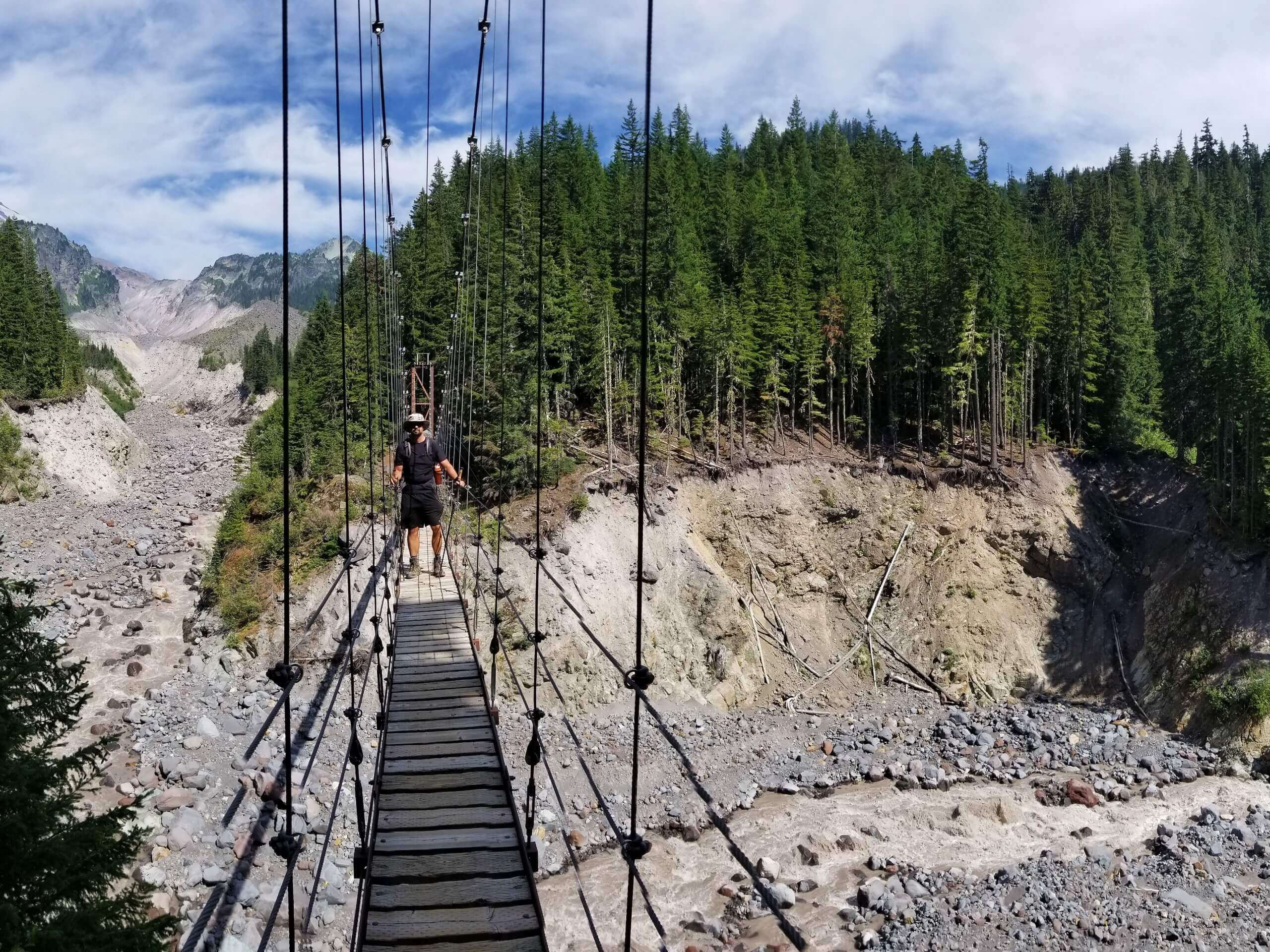
Tahoma Creek Suspension Bridge and Emerald Ridge Loop
Difficulty Rating:
The Tahoma Creek Suspension Bridge to Emerald Ridge Loop is a 11.8mi lightly trafficked trail in Mount Rainier National Park that offers a real sense of adventure due to its sometimes difficult-to-find trail and length. If you’re prepared to do a bit of routefinding, this loop offers a fantastic waterfall, an impressive bridge, and mountain views all to yourself.
Getting there
To get to the trailhead for the Tahoma Creek Suspension Bridge and Emerald Ridge Loop from the Nisqually entrance, drive east on Nisqually Longmire Road for 1.0mi. Turn left onto West Side Road. Follow the road for 3.2mi and park at its end.

About
| Backcountry Campground | South Puyallup River Camp |
| When to do | June-August |
| Pets allowed | No |
| Family friendly | No |
| Route Signage | Poor |
| Crowd Levels | Low |
| Route Type | Lollipop |
Tahoma Creek Suspension Bridge and Emerald Ridge Loop
Elevation Graph
Weather
Tahoma Creek Suspension Bridge and Emerald Ridge Loop Description
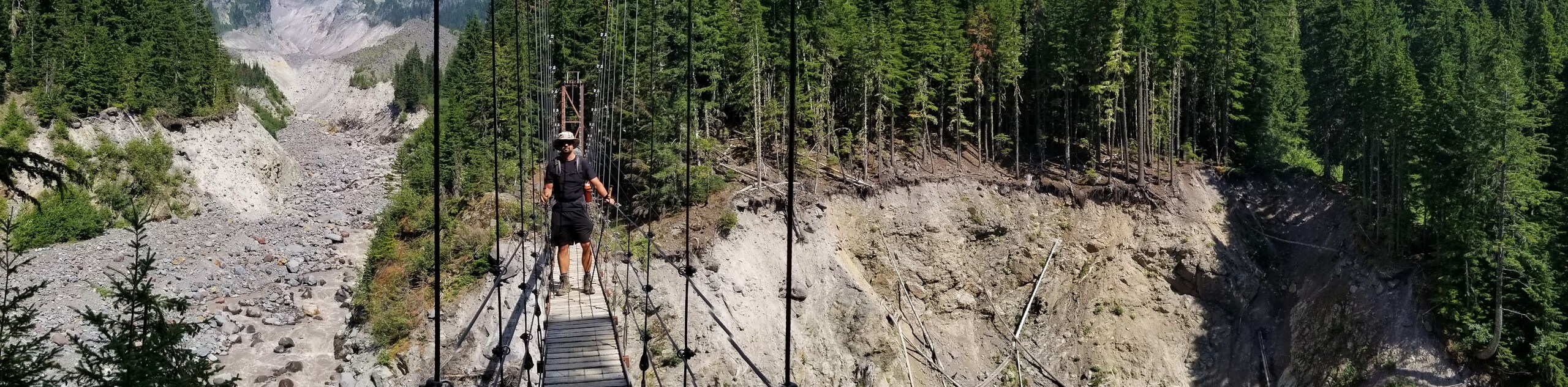
If you’re searching for a trail that feels more adventurous and exciting than some of the common picks in Mount Rainier National Park, the Tahoma Creek Suspension Bridge and Emerald Ridge Loop Trail is a perfect pick. Armed with GPS and the willingness to do some routefinding, you’ll be handsomely rewarded with gorgeous views and a trail that you just might have to yourself.
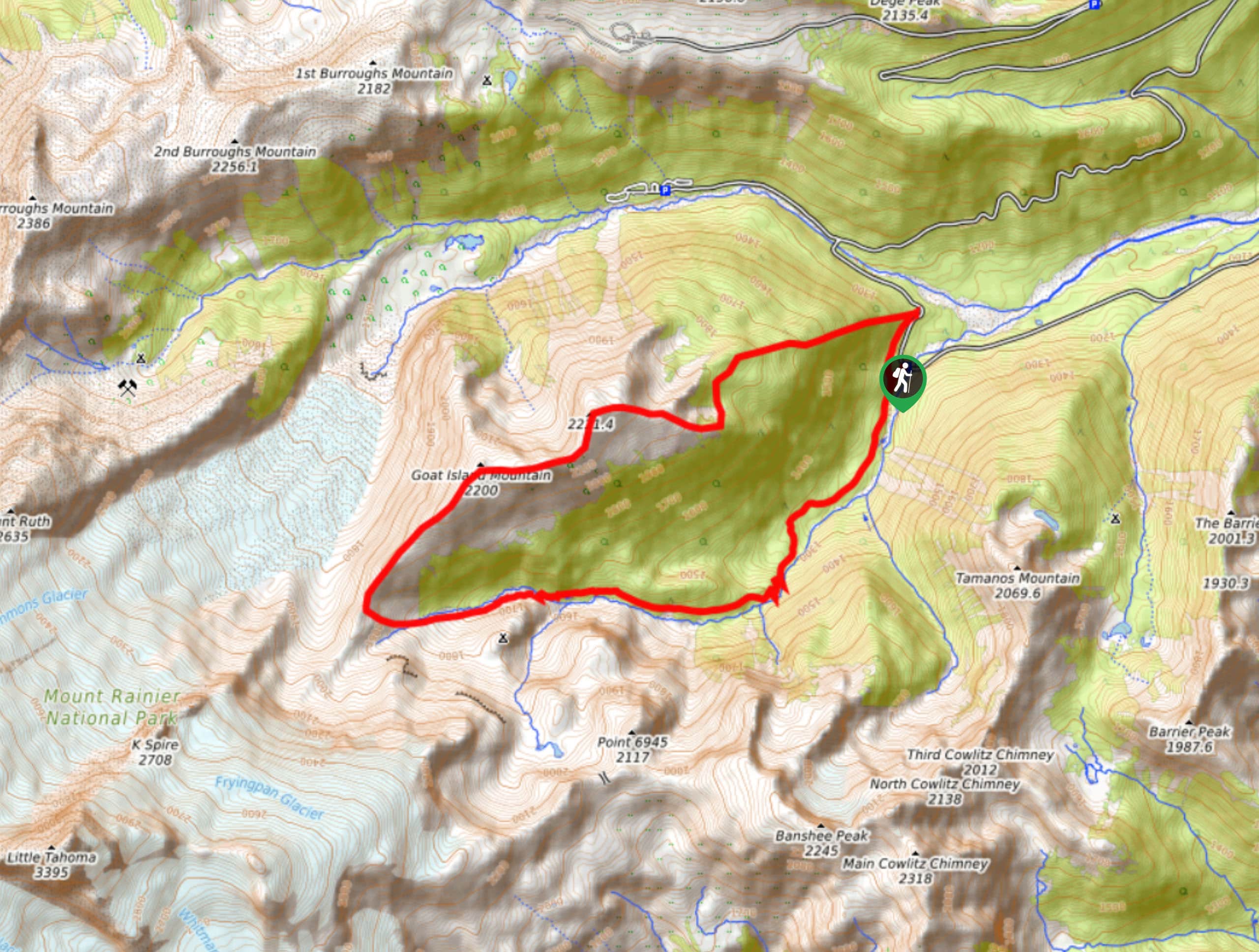
Begin by hiking 1.8mi on the Westside Road to the unmarked Tahoma Creek Trail. You can bike this section to save some time. From the trailhead, begin up the trail for 2.1mi, passing a small waterfall and joining the Wonderland Trail. Note that this trail is unmaintained and subject to washout, so the conditions can be variable.
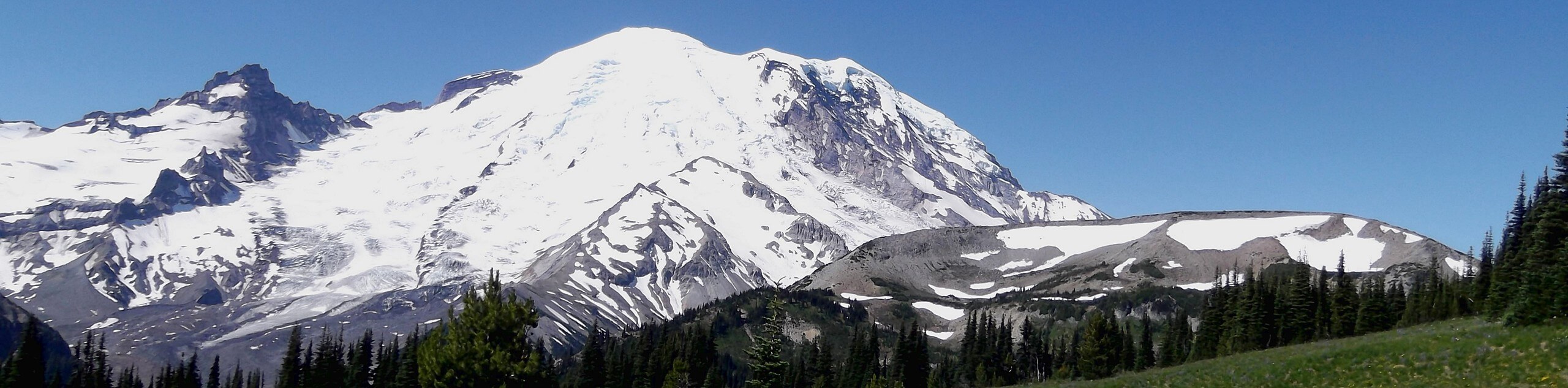
Continue north through the forest, then through volcanic and subalpine landscapes as you ascend. Emerald Ridge comes into view, a wide, bright green and flowered alpine meadow. This is a gorgeous spot with a unique view of Mount Rainier.
Descend off the ridge on a loose rocky trail, taking care not to slip. You’ll dip back into the forest and then go west on the South Puyallup Trail, descending through the woods for 0.6mi to the Westside Road. Turn south of the road and descend to the Tahoma Creek Trail.
Similar hikes to the Tahoma Creek Suspension Bridge and Emerald Ridge Loop hike

Camp Summerland via Wonderland Trail
The hike to Camp Summerland on the Wonderland Trail is a 8.4mi moderately trafficked out and back trail…
Skyscraper Pass and Burroughs Mountain via Wonderland Trail
Skyscraper Pass and Burroughs Mountain via Wonderland Trail is a 8.2mi moderately trafficked route in Mount Rainier National…
Goat Island Mountain Trail
The Goat Island Mountain Trail is a 8.7mi lightly trafficked loop trail in Mount Rainier National Park that…
Comments