Tahoma Creek Suspension Bridge Hike
View Photos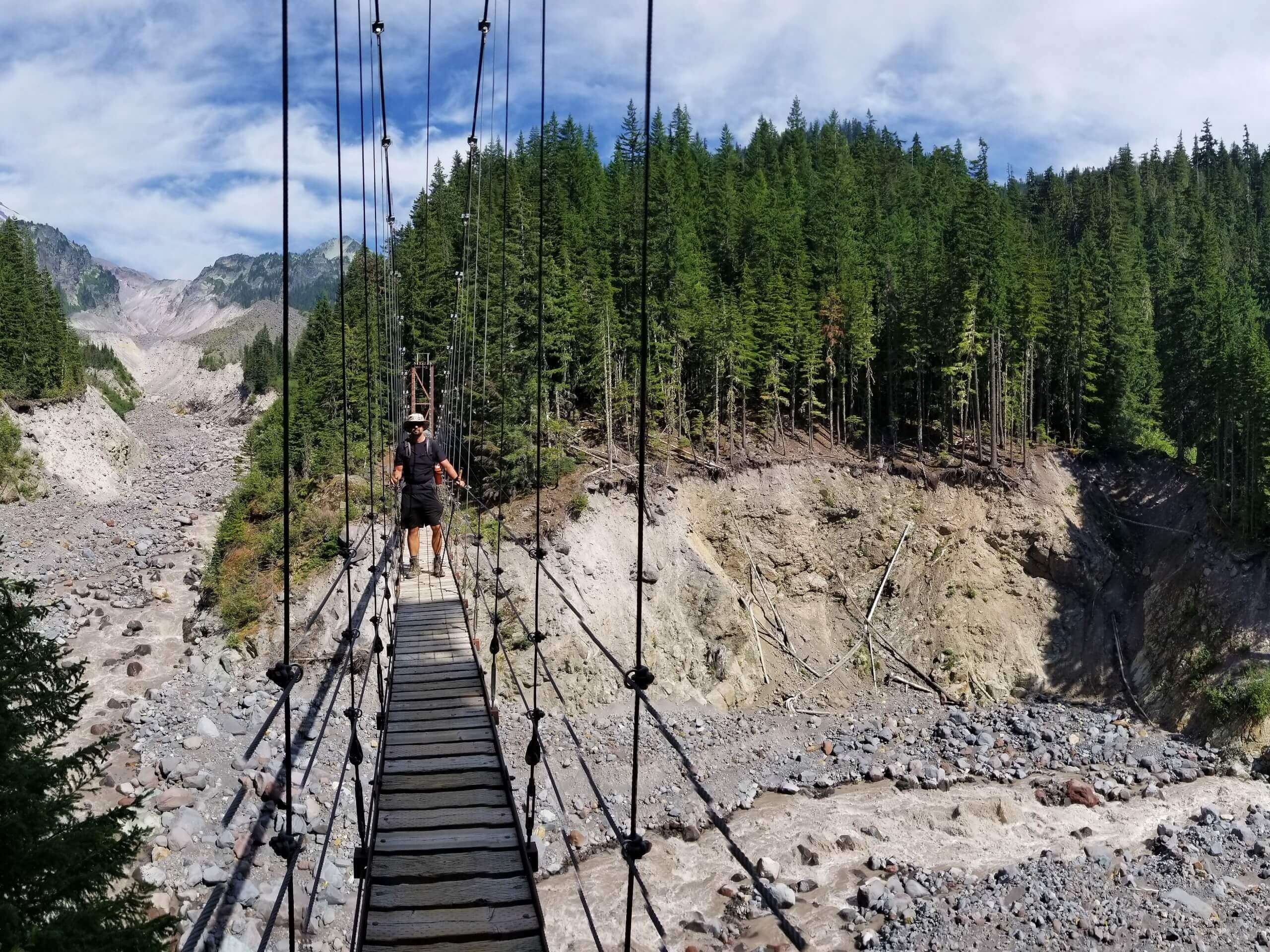
Tahoma Creek Suspension Bridge Hike
Difficulty Rating:
The Tahoma Creek Suspension Bridge hike is a 6.3mi lightly trafficked trail in Mount Rainier National Park that offers a real sense of adventure due to its sometimes hard-to-follow trail and lack of maintenance. If you’re prepared to do a bit of routefinding, Don’t let this scare you away, though. If you’re armed with a GPS, you’ll enjoy a quiet, beautiful trail.
Getting there
To get to the trailhead for the Tahoma Creek Suspension Bridge from the Nisqually entrance, drive east on Nisqually Longmire Road for 1.0mi. Turn left onto West Side Road. Follow the road for 3.2mi and park at its end.

About
| Backcountry Campground | No |
| When to do | April-October |
| Pets allowed | No |
| Family friendly | No |
| Route Signage | Poor |
| Crowd Levels | Low |
| Route Type | Out and back |
Tahoma Creek Suspension Bridge Hike
Elevation Graph
Weather
Tahoma Creek Suspension Bridge Hike Description
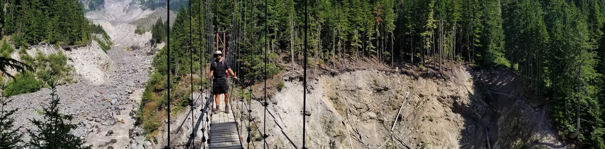
If you’re hoping for more solitude and challenge than your average trail in Mount Rainier National Park, the Tahoma Creek Suspension Bridge hike is a great pick. If you’re prepared to take on this unmaintained, sometimes washed-out trail, you’ll get to enjoy solitude and fantastic views in return.
Begin by hiking 1.8mi on the Westside Road to the unmarked Tahoma Creek Trail. You can bike this section to save some time. From the trailhead, begin up the trail for 2.1mi, passing a small waterfall and joining the Wonderland Trail. Note that this trail is unmaintained and subject to washout, so the conditions can be fine or poor depending on recent rain.
Some users have reported needing to walk through the creek bed for about 400 yards if washout has occurred, but otherwise, you should be able to keep to the trail in the forest for the duration of your hike. If you end up hiking in the creek bed, look for large, fallen logs on the left side of the bed about ⅔ of the way up, which is where you can reconnect to the trail.
You’ll find the bridge at the end of the trail. Enjoy the height over the river, snap some photos, and then carefully find your way back home.
Similar hikes to the Tahoma Creek Suspension Bridge Hike hike

Paul Peak Trail
The Paul Peak Trail is a 6.3mi lightly trafficked out and back trail in Mount Rainier National Park…

Narada Falls to Mazama Ridge Loop
The Narada Falls to Mazama Ridge loop is an 7.4mi moderately trafficked route in Mount Rainier National Park…

Camp Summerland via Wonderland Trail
The hike to Camp Summerland on the Wonderland Trail is a 8.4mi moderately trafficked out and back trail…
Comments