Sunrise Rim Trail
View Photos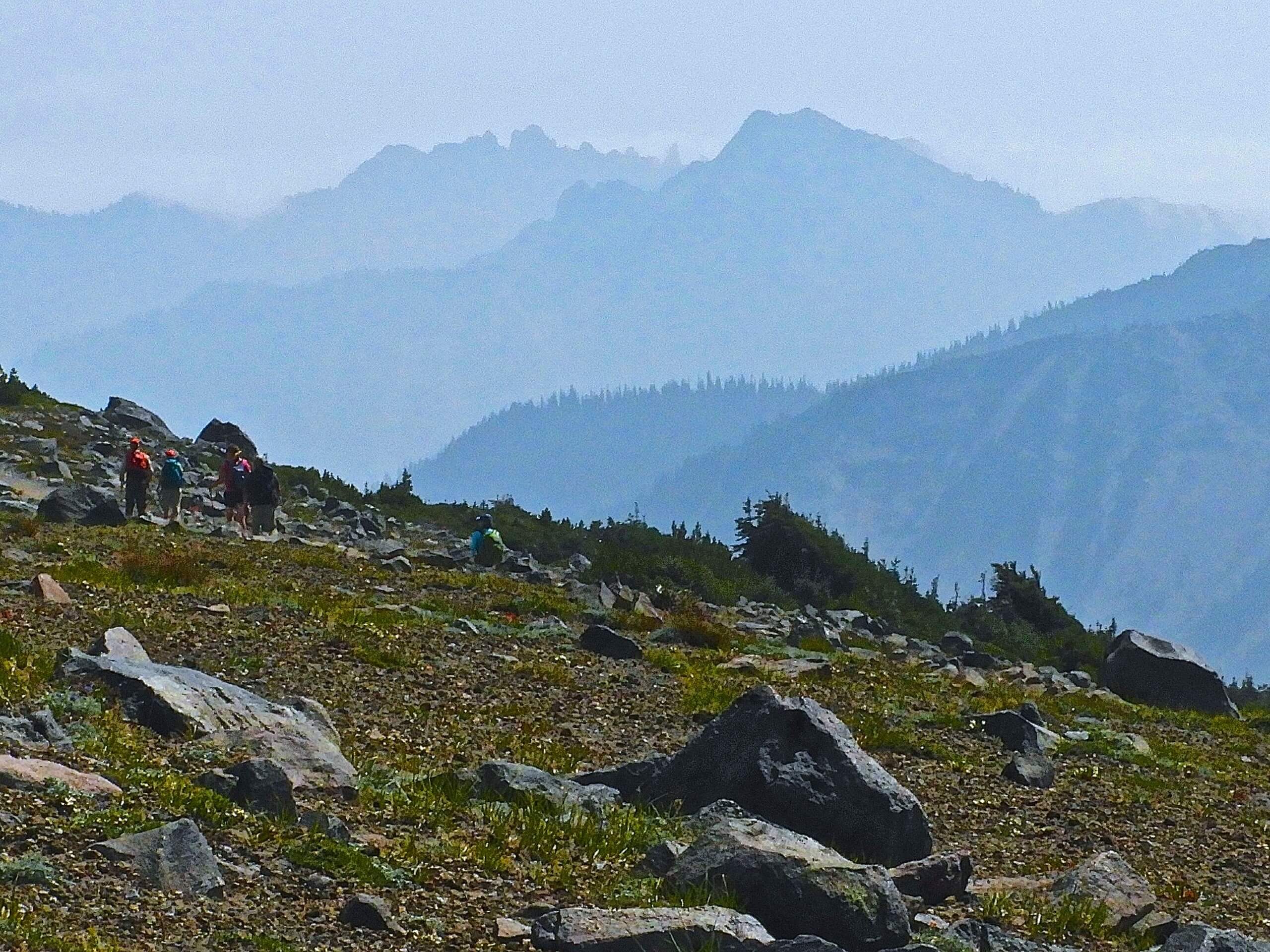
Sunrise Rim Trail
Difficulty Rating:
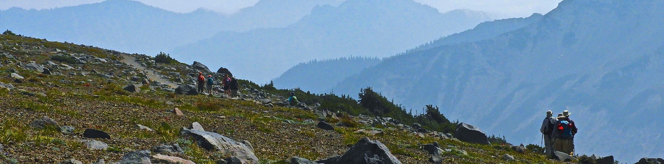
The Sunrise Rim Trail is a 5.0mi moderately challenging loop trail in Mount Rainier National Park that offers splendid views of Mount Rainier, Mount Fremont, the Emmons Glacier, and more. This trail loops to several worthy spots, like the Glacier Overlook and the 1st and 2nd Burroughs, so you can shorten it or hike it as an out and back if you’re not up to completing the entire trail. With expansive views and changing terrain, the Sunrise Rim Trail is one of the most satisfying hikes you can do in Mount Rainier National Park.
Getting there
The trailhead for the Sunrise Rim Trail is located at the western terminus of Sunrise Park Road. You can either travel north or south on Highway 410 (Mather Memorial Parkway) to reach the turnoff for Sunrise Park Road. Take care to keep right onto Sunrise Park Road at the junction with White River Campground Road.

About
| Backcountry Campground | Sunrise Camp |
| When to do | May-October |
| Pets allowed | No |
| Family friendly | Older Children only |
| Route Signage | Average |
| Crowd Levels | Moderate |
| Route Type | Circuit |
Sunrise Rim Trail
Elevation Graph
Weather
Sunrise Rim Trail Description
The Sunrise Rim Trail packs a lot of unforgettable scenery into one hike. You’ll be able to enjoy Shadow Lake, Glacier Overlook, Sourdough Ridge, and more. The nature of the trail makes it very easy to turn around at any of the great viewpoints to shorten your hike, but we definitely recommend completing the loop for an exceptional experience. While the hike is moderately strenuous, it requires no technical skills.
From the Sunrise Parking Lot, take the trail on the south side of the lot. Shortly, you’ll come to a junction, where you’ll stay right. Enjoy subalpine meadows and trees as you hike to Shadow Lake 1.3mi from the trailhead. This is a lovely objective of its own. From the lake, you’ll pass Sunrise Camp and take on a moderate incline to a fantastic viewpoint called Glacier Overlook. Snap some photos of Mount Rainier, look for the impressive Emmons Glacier, and admire the small lakes all over. This is a stunning overlook and a good point to turn around if you want a shorter hike.
Continue on the increasingly steep trail, leaving the trees and beginning to hike over rockier terrain. You’ll notice the walls built to hold back the rocks on this section of the path. Take care to stay on the marked trail in this section, as the rock can be loose and unstable.
Just before arriving at the peak of 1st Burroughs, look for a viewpoint with large rocks. This is a good spot for lunch, as the view here is actually less obstructed than on the top of the mountain.
From the top of 1st Burroughs, continue 0.6mi to 2nd Burroughs. From here, you can either continue to 3rd Burroughs (very strenuous but highly rewarding views of Winthrop Glacier) or head down to Frozen Lake and Sourdough Ridge. This portion of the loop offers nice views of Mount Fremont and even to Mount Baker. Descending Sourdough Ridge, you’ll arrive back at the parking lot.
It’s up to you how far you go on this trail, but no matter what, you’re in for a great journey.
Insider Hints
Parking at Sunrise can fill up early, so we recommend a morning start or visiting in the afternoon after the initial rush of hikers has left.
The trail to 3rd Burroughs is not maintained and is mostly made of soft sand, so we don’t recommend it in wet conditions.
Book a spot at Sunrise Camp to give yourself more time to explore the trail.
Similar hikes to the Sunrise Rim Trail hike

Paul Peak Trail
The Paul Peak Trail is a 6.3mi lightly trafficked out and back trail in Mount Rainier National Park…

Narada Falls to Mazama Ridge Loop
The Narada Falls to Mazama Ridge loop is an 7.4mi moderately trafficked route in Mount Rainier National Park…

Camp Summerland via Wonderland Trail
The hike to Camp Summerland on the Wonderland Trail is a 8.4mi moderately trafficked out and back trail…
Comments