Burroughs Mountain Trail
View Photos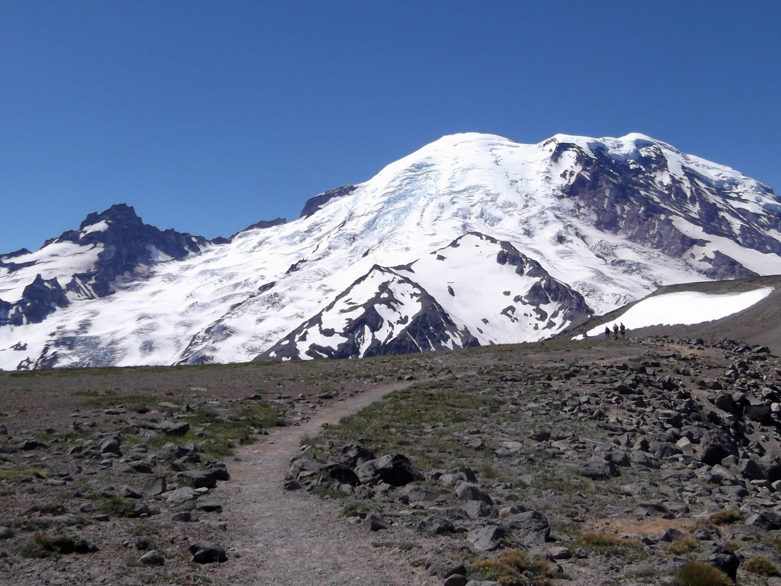
Burroughs Mountain Trail
Difficulty Rating:
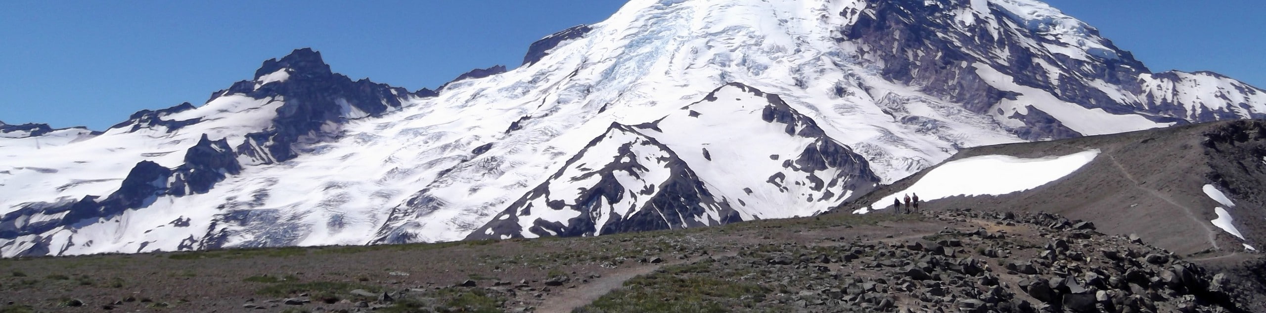
The Burroughs Mountain Trail is a 9.0mi hard hike in Mount Rainier National Park that takes you between three peaks to various viewpoints. The trail is long but not too strenuous; part of the difficulty level comes from sections of unmaintained trail. This hike will grant you up-close views of Mount Rainier, the Emmons Glacier, Sourdough Ridge, Mount Fremont, and more. If the full 9.0mi hike is too long for you, you can turn back from the first or second peaks and still have a fantastic day.
Getting there
To get to the trailhead for the Burroughs Mountain Trail from the White River park entrance, take Highway 410 to Sunrise Park Road, and then follow this road to the western terminus, taking care to keep right at the junction with the White River Campground access road.

About
| Backcountry Campground | Sunrise Camp |
| When to do | May-October |
| Pets allowed | No |
| Family friendly | No |
| Route Signage | Average |
| Crowd Levels | Moderate |
| Route Type | Lollipop |
Burroughs Mountain Trail
Elevation Graph
Weather
Burroughs Mountain Trail Description
The Burroughs Mountain Trail offers unique views from three different summits in one hike, providing the opportunity to push to the furthest peak or reduce your distance if you want a shorter, but still rewarding adventure. From atop the Burroughs, you’ll be able to enjoy Shadow Lake, Sourdough Ridge, Emmons Glacier, and lots more.
This hike requires that you navigate a section of unmaintained trail up to 3rd Burroughs, which is often sandy and can be slippery. If you’d prefer a more moderate journey or the conditions are wet or snowy, we recommend making 2nd Burroughs your turnaround point.
From the Sunrise Parking Lot, take the trail that leaves from the northwest corner of the lot. Even in nice weather, there is often a snowfield on the trail to 1st Burroughs, so proceed with caution and save the hike for later if the crossing seems unsafe.
Follow the signage for Sourdough Ridge, hiking along a wide, steadily uphill trail. You’ll navigate a well-signed intersection with the trail to Frozen Lake (feel free to pop down to the lake if you’d like), where you’ll want to take the Burroughs Mountain Trail heading southwest.
You’ll arrive on the large, wide-open summit of 1st Burroughs. From here, continue along the trail, passing an intersection, to 2nd Burroughs, where the Glacier Overlook awaits. Look down on the Emmons Glacier, Fremont, Skyscraper, and more. This fantastic view is often a turnaround point for hikers looking to avoid unmaintained trail and a big physical push to 3rd Burroughs.
To continue, hike down a saddle to an intersection with the Glacier Basin Trail. The trail leads slightly to the right, heading steadily uphill over sandy terrain. This trail is not always in good condition, so take extra care if it’s wet or snowy.
After a hefty climb, you’ll enjoy up-close views of Mount Rainier atop 3rd Burroughs. Look to the west for a fantastic view of Winthrop Glacier. This section of the hike can be done as a loop if you access the trail using a trailhead on the south side of the Sunrise parking lot. Hike in a clockwise direction and pass Shadow Lake on a flat trail, then climb steeply to an overlook on the White River and Emmons Glacier.
Past the overlook, the route continues up and onto the wide, flat plateau of 1st Burroughs, reaching the intersection at Frozen Lake. Here you can continue on to Second Burroughs using the above directions or hike east another 1.4mi back to the Sunrise parking lot in a loop.
If you’d rather make your hike out-and-back, carefully retrace your steps off 3rd Burroughs the way you came.
Insider Hints
Parking at Sunrise can fill up early, so we recommend a morning start or visiting in the afternoon after the initial rush of hikers has left.
The trail to 3rd Burroughs is not maintained and is mostly made of soft sand, so we don’t recommend it in wet conditions.
Book a spot at Sunrise Camp to give yourself more time to explore the trail.
Similar hikes to the Burroughs Mountain Trail hike

Paul Peak Trail
The Paul Peak Trail is a 6.3mi lightly trafficked out and back trail in Mount Rainier National Park…

Narada Falls to Mazama Ridge Loop
The Narada Falls to Mazama Ridge loop is an 7.4mi moderately trafficked route in Mount Rainier National Park…

Camp Summerland via Wonderland Trail
The hike to Camp Summerland on the Wonderland Trail is a 8.4mi moderately trafficked out and back trail…
Comments