Kautz Creek Trail to Longmire
View Photos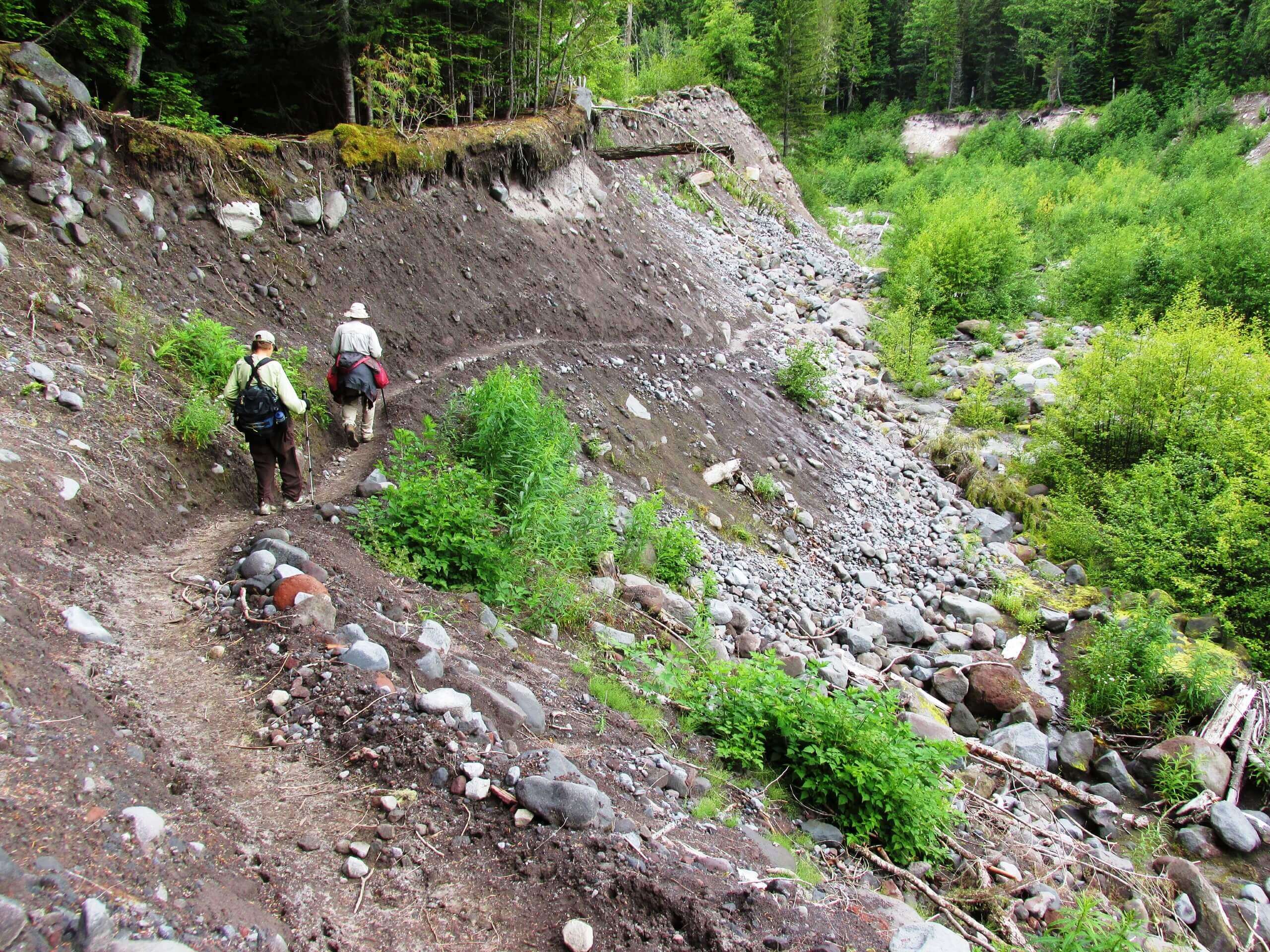
Kautz Creek Trail to Longmire
Difficulty Rating:
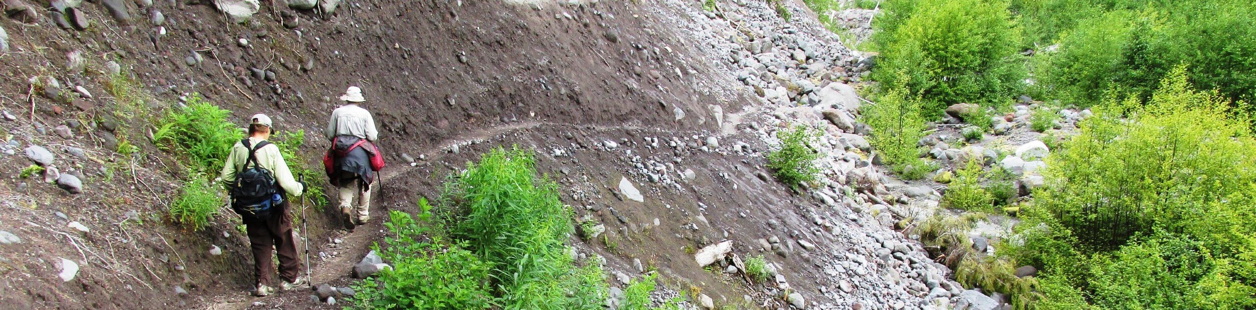
The Kautz Creek Trail to Longmire via Indian Henry’s Hunting Ground hike is a 12.1mi hard hike in Mount Rainier National Park that will test your endurance. This hike passes through a historic area of the park before arriving in Longmire. This long, steep trail passes through a picturesque meadow that used to be home to a Native American mountain guide who guided many of the founders of the park. Bring lots of water and lots of bug repellent for this one!
Getting there
To get to the trailhead for the Kautz Creek Trail from the Nisqually entrance to the park, drive east and look for a parking area with facilities on the right-hand side of the road just after a bridge and a culvert.

About
| Backcountry Campground | Devils’ Dream Camp, Pyramid Creek Camp |
| When to do | July-October |
| Pets allowed | No |
| Family friendly | No |
| Route Signage | Average |
| Crowd Levels | Moderate |
| Route Type | One Way |
Kautz Creek Trail to Longmire
Elevation Graph
Weather
Kautz Creek Trail to Longmire Description
The hike on Kautz Creek Trail is a long, arduous one, but it leads through a very special part of Mount Rainier National Park to Longmire. You’ll arrive in Indian Henry’s Hunting Ground, the former home of a Native American guide named So-To-Lick who provided guidance to the founders of the park many years ago. Bring lots of water and bug spray on this trail, as the elevation gain is constant and the bugs can be plentiful.
The trail begins from the north side of the road, switchbacking through the forest. The ascent is consistent and unrelenting to the summit ridge of Mount Ararat, where you’ll have a great view of Rainier. Continue on, crossing meadows about 4.0mi in. From the meadows, continue for a mile to the junction with the Wonderland Trail. You’ll want to go right here, but you can go left to pop over to the patrol cabin and chat with the rangers at the hunting ground if you’d like.
Following the Wonderland Trail southeast, you’ll descend, eventually crossing Devil’s Dream Creek and skirting two lakes. Cross through Devil’s Dream Camp and then back over the creek. The trail ascends, crosses another creek, descends through switchbacks, and crosses Pearl Creek.
You’ll pass by Pyramid Creek Camp, cross Kautz Creek, and then continue along switchbacks to a Y-junction. Keep right here onto Rampart Ridge Trail, switchbacking your way to the intersection with Trail of the Shadows. The trail ends here, just outside of Longmire.
Similar hikes to the Kautz Creek Trail to Longmire hike

Paul Peak Trail
The Paul Peak Trail is a 6.3mi lightly trafficked out and back trail in Mount Rainier National Park…

Narada Falls to Mazama Ridge Loop
The Narada Falls to Mazama Ridge loop is an 7.4mi moderately trafficked route in Mount Rainier National Park…

Camp Summerland via Wonderland Trail
The hike to Camp Summerland on the Wonderland Trail is a 8.4mi moderately trafficked out and back trail…
Comments