Panhandle Gap Hike
View Photos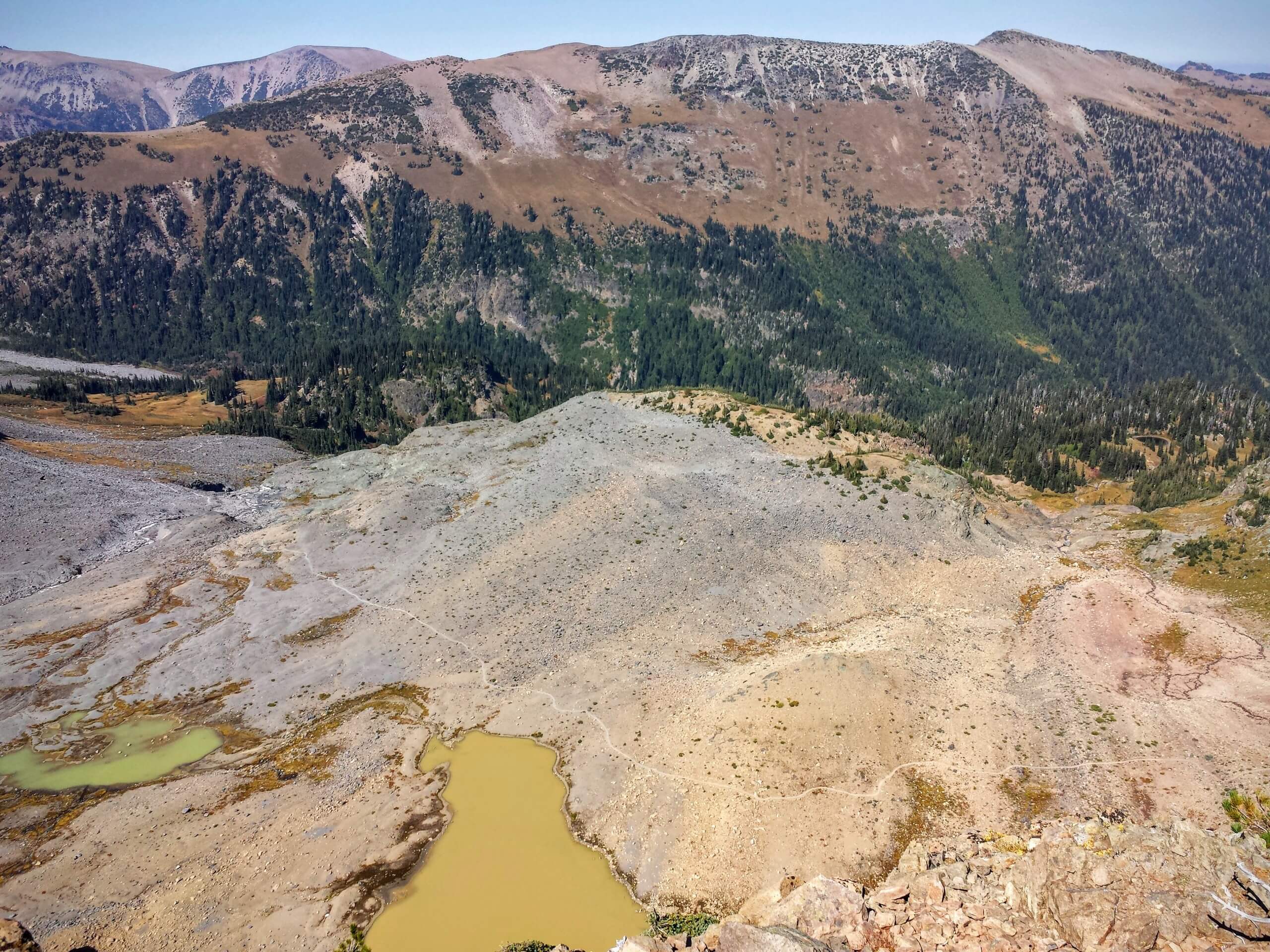
Panhandle Gap Hike
Difficulty Rating:
The Panhandle Gap hike is a 11.1mi trail in Mount Rainier National Park that offers nice mountain views and is rated as hard. This hike passes Camp Summerland, a few small lakes, and then culminates at Panhandle Gap, which has amazing views.
Getting there
The trailhead for the Panhandle Gap hike is located at the parking lot for Summerland Trail on Sunrise Park Road. You’ll leave from the north side of the road.

About
| Backcountry Campground | Camp Summerland |
| When to do | July-October |
| Pets allowed | No |
| Family friendly | No |
| Route Signage | Average |
| Crowd Levels | Moderate |
| Route Type | Out and back |
Panhandle Gap Hike
Elevation Graph
Weather
Panhandle Gap Hike Description
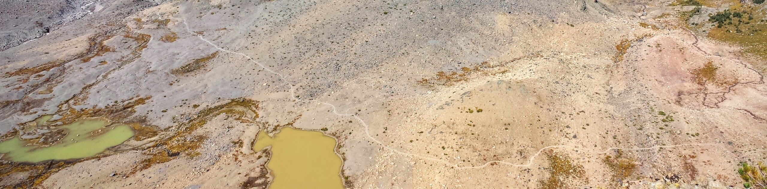
The hike to Panhandle Gap is long, but it’s full of great views and points of interest along the trail. You’ll cross through Summerland Gap, enjoy some small lakes, and then finish off at the gap, which offers awesome views.
Take Summerland Trail south from the Summerland parking area. The trail shortly joins Wonderland Trail- stay straight and hike roughly alongside Fryingpan Creek. You’ll switchback along a few tight turns and then continue straight along to Camp Summerland after a few more switchbacks. The trail out of camp continues south along Wonderland.
Hiking along Wonderland for another mile, you’ll pass a couple of small lakes. These are somewhat uninspiring, so keep going for 0.4mi to the gap. The views here are fantastic, and it’s a nice place to recoup before retracing your steps back to the parking area.
Similar hikes to the Panhandle Gap Hike hike

Paul Peak Trail
The Paul Peak Trail is a 6.3mi lightly trafficked out and back trail in Mount Rainier National Park…

Narada Falls to Mazama Ridge Loop
The Narada Falls to Mazama Ridge loop is an 7.4mi moderately trafficked route in Mount Rainier National Park…

Camp Summerland via Wonderland Trail
The hike to Camp Summerland on the Wonderland Trail is a 8.4mi moderately trafficked out and back trail…
Comments