Eagle Peak Trail
View Photos
Eagle Peak Trail
Difficulty Rating:
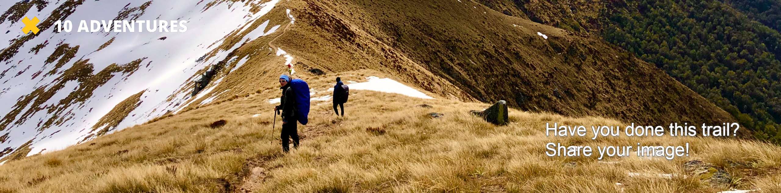
For a classic hiking-in-Rainier experience, the 7.2mi Eagle Peak Trail delivers. This hard hike brings you through old-growth forest and wildflower-filled subalpine meadows to reach fantastic views of Rainier, Mount St. Helens, and Mount Tahoma. With a good bit of elevation gain to contend with, you’ll feel like you earned every inch of your summit view.
Getting there
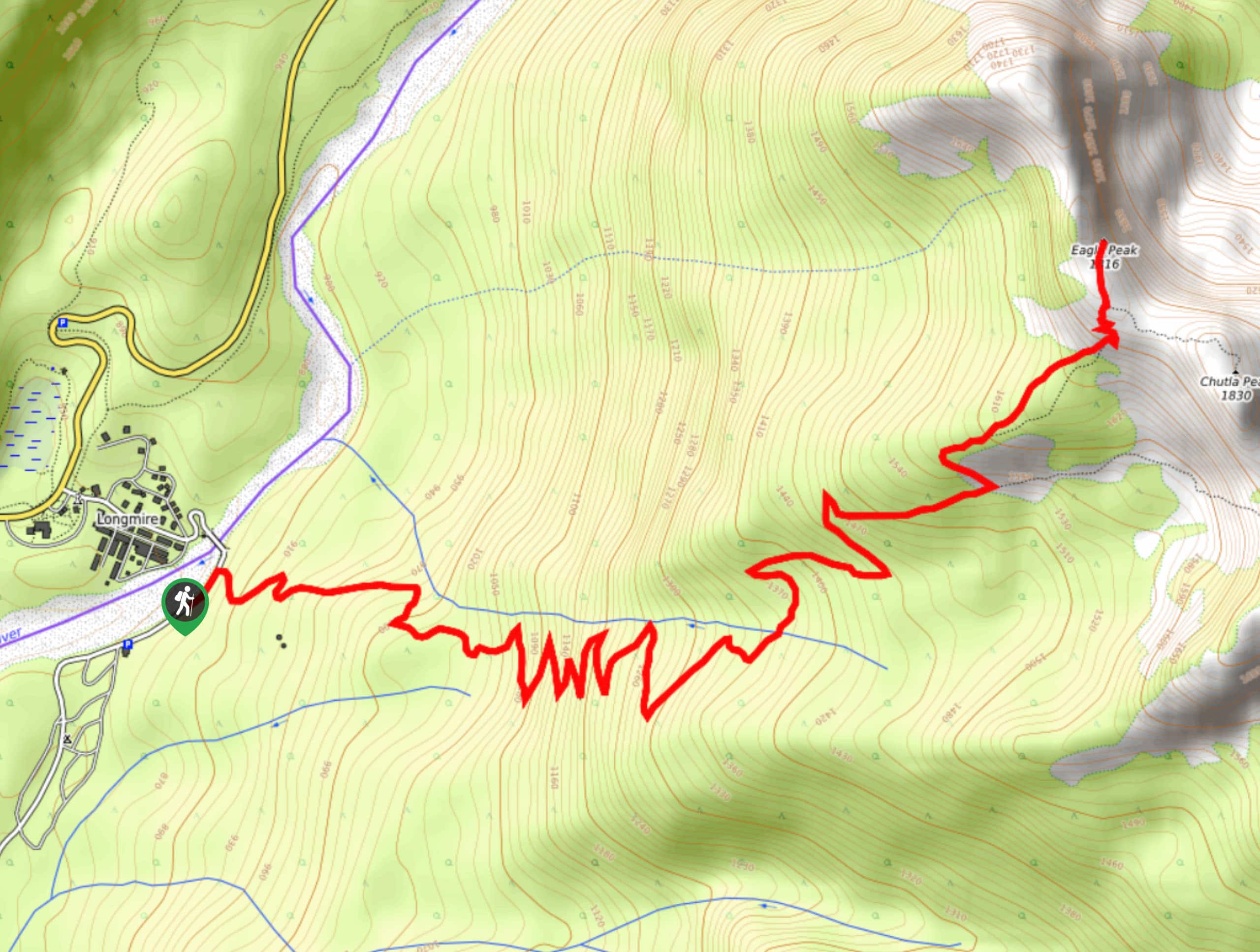
To get to the trailhead for the Eagle Peak Trail from the Nisqually entrance to the park, drive east on Highway 706 to Longmire. Turn into the lodge and museum parking lot.

About
| Backcountry Campground | No |
| When to do | July-October |
| Pets allowed | No |
| Family friendly | No |
| Route Signage | Average |
| Crowd Levels | Moderate |
| Route Type | Out and back |
Eagle Peak Trail
Elevation Graph
Weather
Eagle Peak Trail Description
The Eagle Peak Trail demands some decent elevation gain, but it rewards your efforts with incredible views of Mount Rainier and the surrounding summits. With pretty meadows and ancient forest to walk through, you’ll love every mile on this hike. Just be sure to wear lots of bug spray!
Begin by heading south from the Nisqually suspension bridge for around 200ft. Follow the signage for the Eagle Peak Trail on the left side of the road. Begin climbing right away, making your way through the switchbacks under a roof of evergreen trees.
About 2.3mi in, cross a small creek. Around 3.0mi, you’ll hike through a pretty meadow. Prepare for another set of switchbacks, this time steeper. Enjoy an even better meadow, then crest the pass at 3.6mi. The views here are spectacular!
We don’t recommend the scramble to the top of Eagle Peak, as it’s Class IV. Enjoy the pass before retracing your steps.
Similar hikes to the Eagle Peak Trail hike

Paul Peak Trail
The Paul Peak Trail is a 6.3mi lightly trafficked out and back trail in Mount Rainier National Park…

Narada Falls to Mazama Ridge Loop
The Narada Falls to Mazama Ridge loop is an 7.4mi moderately trafficked route in Mount Rainier National Park…

Camp Summerland via Wonderland Trail
The hike to Camp Summerland on the Wonderland Trail is a 8.4mi moderately trafficked out and back trail…
Comments