Glacier Basin Trail
View Photos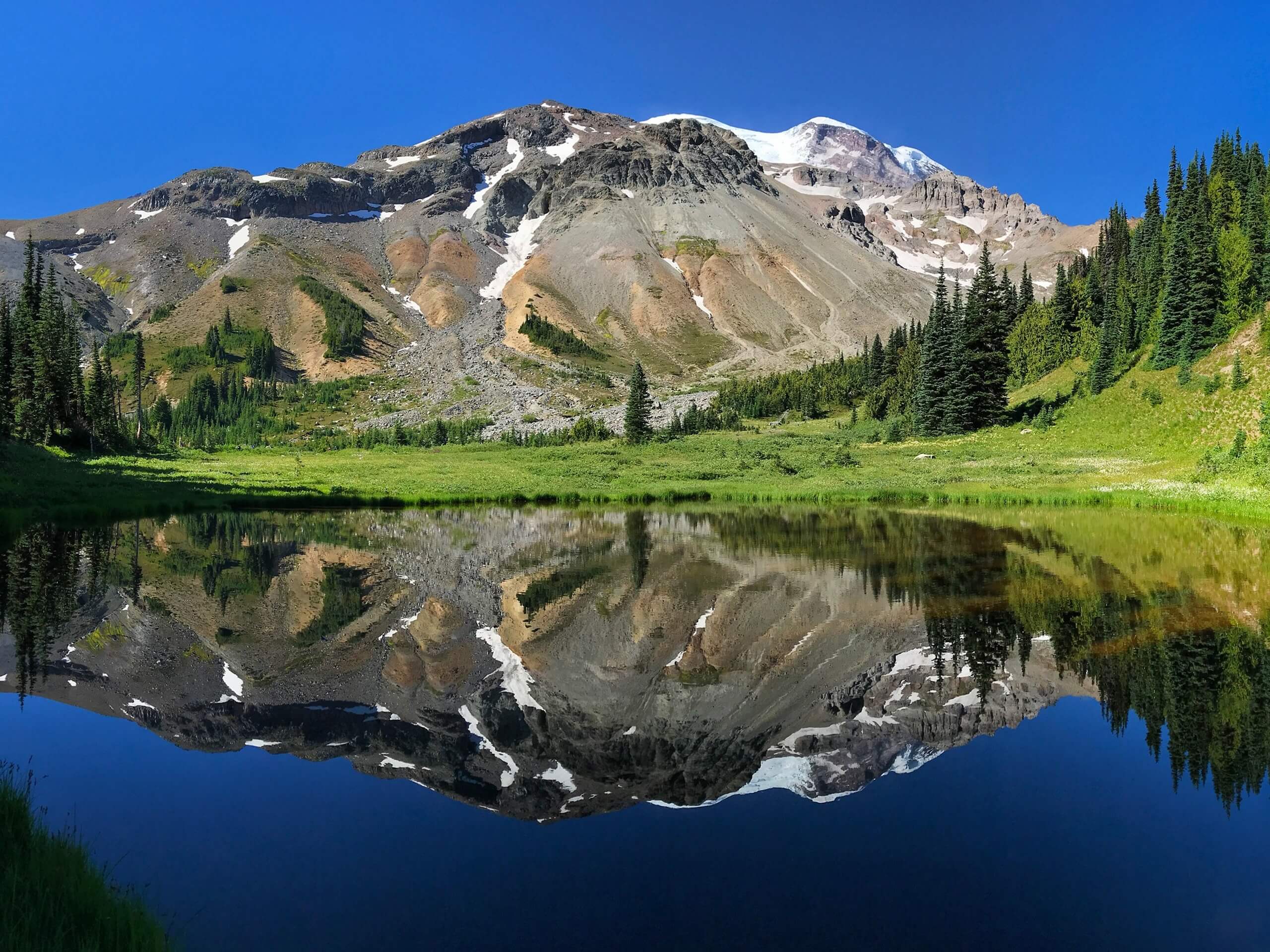
Glacier Basin Trail
Difficulty Rating:
The Glacier Basin Trail is a 6.5mi moderately trafficked route in Mount Rainier National Park that offers beautiful glacier views, wildflowers, and a peak of Mount Rainier. After being devastated by a flood in 2006, the trail was painstakingly reworked over four years to provide new access into Glacier Basin. This is a highly rewarding trail and a perfect way to enjoy one of the most iconic glaciers in the park.
Getting there
To get to the trailhead for the Glacier Basin Trail from the White River park entrance, turn right onto Sunrise Road and drive for 5.0mi. Cross the White River and turn left onto the White River Campground. The trailhead is at the top of the loop in the campground.

About
| Backcountry Campground | Glacier Basin Camp |
| When to do | June-October |
| Pets allowed | No |
| Family friendly | Older Children only |
| Route Signage | Average |
| Crowd Levels | Moderate |
| Route Type | Out and back |
Glacier Basin Trail
Elevation Graph
Weather
Glacier Basin Trail Description
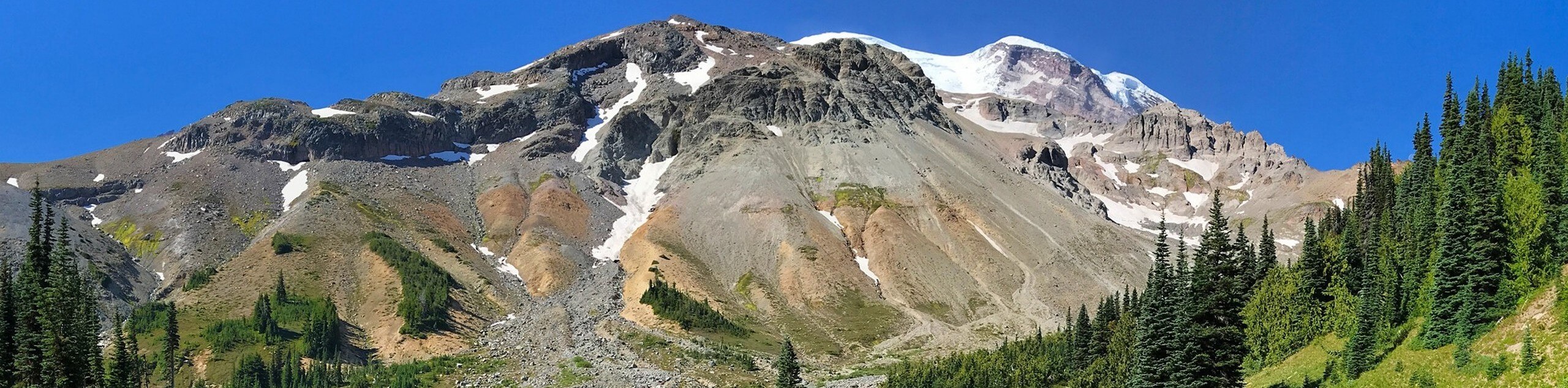
The Glacier Basin Trail is a stunning hike in Mount Rainier National Park that leads to a wide basin with fantastic views of nearby glaciers and mountains. In July and early August, you’ll enjoy wildflower blooms. This trail was decimated by a flood in 2006, but a new trail was forged by the Washington Trails Association and provides easy access to the basin.
Follow the Inter Fork of the White River. You’ll pass a half-mile side trail to Emmons Moraine, a nice quick addition to the hike. Continue a mile to the junction with the Burroughs Mountain Trail, continuing on to the Glacier Basin campsite. Just past the camp, the basin widens into a glorious spectacle, boasting views of Mount Ruth, The Mountain of The Wedge, and more. This is a special spot, so linger awhile before retracing your steps.
You can make this a loop hike by summiting Burroughs Mountains on the return, hiking to Frozen Lake, and hiking southeast on the Wonderland Trail to the White River Campground.
Similar hikes to the Glacier Basin Trail hike

Paul Peak Trail
The Paul Peak Trail is a 6.3mi lightly trafficked out and back trail in Mount Rainier National Park…

Narada Falls to Mazama Ridge Loop
The Narada Falls to Mazama Ridge loop is an 7.4mi moderately trafficked route in Mount Rainier National Park…

Camp Summerland via Wonderland Trail
The hike to Camp Summerland on the Wonderland Trail is a 8.4mi moderately trafficked out and back trail…
Comments