Mount Ruth via Glacier Basin and Emmons Moraine Trails
View Photos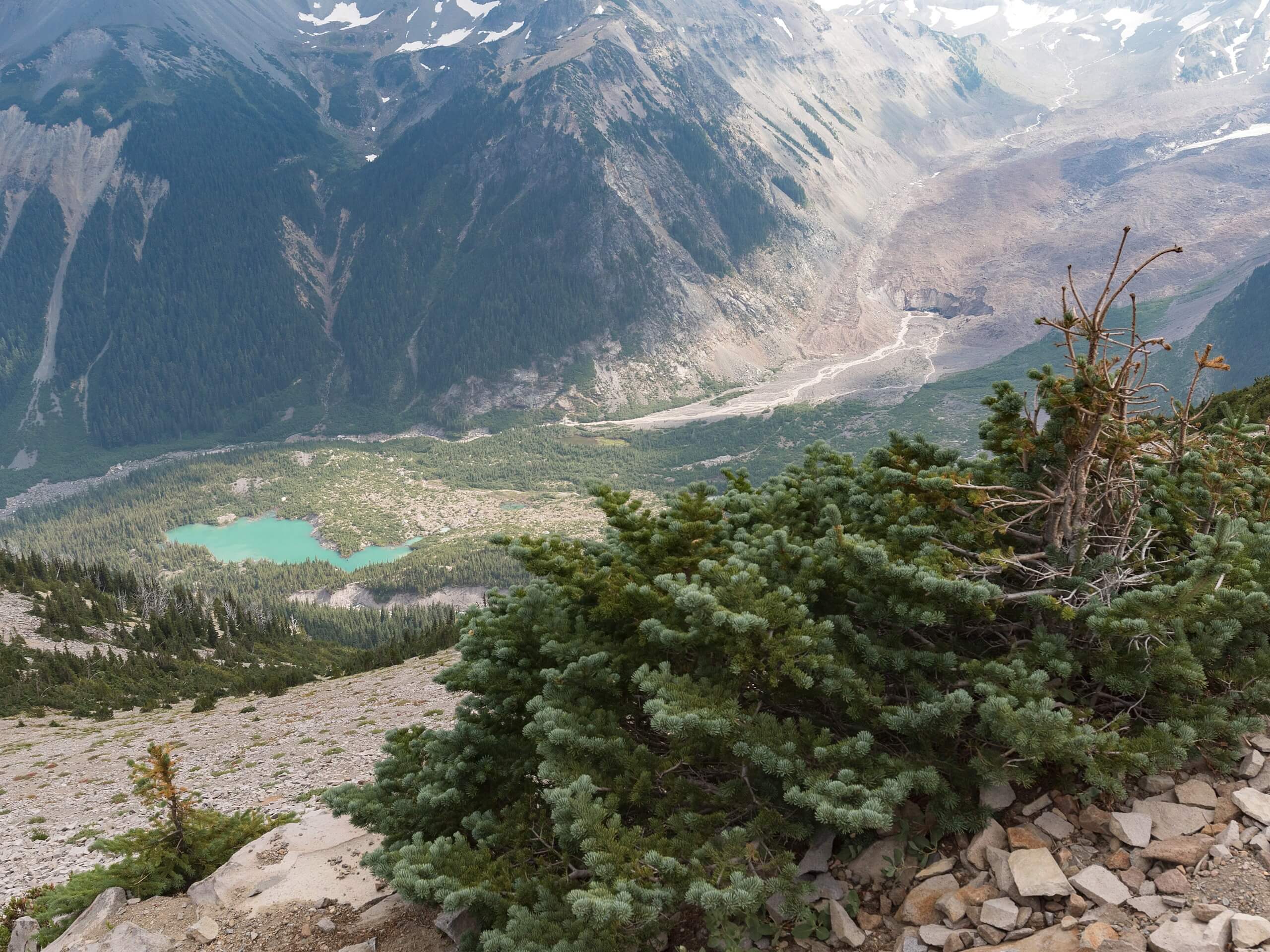
Mount Ruth via Glacier Basin and Emmons Moraine Trails
Difficulty Rating:
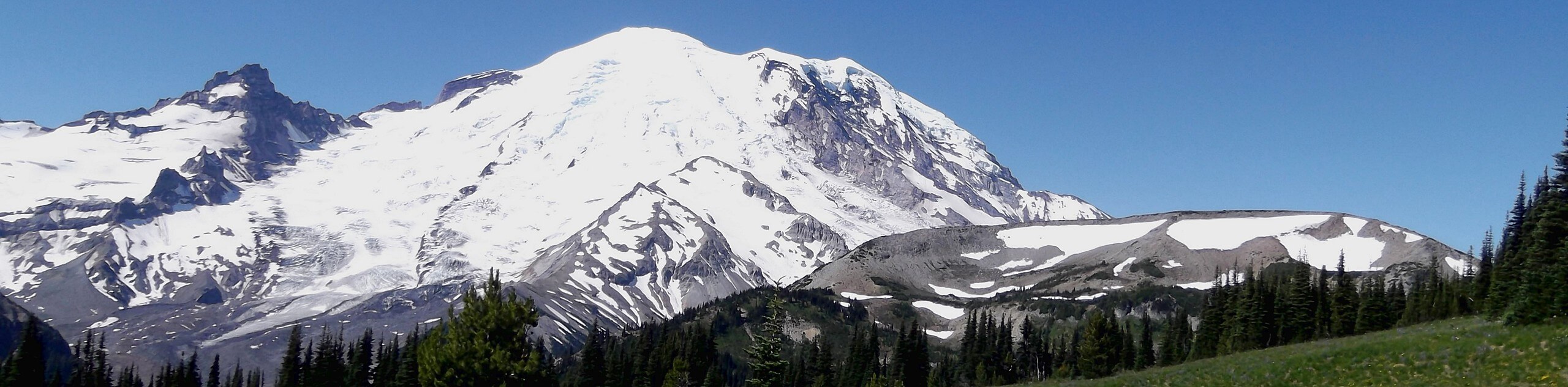
The Mount Ruth via Glacier Basin and Emmons Moraine Trails hike is a 8.4mi difficult hike in Mount Rainier National Park. This hike is no small task in terms of distance and elevation gain, but it earns extra difficulty points for its sometimes difficult-to-find route and the need to bring ice axes, crampons, and a helmet. We recommend this trail for more experienced hikers.
Getting there
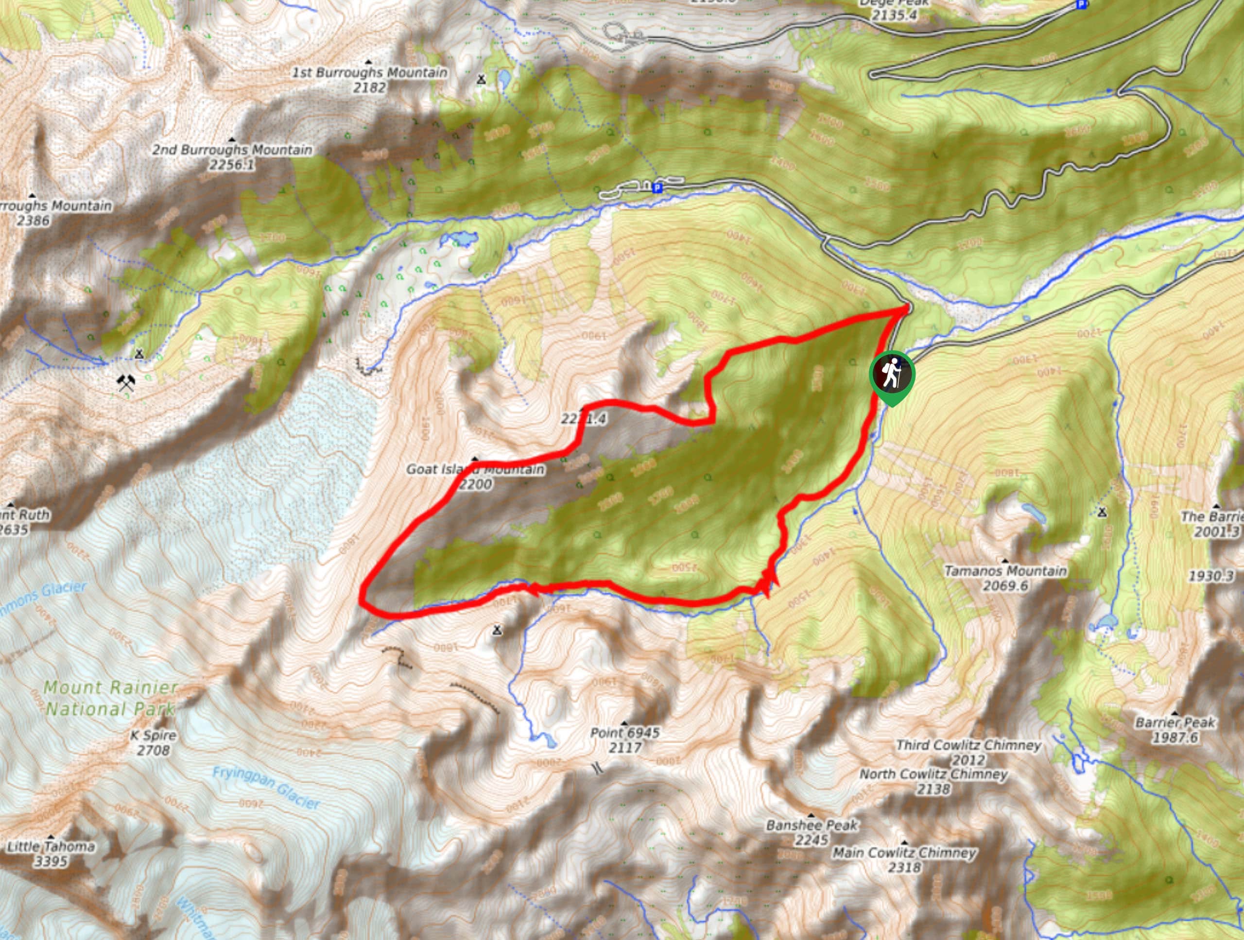
The trailhead for the Mount Ruth via Glacier Basin and Emmons Moraine Trails hike is at the terminus of the White River Campground Road off of Sunrise Road. The trail begins right at the far west end of the campground.

About
| Backcountry Campground | White River, Glacier Basin |
| When to do | July-October |
| Pets allowed | No |
| Family friendly | No |
| Route Signage | Poor |
| Crowd Levels | Low |
| Route Type | Loop |
Mount Ruth via Glacier Basin and Emmons Moraine Trails
Elevation Graph
Weather
Mount Ruth via Glacier Basin and Emmons Moraine Trails Hike Description
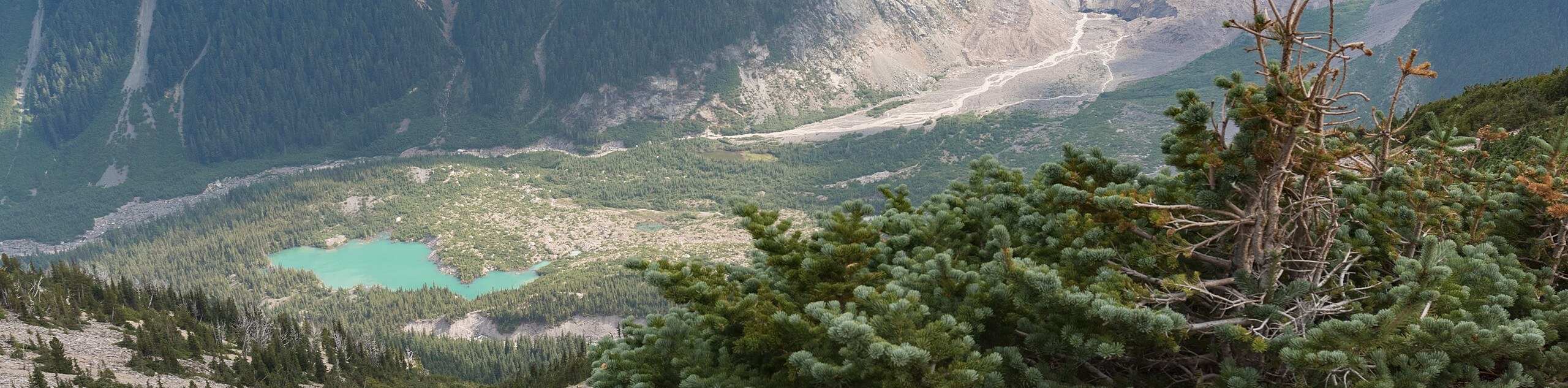
The hike up Mount Ruth on Glacier Basin and Emmons Moraine trails is a difficult hike that requires some routefinding and special equipment (we recommend bringing ice axes and crampons), but it’s a fun adventure for the more experienced hiker.
The trail begins from the western end of the White River Campground. Take Glacier Basin Trail, skirting the base of the ridge, to Glacier Basin Camp. Just past the campsite, take the trail that crosses Inter Fork River and heads straight up the ridge. Up on the ridgeline, this is where the trail can become difficult to find. Just keep heading across the ridge.
The ascent of Mount Ruth is challenging, especially when the snow is still clinging. Take your time and be careful. While some hikers follow the ridgeline back (as this route does), more prefer to drop back down off the ridge to Glacier Basin Camp and do this trail as an out-and-back. If you prefer a challenge, take the ridgeline. If you’d prefer an easier route, retrace your steps to White River.
Similar hikes to the Mount Ruth via Glacier Basin and Emmons Moraine Trails hike

Camp Summerland via Wonderland Trail
The hike to Camp Summerland on the Wonderland Trail is a 8.4mi moderately trafficked out and back trail…
Skyscraper Pass and Burroughs Mountain via Wonderland Trail
Skyscraper Pass and Burroughs Mountain via Wonderland Trail is a 8.2mi moderately trafficked route in Mount Rainier National…
Goat Island Mountain Trail
The Goat Island Mountain Trail is a 8.7mi lightly trafficked loop trail in Mount Rainier National Park that…
Comments