Glacier Vista Trail
View Photos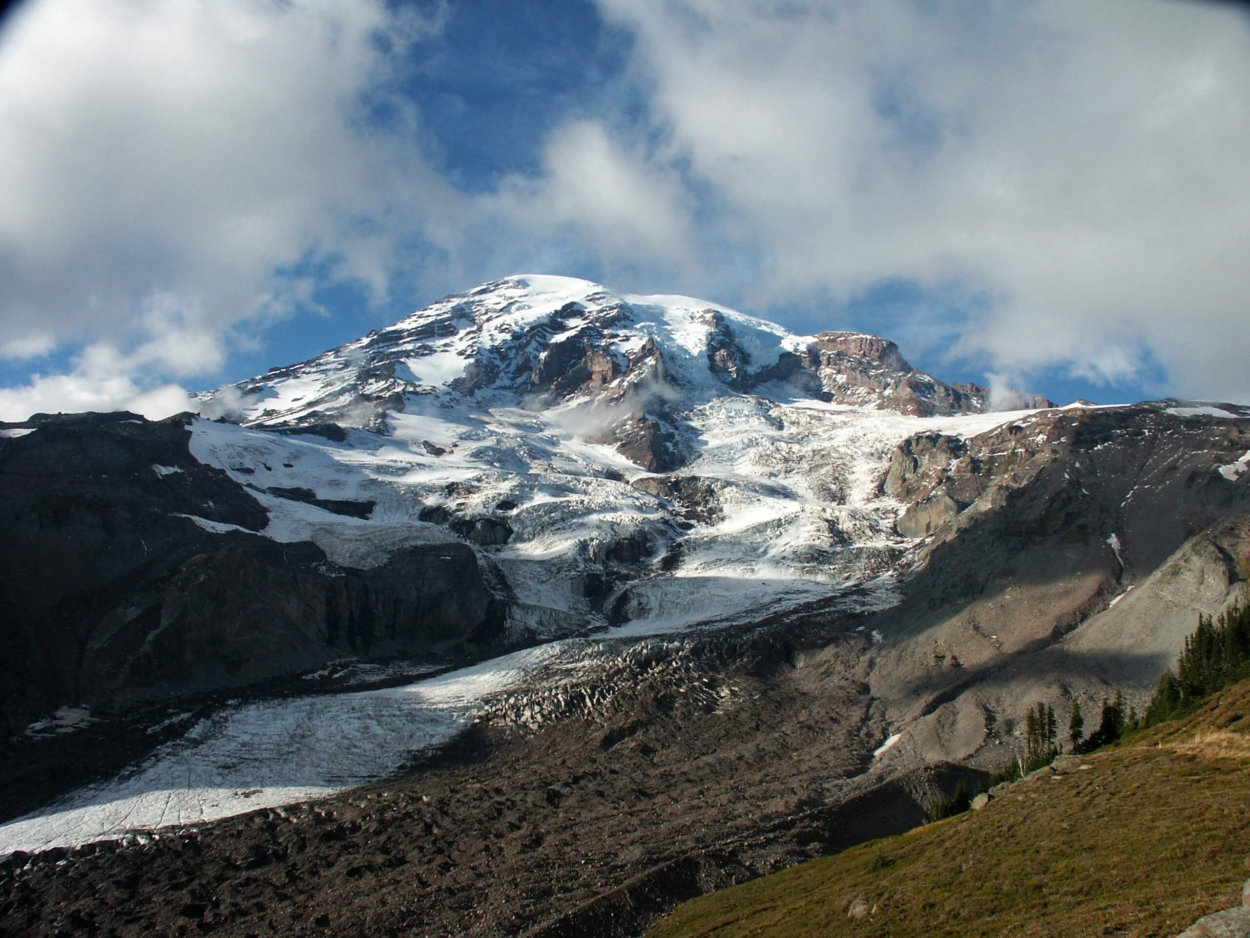
Glacier Vista Trail
Difficulty Rating:
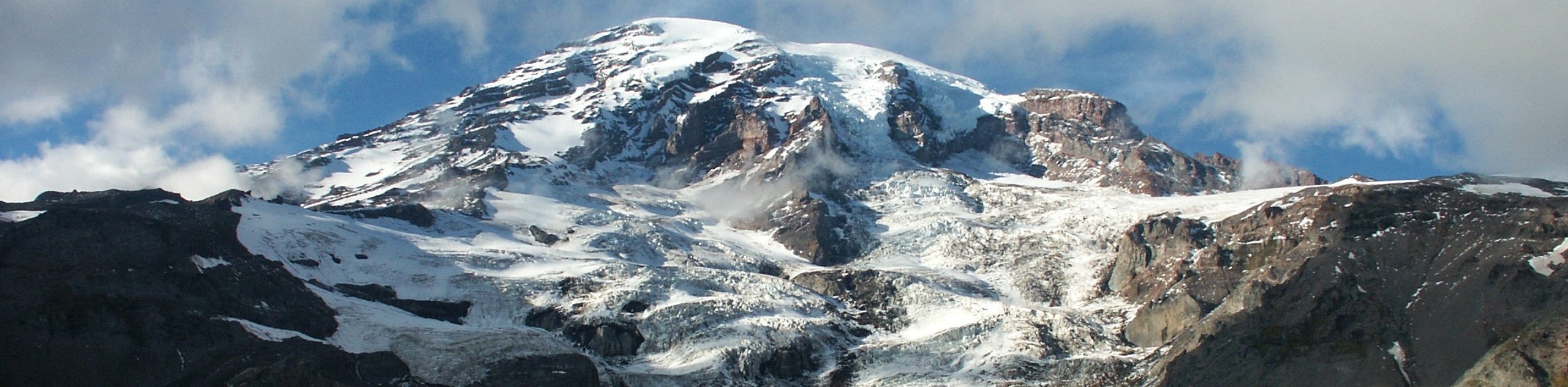
The Glacier Vista Trail hike via Skyline is a 4.2mi easy-moderate hike in Mount Rainier National Park. This enjoyable hike is often enjoyed by families and is a favourite for local hikers because of its ease of connection with nearby trails, making your trip customizable. Enjoy great views of the Paradise region of the park, especially Mount Rainier.
Getting there
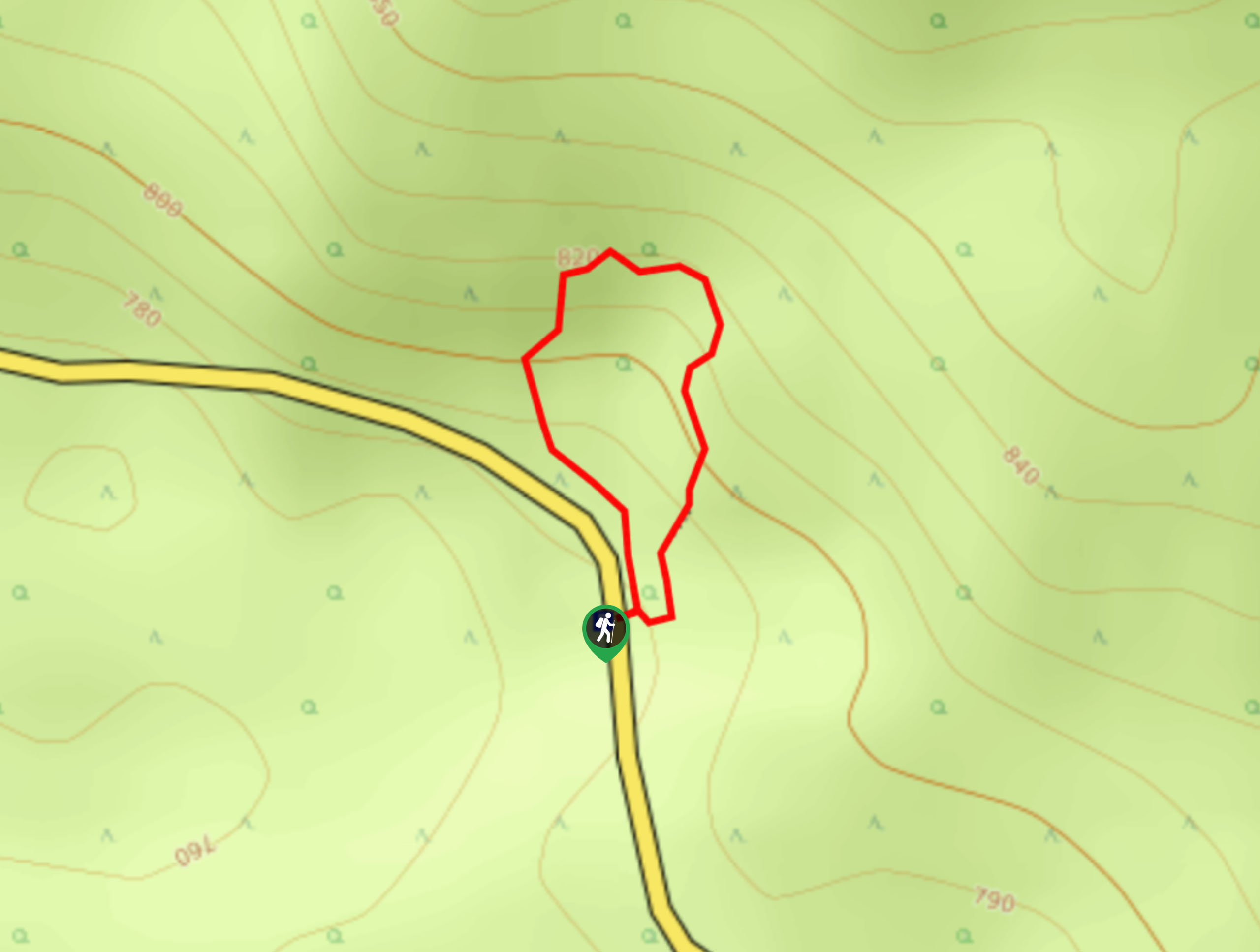
The trailhead for the Skyline and Golden Gate Loop is located in the upper Paradise parking area off Longmire-to-Paradise Road, just to the left of the restrooms.

About
| Backcountry Campground | No |
| When to do | July-October |
| Pets allowed | No |
| Family friendly | Older Children only |
| Route Signage | Average |
| Crowd Levels | High |
| Route Type | Loop |
Glacier Vista Trail
Elevation Graph
Weather
Glacier Vista Trail Description
The Glacier Vista Trail via Skyline hike is a loop, so you can do it either way. We will describe it going clockwise. The hike begins from the Paradise visitors area to the left of the bathrooms. Follow signage for Dead Horse Creek Trail and hike to where it merges with Skyline Trail.
Stay left at the junction that comes next, and you’ll reach Glacier Vista in no time. From here, you can loop down the other side of the trail or retrace your steps back to the junction with Skyline. Take Skyline (to your left) down to Alta Vista Trail, descending back to the visitor’s area. You can add on a quick trip to Alta Vista on the way back by staying right onto Alta Vista Trail.
Similar hikes to the Glacier Vista Trail hike
Twin Firs Loop Trail
Twin Firs Loop is a 0.3mi hike in Mount Rainier National Park that is incredibly easy, making it…

Paul Peak Trail
The Paul Peak Trail is a 6.3mi lightly trafficked out and back trail in Mount Rainier National Park…

Narada Falls to Mazama Ridge Loop
The Narada Falls to Mazama Ridge loop is an 7.4mi moderately trafficked route in Mount Rainier National Park…
Comments