Owyhigh Lakes Trail
View Photos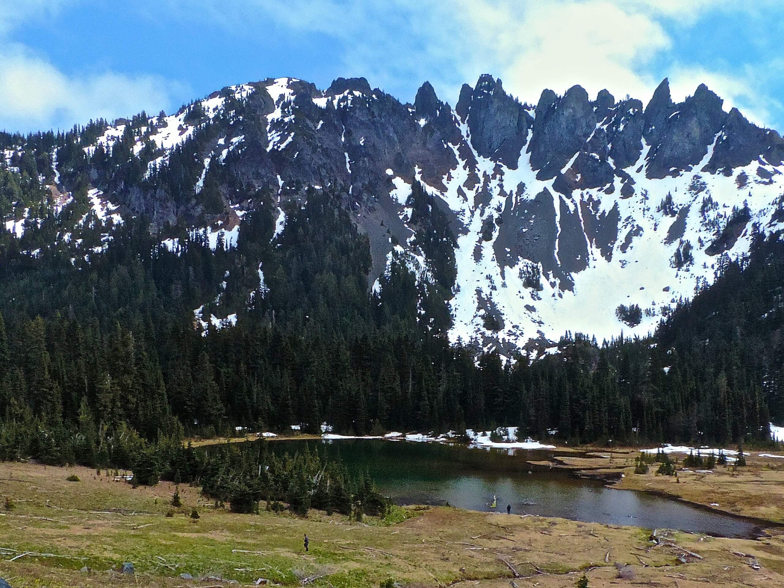
Owyhigh Lakes Trail
Difficulty Rating:
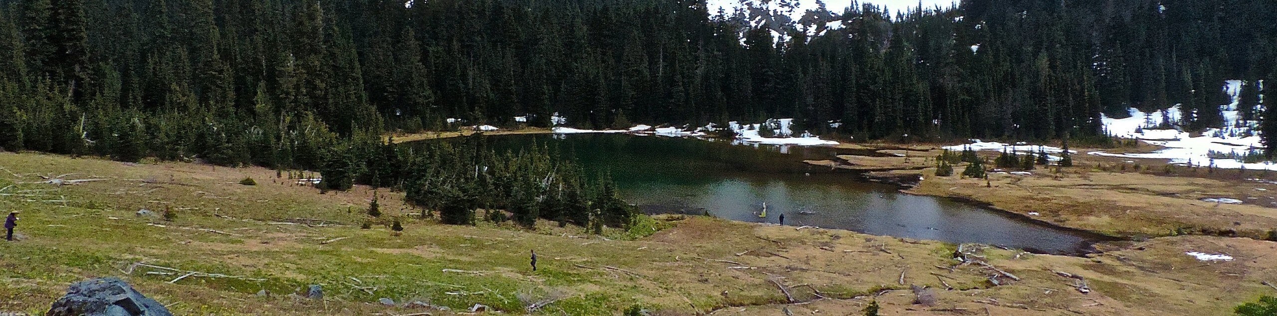
The scenic Owyhigh Lakes Trail in Mount Rainier National Park is a moderate trail that leads you to two pretty blue lakes nestled underneath an impressive mountain ridge. This trail also provides the opportunity to summit nearby Tamanos Mountain if you’re looking to add some challenge. Enjoy these gem-blue lakes in the midst of a forest clearing for a pleasant outing in the park.
Getting there
To get to the trailhead for the Owyhigh Lakes Trail from the White River entrance to the park, drive 2.2mi into the park to the signed trailhead. The parking area is small, so arrive early if you can.

About
| Backcountry Campground | Tamanos Creek Camp |
| When to do | June-October |
| Pets allowed | No |
| Family friendly | Older Children only |
| Route Signage | Average |
| Crowd Levels | Moderate |
| Route Type | Out and back |
Owyhigh Lakes Trail
Elevation Graph
Weather
Owyhigh Lakes Trail Description
The hike to Owyhigh Lakes is a pretty, less busy option in Mount Rainier National Park. These two lakes underneath a dramatic mountain ridge make for a perfect picnic stop! You can also continue past the lakes to summit Tamanos Mountain if you’d like to extend your adventure.
Begin from the signed trailhead across the road from the parking area. It’s a nice trail and the elevation gain is gradual. You’ll be hiking through the trees for the first portion of the trail. At 0.6mi, you can see over the Shaw Creek drainage. A bridge appears at 2.9mi before the campsite.
A half-mile past the campsite, the forest gives way to meadows. The meadows are absolutely filled with flowers during midsummer. At 3.5mi, the trail passes the lakes from above, where you’ll be treated to views of the deep blue water and Governors Ridge above. It’s not recommended to go into the actual meadow that holds the lakes from the ridge, as it’s fragile land; look for the trail that heads to the lakes from the southwest to avoid trampling the area.
From this lookout, either retrace your steps back to the lot or continue to a Y-junction where the trail to Tamanos Mountain branches off to the right if you’re going to attempt the summit.
Similar hikes to the Owyhigh Lakes Trail hike

Paul Peak Trail
The Paul Peak Trail is a 6.3mi lightly trafficked out and back trail in Mount Rainier National Park…

Narada Falls to Mazama Ridge Loop
The Narada Falls to Mazama Ridge loop is an 7.4mi moderately trafficked route in Mount Rainier National Park…

Camp Summerland via Wonderland Trail
The hike to Camp Summerland on the Wonderland Trail is a 8.4mi moderately trafficked out and back trail…
Comments