
Lake George Trail
View Photos
Lake George Trail
Difficulty Rating:
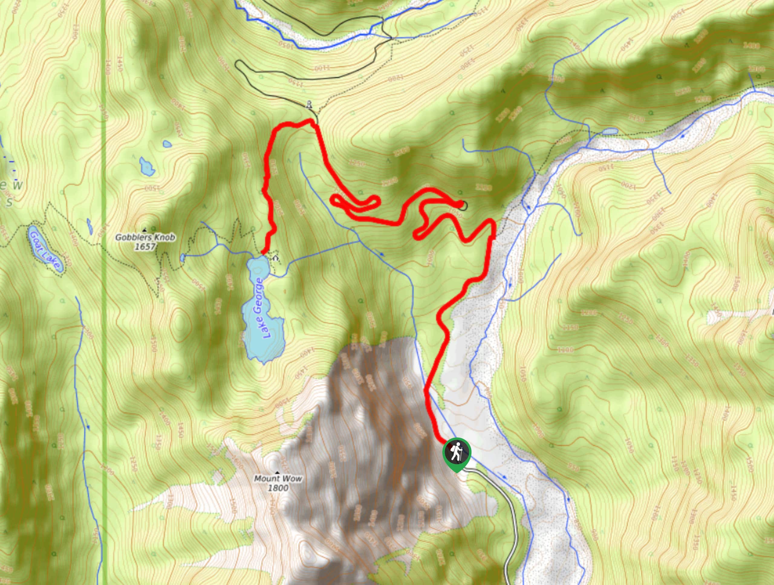
The Lake George Trail hike is a 8.7mi trip in Mount Rainier National Park that involves hiking on sections of decommissioned trail. For what you might sacrifice in maintenance, you’ll be rewarded with less traffic, pleasant views, and untouched wildflowers. This is a moderate trail with modest elevation gain for its length.
Getting there
To get to the trailhead for the Lake George Trail from the Nisqually entrance to the park, drive east on Nisqually-Longmire Road for a mile, then turn left onto Westside Road. There is no parking lot, so you’ll need to park along the road.

About
| Backcountry Campground | Lake George Camp |
| When to do | March-October |
| Pets allowed | No |
| Family friendly | No |
| Route Signage | Poor |
| Crowd Levels | Moderate |
| Route Type | Out and back |
Lake George Trail
Elevation Graph
Weather
Lake George Trail Description
The hike on Lake George Trail is a bit wild due to sections that are unmaintained, but the serene atmosphere of the lake is well worth the effort.
Begin by following the 3.8mi decommissioned section of Westside Road to a crossing over Fish Creek. You’ll hike through old-growth Douglas fir on a gradually climbing trail with the creek beside you. Enjoy wildflowers flanking the trail and the shade of the trees.
Once you reach the campground by Lake George, you’ll take an unmarked and often overgrown trail to the south shore of the lake.
Either return the way you came or, if you booked a spot, settle in at the campsite.
Similar hikes to the Lake George Trail hike

Paul Peak Trail
The Paul Peak Trail is a 6.3mi lightly trafficked out and back trail in Mount Rainier National Park…

Narada Falls to Mazama Ridge Loop
The Narada Falls to Mazama Ridge loop is an 7.4mi moderately trafficked route in Mount Rainier National Park…

Camp Summerland via Wonderland Trail
The hike to Camp Summerland on the Wonderland Trail is a 8.4mi moderately trafficked out and back trail…
Comments