Mildred Point Trail
View Photos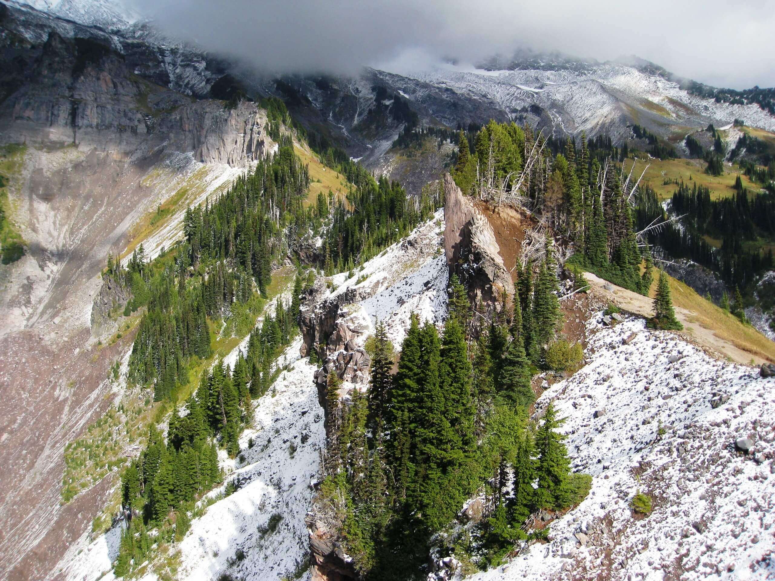
Mildred Point Trail
Difficulty Rating:
The Mildred Point hike is a 6.1mi out and back trail in Mount Rainier National Park that requires some exertion but rewards with great waterfall and mountain views. Comet Falls are along the trail and Mildred Point offers impressive views over the park, making for an enjoyable (and sweaty) hike.
Getting there
To get to the Mildred Point trailhead from the Nisqually entrance to the park, take State Route 706 for 13.5mi east of Elbe. Continue 10.0mi to the parking lot for Comet Falls.

About
| Backcountry Campground | No |
| When to do | July-October |
| Pets allowed | No |
| Family friendly | No |
| Route Signage | Average |
| Crowd Levels | Moderate |
| Route Type | Out and back |
Mildred Point Trail
Elevation Graph
Weather
Mildred Point Trail Description
You don’t have to choose between rushing waterfalls and high mountain views on the Mildred Point hike. This hard trail follows the Van Trump Creek past Bloucher and Comet falls to earn a great view of the Kautz Creek Valley from the point. While the hike involves some steady, steep climbs, it doesn’t require any technical skill. Another thing to note is that there is only room for about 20 vehicles in the Comet Falls lot, so we recommend hiking early in the day to secure parking.
The trail begins from the Comet Falls parking lot. Cross a bridge over Van Trump Creek and then follow the creek upstream through a pretty gorge filled with small waterfalls. Around a corner, the three-tiered Bloucher Falls appears.
Cross a footlong and go left below the bank to find the trail. At 1.9mi in, an offshoot path on your left gives you the chance to see the falls up close. Continue to the right and climb steeply to a junction, where you’ll go right.
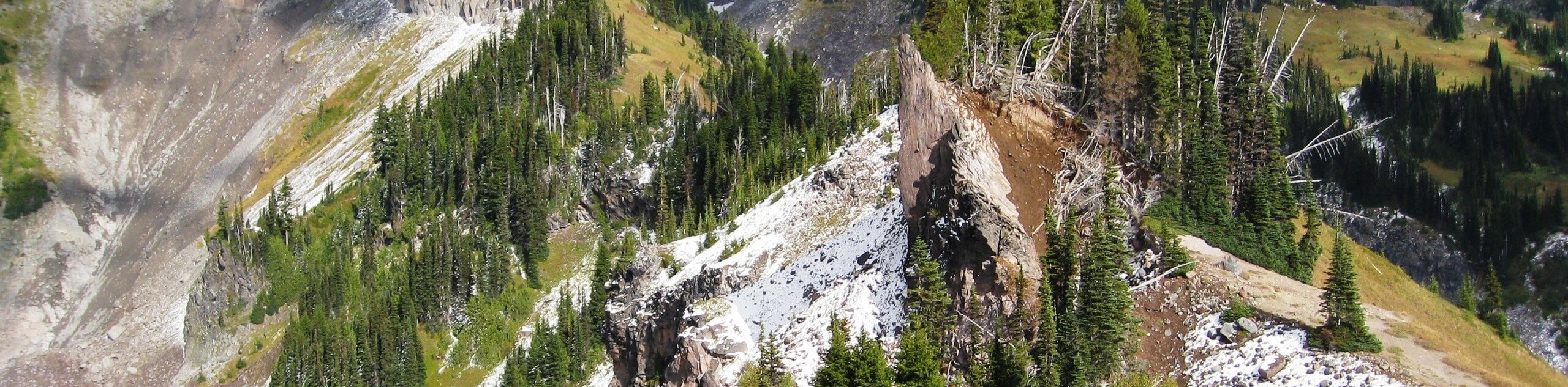
Hike through a meadow with a brief view of Mount Rainier, turning left at the next junction and hiking down to a log crossing over Van Trump (which can sometimes be washed out). Turn left, then after a half-mile, turn right. The final half-mile of the trail isn’t in great condition, but it’ll get you to Mildred Point. Look over the surreal landscape, including the volcanic rock formations and unobstructed Mount Rainier.
To return, retrace your steps back to the parking lot. Do note that parts of this hike can be covered in snow into mid-July, so take care in the early summer.
Similar hikes to the Mildred Point Trail hike

Paul Peak Trail
The Paul Peak Trail is a 6.3mi lightly trafficked out and back trail in Mount Rainier National Park…

Narada Falls to Mazama Ridge Loop
The Narada Falls to Mazama Ridge loop is an 7.4mi moderately trafficked route in Mount Rainier National Park…

Camp Summerland via Wonderland Trail
The hike to Camp Summerland on the Wonderland Trail is a 8.4mi moderately trafficked out and back trail…
Comments