Comet and Christine Falls Trail
View Photos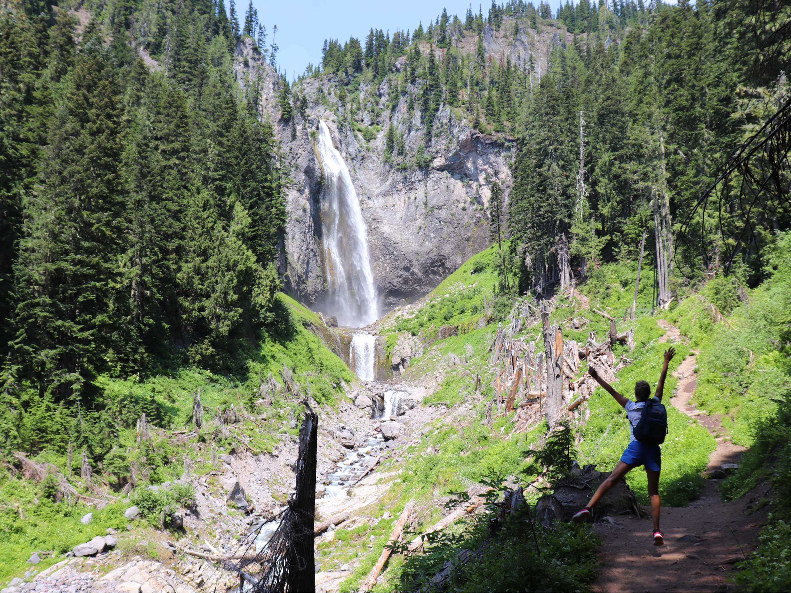
Comet and Christine Falls Trail
Difficulty Rating:
The Comet and Christine Falls Trail is a moderate hike in Mount Rainier National Park that takes you to two waterfalls in a pleasant, shaded forest. It’s a hike that falls on the more strenuous side of moderate, but it’s still a top pick for a hot summer day because of the cool, refreshing mist of the falls. With the thundering falls, flowing rivers, and verdant forest around you, this hike is a great half-day outing in the park.
This hike provides a steady uphill climb, and thankfully, a previously steep section has been improved by the WTA to eliminate the technical challenge. For a few solid hours of cardio and some lovely moments spent by the rushing water, the Comet and Christine Falls Trail is a perfect choice.
Getting there
To get to the Comet and Christine Falls trailhead from the west entrance to Mount Rainier National Park, drive 10.2mi on State Route 706 to the signed parking lot on your left.

About
| Backcountry Campground | No |
| When to do | July-October |
| Pets allowed | No |
| Family friendly | Older Children only |
| Route Signage | Average |
| Crowd Levels | High |
| Route Type | Out and back |
Comet and Christine Falls Trail
Elevation Graph
Weather
Comet and Christine Falls Trail Description
The Comet and Christine Falls Trail is a great hot weather hike in Mount Rainier National Park that rewards a bit of a sweat with two impressive waterfalls. With a couple of impressive 300-foot drops bookended by multiple smaller cascades, the falls are a perfect place to cool off during your hike.
The parking area for this hike will fill up on a nice day, so we recommend arriving prior to 9am if possible to have the best chance of getting a spot.
From the parking lot, take the wide trail into the trees. You’ll cross a bridge over Van Trump Creek after 0.3mi. From here you’ll be able to see Christine Falls and the white water that tumbles through a rocky channel upstream.
Continue alongside Van Trump Creek on the obvious trail. At 1.2mi, there is a crib ladder you can take up a steep rock face. After a 2012 rock slide rendered this portion of the trail nearly impassable, the ladder was installed to restore access to the trail.
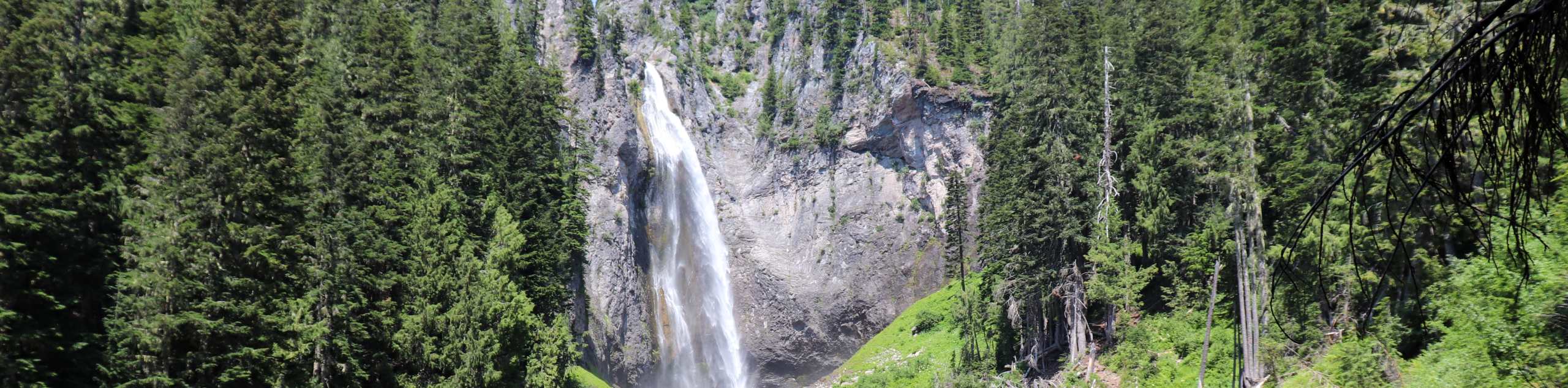
Continue 0.4mi to a signed junction. Before following the sign to Comet Falls, take some time to enjoy the tributary here. This churning mass of water is where East Fork Van Trump Creek plunges 124ft down. Comet Falls are only 200ft or so past this point.
Cross the East Fork on a log bridge, then follow the bank to the left to pick up the trail. The falls will start to appear through the trees. While you’ll be able to see the falls here, continue 0.2mi up a couple of switchbacks. A trail continues up to Van Trump Park, but you’ll instead head to the left to the best viewpoint of the falls.
After cooling off in the mist and enjoying the views, you’ll retrace your steps back to the parking lot.
Insider Hints
The rocks around the viewpoint are extremely slippery. Please be cautious.
There is a rockfall hazard in windy conditions above Comet Falls, so keep a safe distance.
Similar hikes to the Comet and Christine Falls Trail hike

Paul Peak Trail
The Paul Peak Trail is a 6.3mi lightly trafficked out and back trail in Mount Rainier National Park…

Narada Falls to Mazama Ridge Loop
The Narada Falls to Mazama Ridge loop is an 7.4mi moderately trafficked route in Mount Rainier National Park…

Camp Summerland via Wonderland Trail
The hike to Camp Summerland on the Wonderland Trail is a 8.4mi moderately trafficked out and back trail…
Comments