Old Mine Trail
View Photos
Old Mine Trail
Difficulty Rating:
The Old Mine Trail is a 3.4mi easy hike in Mount Rainier National Park that features a mine shaft and tends to be less busy than other trails. This hike is family-friendly, only requiring hikers to complete one steeper section. This trail is suitable for little ones as long as they can make a short effort on the steep section.
Getting there
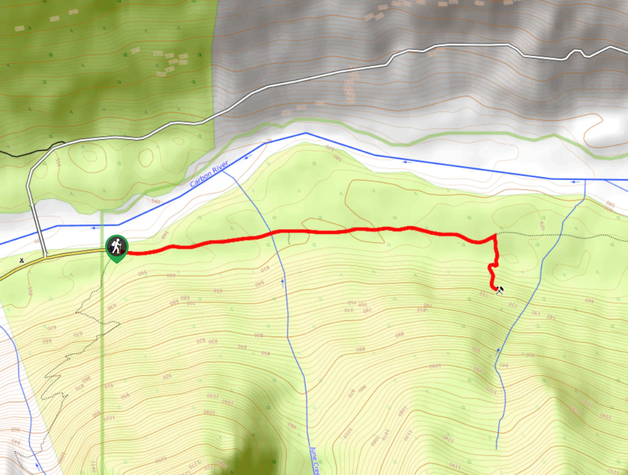
The Old Mine Trail is just inside the Carbon River entrance to the park. Because of flooding damage, it is necessary to walk the road to the trail inside the park boundary.

About
| Backcountry Campground | No |
| When to do | May-October |
| Pets allowed | No |
| Family friendly | Yes |
| Route Signage | Average |
| Crowd Levels | Low |
| Route Type | Out and back |
Old Mine Trail
Elevation Graph
Weather
Old Mine Trail Description
The Old Mine Trail is an easy, enjoyable hike that takes you through lush forest to an old mine. This is a good trail for families.
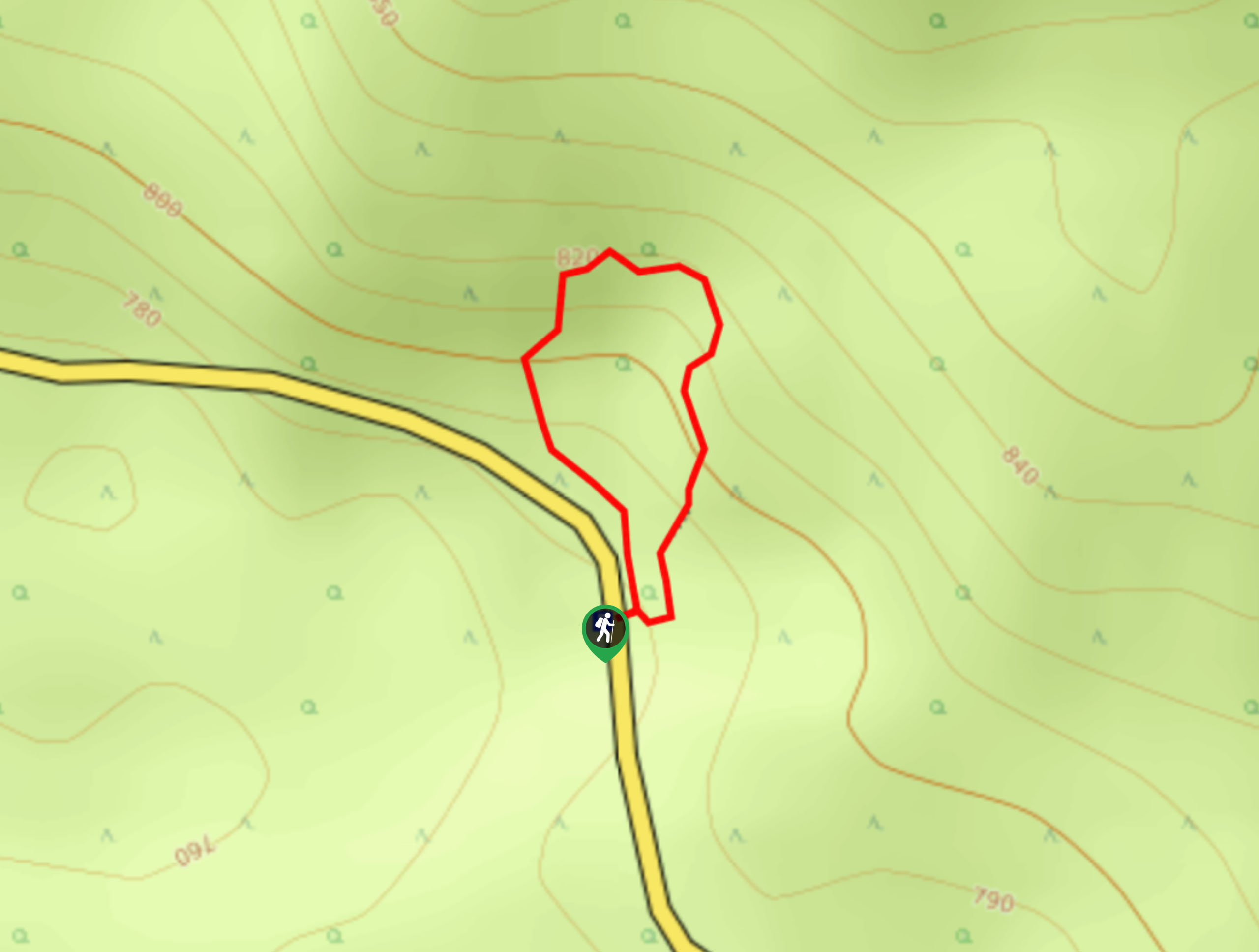
Just past the Carbon River Ranger Station, park your car and walk down the trail (previously a road). Hike for about a mile, then look for a trail branching off to your right. Take this trail, beginning a short, steep section through red cedar and Douglas fir trees.
Arrive at the mineshaft in 0.3mi. You can explore about a hundred feet into the shaft before arriving at a gate. When you’re ready to return, retrace your steps back to your car.
Similar hikes to the Old Mine Trail hike
Twin Firs Loop Trail
Twin Firs Loop is a 0.3mi hike in Mount Rainier National Park that is incredibly easy, making it…

Paul Peak Trail
The Paul Peak Trail is a 6.3mi lightly trafficked out and back trail in Mount Rainier National Park…

Narada Falls to Mazama Ridge Loop
The Narada Falls to Mazama Ridge loop is an 7.4mi moderately trafficked route in Mount Rainier National Park…
Comments