Skyline Loop Trail
View Photos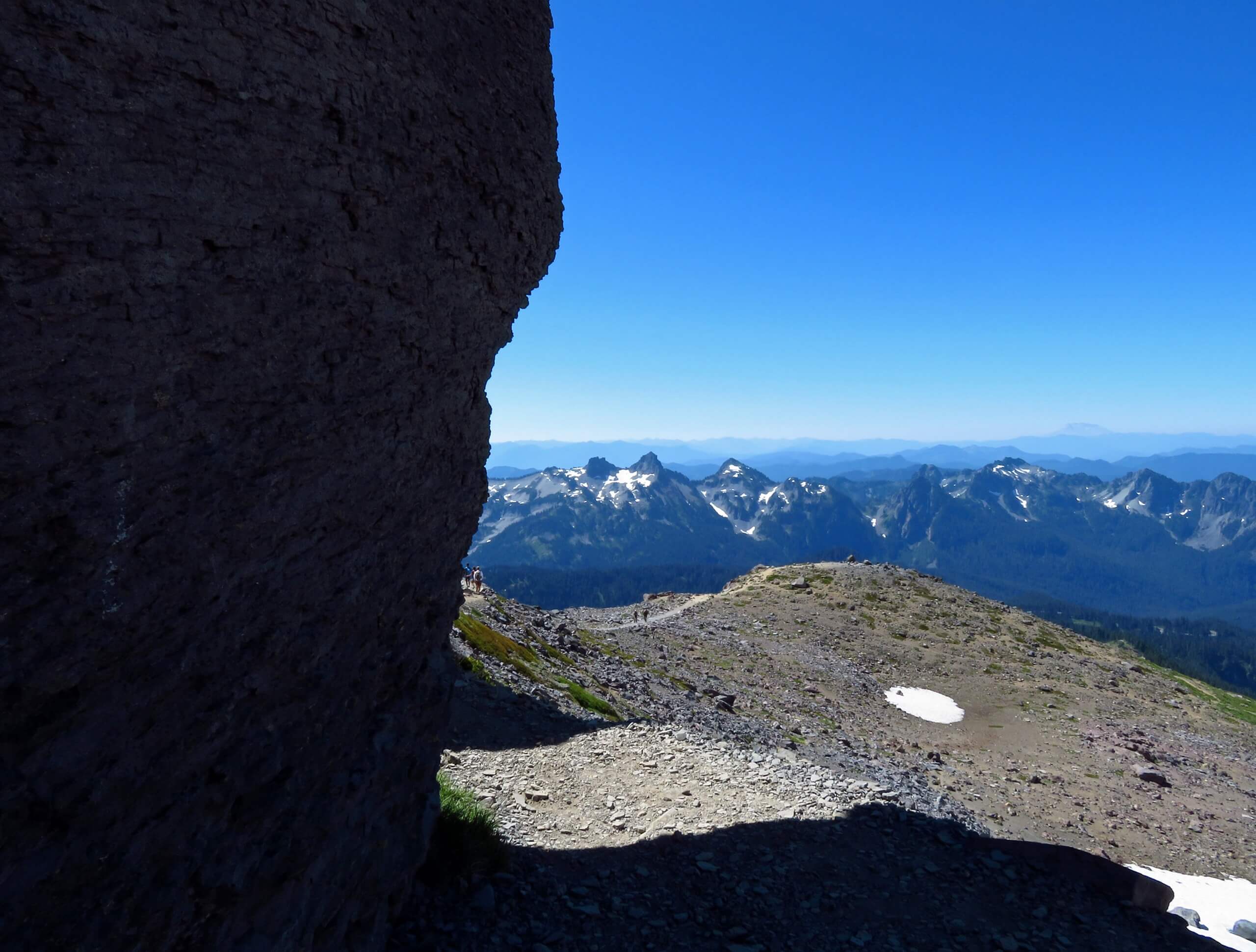
Skyline Loop Trail
Difficulty Rating:
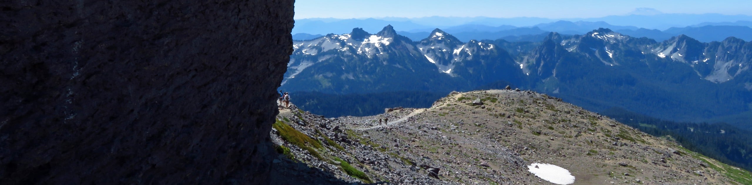
The Skyline Loop Trail is a 5.5mi moderately difficult trail in Mount Rainier National Park that boasts exceptional views and wide swathes of wildflowers in the summertime. Not only will you see countless wildflowers, but this moderate-length hike packs a punch when it comes to stunning scenery. Expect to pass by cascading waterfalls and mighty glaciers. Of course, the star of the show is the grand view of Mount Rainier. This pretty hike is a favourite among locals and a must-do for anyone visiting the park.
Getting there
To get to the Skyline Loop Trail from Tacoma, take Highway 7 south for 30.0mi to Elbe. After Elbe, the road splits off to the right. Stay straight, proceeding onto WA-706. Drive for 15.0mi, entering the park and continuing as the road turns into Paradise Road E. Continue for 16.0mi until the Paradise Visitor Center, where you can park in any of the parking areas.

About
| When to do | July-October |
| Backcountry Campsites | No |
| Pets allowed | No |
| Family friendly | No |
| Route Signage | Average |
| Crowd Levels | High |
| Route Type | Circuit |
Skyline Loop Trail
Elevation Graph
Weather
Skyline Loop Trail Description
The Skyline Loop Trail is an undeniable favorite in Mount Rainier National Park, giving hikers the chance to experience next-level scenery without massive challenge. The trailhead for the Skyline Loop Trail is just behind the Jackson Visitor Center. We recommend picking up a map from the visitor center as the network of interconnecting trails can be disorienting. This trail can be hiked either counterclockwise or clockwise, but this route guide follows a clockwise direction.
Head north, following the signage for the Skyline Trail over initially steep ground. You’ll soon reach a split where the Waterfall and Dead-horse Creek trails depart; take care to stay on Skyline here. At the 0.4 mile mark, the trail begins to even out a little, and you’ll cross another split where Glacier Vista connects. Keep right.
Head up a set of stone stairs, where incredible views of Tahoma peak start to appear. Soon on your left, the Glacier Vista will appear. This is one of the best photo spots on the trail, so stop and enjoy the views. If you’re not in the mood for the bigger climb ahead, this is a perfect turnaround point.
The trail loops around a tight turn to head southwest near the Nisqually Glacier. A half a 1.0mi past this, you’ll reach the junction with Pebble Creek and Camp Muir. Continue straight (the other trailheads for the summit of Muir) to Panorama Point, where views of the Paradise Valley, Mount Adams, and even Mount Hood appear.
Take the path to the east, noting that although this is signed as the Skyline Trail, some consider it to be a lower shortcut and prefer the footing of the higher trail to the north. We recommend taking the high trail for more security, but they meet in about a 0.5mi regardless. Shortly after, you’ll reach the junction for the Golden Gate Trail. You can take this path to cut a 1.0mi off of your overall journey, or continue southwest to Sluiskin Falls.
Hike past the Stevens Van Trump Historic Monument, heading generally west until Myrtle Falls. The parking lot is only about a 0.5mi past this point.
Hiking Route Highlights
Paradise
The Paradise area of Mount Rainier National Park is renowned for its expansive wildflower meadows and summit views. When James Longmire’s daughter-in-law, Martha, first saw this area, she said, “Oh, what a paradise!” She was right, and visitors flock to this part of the park in July and August when the blooms are at their best.
Frequently Asked Questions
Is the Skyline Trail very difficult?
The Skyline Loop Trail is moderately difficult. Hikers with a basic level of fitness are able to enjoy the hike with no technical skills required.
What mountains can you see from Panorama Point?
From west to east, you can see Spanish Mountain (10051ft), the Obelisk (9700ft), Mount McGee (12969ft), Mount Goddard (12568ft), Kettle Dome (9446ft), North Palisade (14242ft), and Eagle Peak (9645ft).
Insider Hints
Hiking counterclockwise offers a more relaxed start but a steeper descent,
Hiking clockwise gets most of the elevation out of the way early and offers wonderful views early on.
There is a toilet at Panorama Point, just make sure to securely latch the door upon leaving.
Similar hikes to the Skyline Loop Trail hike

Paul Peak Trail
The Paul Peak Trail is a 6.3mi lightly trafficked out and back trail in Mount Rainier National Park…

Narada Falls to Mazama Ridge Loop
The Narada Falls to Mazama Ridge loop is an 7.4mi moderately trafficked route in Mount Rainier National Park…

Camp Summerland via Wonderland Trail
The hike to Camp Summerland on the Wonderland Trail is a 8.4mi moderately trafficked out and back trail…
Comments