Sturtevant Falls Trail
View Photos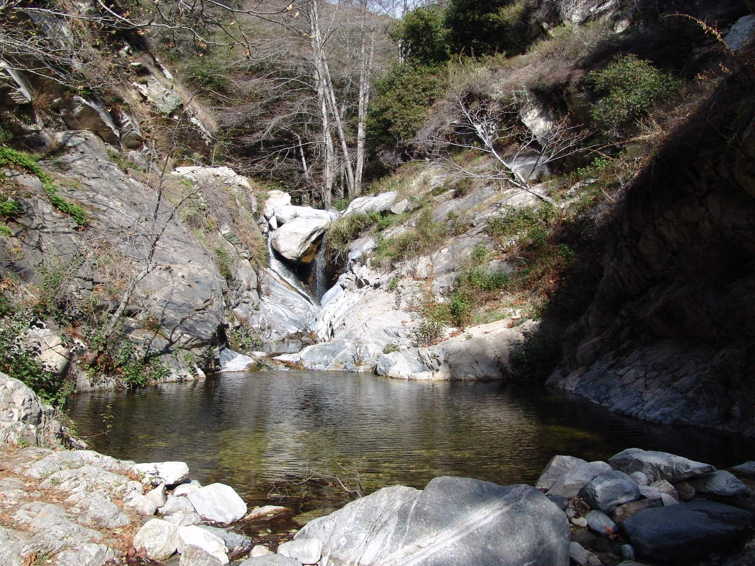
Sturtevant Falls Trail
Difficulty Rating:
The Sturtevant Falls Trail is a beautifully scenic hiking route in Southern California that will take you to one of the most popular waterfalls within the Angeles National Forest. While out hiking the trail, you will follow along the peaceful banks of Big Santa Anita Creek and enjoy the lovely canyon views, before arriving at the impressive site of Sturtevant Falls and the serene pool below. Make sure to purchase an adventure pass and display it in your vehicle when setting out on this hike.
This trail is currently closed due to the recent Bobcat Wildfire.
Getting there
The trailhead for this hike can be found at the Chantry Flats parking lot on Santa Anita Canyon Avenue.

About
| Backcountry Campground | No |
| When to do | Year-Round |
| Pets allowed | Yes - On Leash |
| Family friendly | Yes |
| Route Signage | Average |
| Crowd Levels | High |
| Route Type | Out and back |
Sturtevant Falls Trail
Elevation Graph
Weather
Sturtevant Falls Trail Description
The Sturtevant Falls Trail is an amazing hiking route with impressive scenery, but unfortunately that means you will also be sharing your day on the trails with plenty of other hikers. Be sure to arrive early if you want to secure parking and enjoy a bit of solitude. Additionally, those who want to experience the falls into their most impressive state should try to do so during the spring season.
Even though it is a popular trail, you will be sure to enjoy your day along the Sturtevant Falls Trail. Beautifully scenic canyon views, a gorgeous waterfall, and the chance to take a refreshing dip in the serene pool of water below the falls all make this an unforgettable experience for the entire family.
From the Chantry Flats parking lot, make your way southeast to pick up the Gabrielino Trail. Here, the route will lead you to the northeast for 0.6mi, passing by a man-made waterfall to arrive at a junction in the trail.
Keep straight through the junction and you will soon arrive at the banks of the Big Santa Anita Creek. Continuing along the trail to the north for the next 0.7mi, you will hike alongside the creek and enjoy beautiful views of the surrounding canyon landscape, before arriving at another junction.
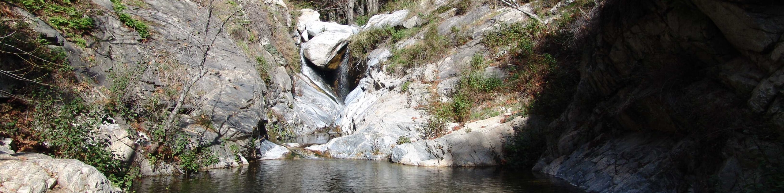
Turn right here to continue along the water’s edge and cross over the creek. After 0.3mi, you will arrive at the site of Sturtevant Falls, where you can sit and relax alongside the sound of crashing water or take the opportunity for a refreshing dip in the pool below the falls.
After visiting the impressive cascade, turn back along the trail and retrace your route to relive the beautiful scenery on the way to the parking area where you began your adventure along the Sturtevant Falls Trail.
Trail Highlights
Sturtevant Falls
Located along the pristine Big Santa Anita Creek, Sturtevant Falls is one of the most scenic, and popular, waterfalls to visit within the boundary of the Angeles National Forest. The cascade of water drops over 50ft down a moss-covered rock face into a serene pool below, which is often used by hikers as a swimming hole to escape the heat of the day.
Frequently Asked Questions
Can I swim below Sturtevant Falls?
Swimming is permitted in the pool below Sturtevant Falls; however, they are advised to not swim near the storm drain or after a period of heavy rainfall.
Are dogs permitted on the Sturtevant Falls Trail?
Yes, dogs are permitted along the Sturtevant Falls Trail, although they need to be kept on a leash.
Insider Hints
Be sure to purchase an adventure pass for this hike.
Wear proper hiking footwear to traverse the terrain.
Bring a swimsuit for a quick dip in the pool below the falls.
If you are looking for another hike in the area, check out the nearby Mount Zion via Lower Winter Creek Trail Loop.
Similar hikes to the Sturtevant Falls Trail hike

Mount Zion via Lower Winter Creek Trail Loop
The Mount Zion via Lower Winter Creek Trail Loop is a physically demanding Southern California adventure that features waterfall and…

Castaic Falls Trail
Hiking the Castaic Falls Trail is a fun little adventure in the Angeles National Forest that features a charming waterfall.…

Graveyard Truck Trail
Hiking the Graveyard Truck Trail is a pleasant experience in Southern California that features easy-going terrain and views of the…
Comments