
Fish Creek Narrows Hike
View Photos
Fish Creek Narrows Hike
Difficulty Rating:
The Fish Creek Narrows Hike is a laidback adventure in the Angeles National Forest that is well-suited for a fun family excursion. While out hiking the trail, you will make your way along the winding banks of Fish Creek as they navigate through a tranquil and scenic canyon setting. Make sure that your adventure pass is visible in your vehicle when out hiking this trail.
Getting there
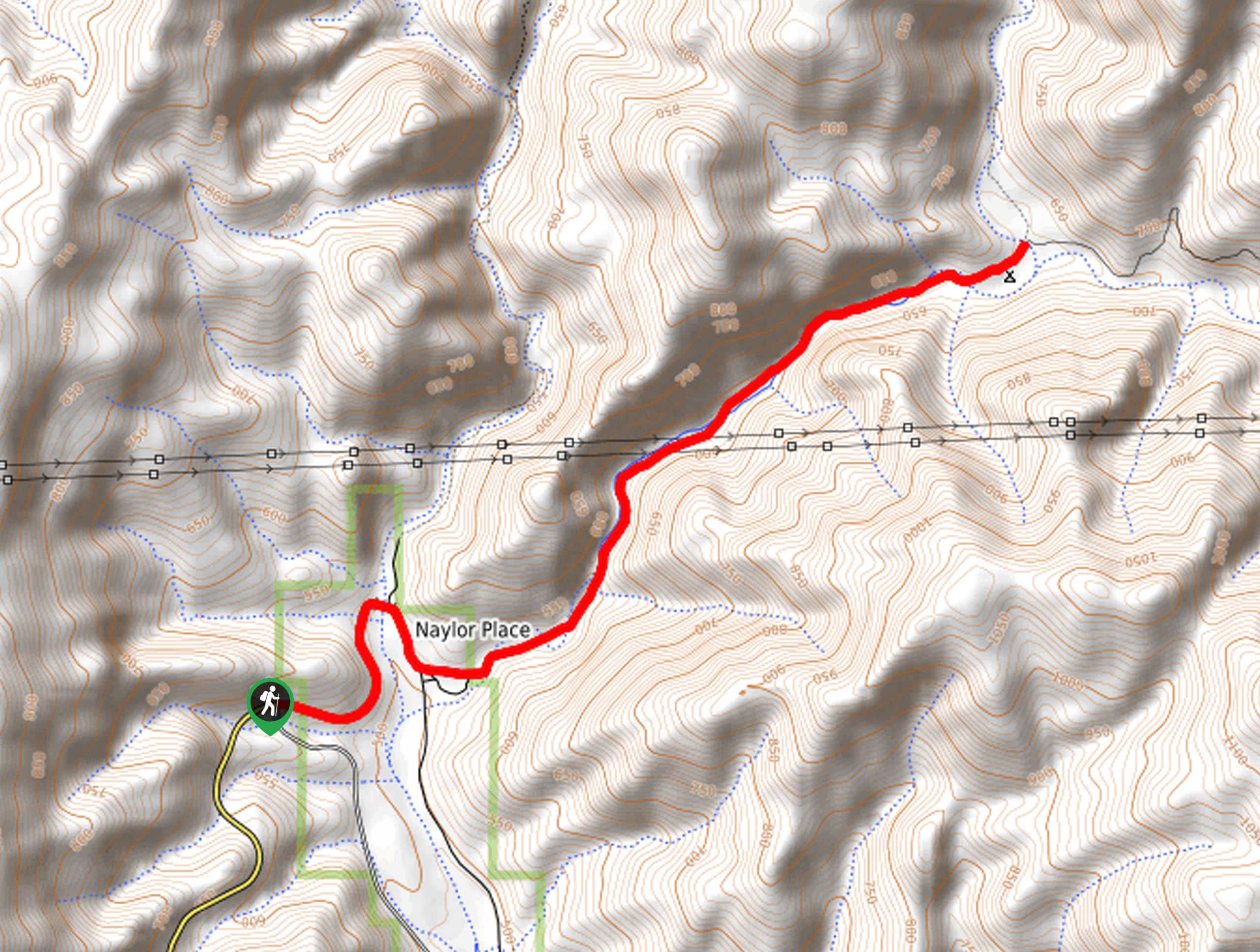
The trailhead for the Fish Creek Narrows Hike can be found at the junction of Templin Highway and the Los Angeles City Water and Power Road in Fish Canyon.

About
| Backcountry Campground | Cienaga Campground |
| When to do | Year-Round |
| Pets allowed | Yes - On Leash |
| Family friendly | Yes |
| Route Signage | Average |
| Crowd Levels | Low |
| Route Type | Out and back |
Fish Creek Narrows Hike
Elevation Graph
Weather
Fish Creek Narrows Hike Description
For those who want a laid back and relatively secluded adventure in the Angeles National Forest, the Fish Creek Narrows Hike is the place to be! This quiet trail will see you skirt along the edge of a peaceful creek while taking in the views of the undulating landscape surrounding you.
Setting out from the trailhead, you will follow Templin Highway in an eastward direction, before crossing over Castaic Creek. Here, you will initially follow the road southeast, before breaking off to the northeast on a forest service road that runs along Fish Creek.
Continue along this road as it winds through the canyon to the northeast until you arrive at the narrows and the Cienaga Campground. From here, simply turn back along the trail to make your return to the trailhead.
Similar hikes to the Fish Creek Narrows Hike hike

Mount Zion via Lower Winter Creek Trail Loop
The Mount Zion via Lower Winter Creek Trail Loop is a physically demanding Southern California adventure that features waterfall and…

Castaic Falls Trail
Hiking the Castaic Falls Trail is a fun little adventure in the Angeles National Forest that features a charming waterfall.…

Graveyard Truck Trail
Hiking the Graveyard Truck Trail is a pleasant experience in Southern California that features easy-going terrain and views of the…
Comments