
Iron Mountain via Heaton Flats Trail
View Photos
Iron Mountain via Heaton Flats Trail
Difficulty Rating:
Hiking to the summit of Iron Mountain via Heaton Flats Trail is a physically demanding experience in Southern California that is just as treacherous on the way down as it is on the way up. While out on the trail, you will be faced with a constant uphill climb through rough and rugged terrain, before finally reaching the summit for an incredible view of the Angeles National Forest. This challenging trail should not be underestimated and should not be attempted by inexperienced hikers.
Getting there
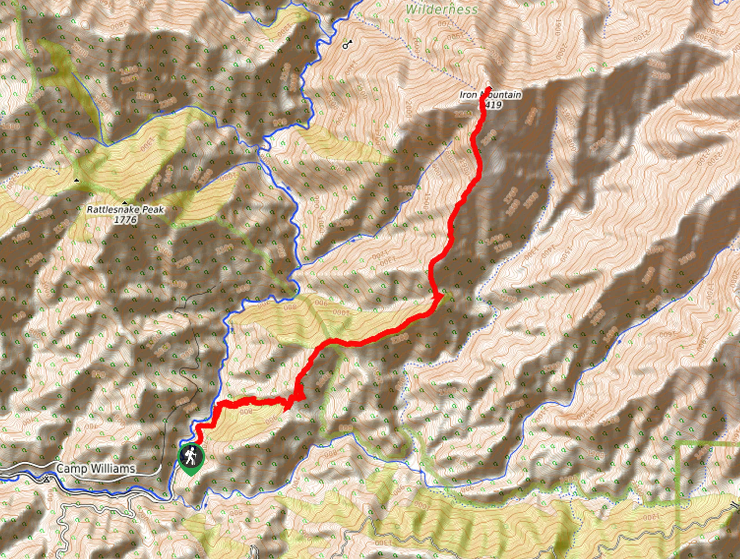
The starting point for this hike can be found at the Heaton Flats Trailhead on Camp Bonita Road.

About
| Backcountry Campground | No |
| When to do | May-November |
| Pets allowed | No |
| Family friendly | No |
| Route Signage | Average |
| Crowd Levels | High |
| Route Type | Out and back |
Iron Mountain via Heaton Flats Trail
Elevation Graph
Weather
Iron Mountain via Heaton Flats Trail Description
Known to be one of the most remote and challenging day hikes in the Angeles National Forest, the hike up Iron Mountain via Heaton Flats Trail is best left for experienced hikers who have a strong level of physical fitness. When setting out on this hike, make sure that you bring at least 4L of water, plenty of snacks, sturdy footwear, and have an adventure pass displayed in your vehicle.
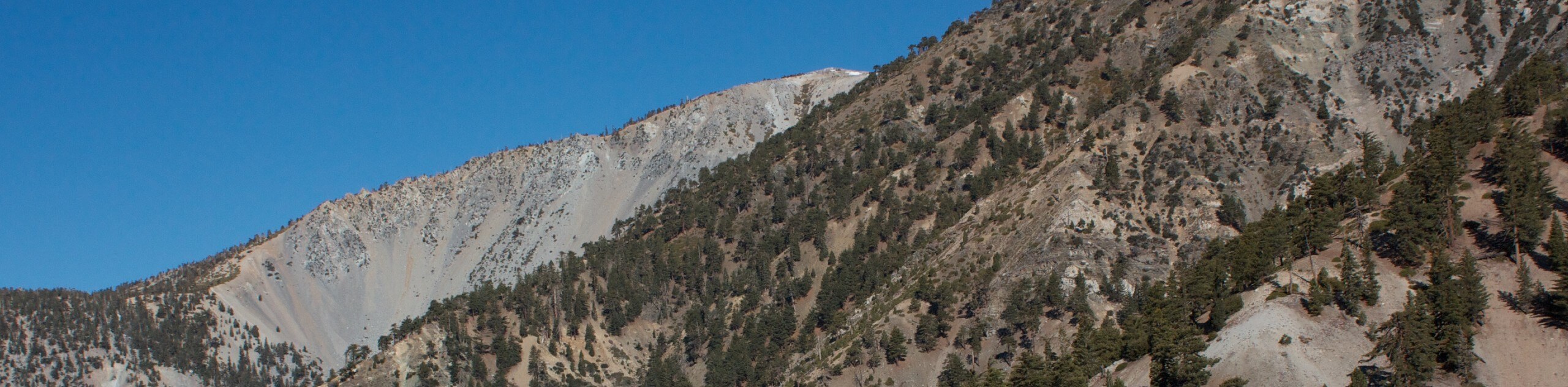
For those adventurers who are able to undertake such a long and difficult journey, the trek up Iron Mountain is one that will certainly leave you feeling accomplished. Breathtaking summit views and an incredible sense of achievement await for those who can conquer “Big Iron”.
Setting out from the trailhead, you will make your way to the northeast along the road for roughly 0.5mi, where you will find toilet facilities and the Heaton Flats Trail branching off to the right. Take this trail and follow it east through the tree cover, where you will begin the long and treacherous climb up to the summit of Iron Mountain.
Here, the trail will bend to the northeast and continue climbing through the rugged terrain for the next 3.6mi, traversing a ridgeline on the way to the Allison Saddle. This is a great place to pause for a rest before making the grueling push up to the summit.
From the saddle, you will keep right at the junction and continue on to the north, working your way up the steep slope of Iron Mountain for the next 2.3mi. There is no doubt about it that this is the most physically demanding portion of the hike, but once you arrive at the summit you will be met with views that make the entire experience worthwhile.
After trudging the last few feet to the top of Iron Mountain, you will have an incredible sightline that extends across the entirety of the Angeles National Forest and the countless peaks of the San Gabriel Range. When you are ready, turn back along the trail and retrace your footsteps to make your descent. Trekking poles will come in handy here, as they provide some stability when traversing the steep and uneven terrain.
Eventually, you will arrive back at the trailhead where you started your long and arduous journey to the summit of Iron Mountain.
Trail Highlights
Iron Mountain
Often referred to as “Big Iron”, Iron Mountain is a remote peak in the San Gabriel Mountains that is known to provide one of the most strenuous day hiking experiences in the region. Rugged, exposed, and relentless, the trail will take you to the top of the 7936ft peak for incredible views of Southern California.
Insider Hints
There is a $5 parking fee at the trailhead.
Bring at least 4L of water per person and plenty of high calorie snacks.
Wear sturdy hiking footwear and bring trekking poles for support.
Toilets can be found near the trailhead.
Similar hikes to the Iron Mountain via Heaton Flats Trail hike

Mount Zion via Lower Winter Creek Trail Loop
The Mount Zion via Lower Winter Creek Trail Loop is a physically demanding Southern California adventure that features waterfall and…

Sunset Peak Alternate Approach Hike
The Sunset Peak Alternate Approach Hike is a great intermediate-length route in Southern California that features some gorgeous canyon views.…
Register Ridge to Mount San Antonio Hike
The Register Ridge to Mount San Antonio Hike is equal parts scenic and incredibly challenging. While out on the trail,…
Comments