
Grizzly Flat Trail
View Photos
Grizzly Flat Trail
Difficulty Rating:
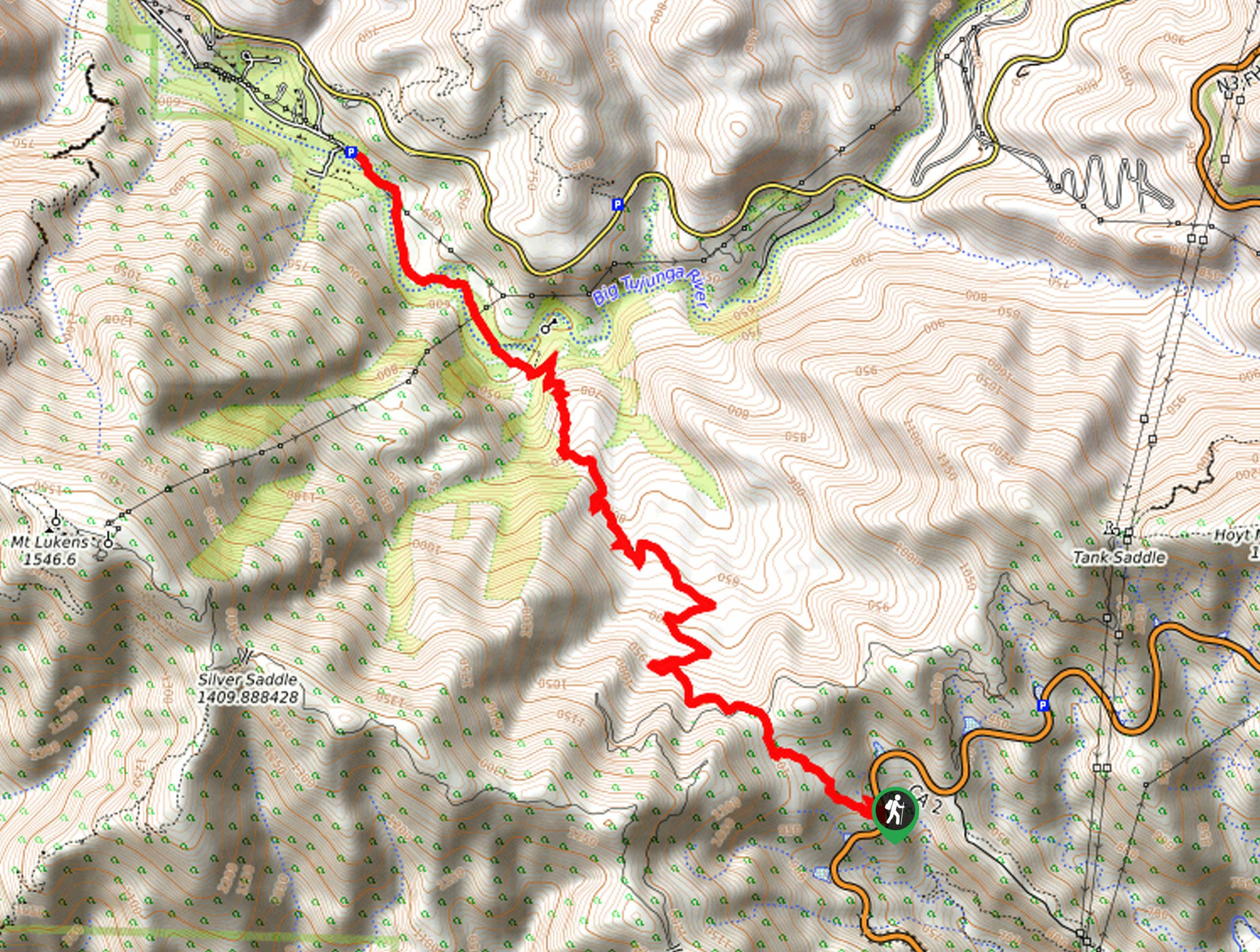
Hiking the Grizzly Flat Trail is a fun experience in Southern California that will take you through some undulating terrain within Angeles National Forest. While out on the trail, you will climb uphill through some steep terrain to reach the top of a ridge, before descending into Grizzly Flat and the banks of the big Tujunga River. Make sure to purchase and display an adventure pass prior to your hike.
Getting there
The Grizzly Flat Trail can be accessed from the Dark Canyon Trail Entrance along CA-2/Angeles Crest Highway.

About
| Backcountry Campground | No |
| When to do | Year-Round |
| Pets allowed | Yes - On Leash |
| Family friendly | Older Children only |
| Route Signage | Average |
| Crowd Levels | Moderate |
| Route Type | Out and back |
Grizzly Flat Trail
Elevation Graph
Weather
Grizzly Flat Trail Description
For those SoCal adventurers who are after an enjoyable day on the trails with a mixture of terrain, plenty of shade, and a lovely natural setting, the Grizzly Flat Trail is a fantastic option to explore. Hikers should take note that the initial stretch of this hike is a bit steep, so make sure to wear proper hiking footwear with good support to better traverse the trail.
Setting out from the trailhead off CA-2, you will follow the path as it leads uphill to the northwest. Here, you will quickly gain elevation, as you work your way through the steep terrain in order to reach the top of the ridge.
Continuing along the trail, you will descend the opposite side of the ridge and keep on to the northwest to reach Grizzly Flat. From here, the trail will head further downhill to bring you to the banks of the Big Tujunga River and the Stonyvale Picnic Area. After pausing for a relaxing lunch, retrace your steps back over the ridge to return to the trailhead.
Similar hikes to the Grizzly Flat Trail hike

Mount Zion via Lower Winter Creek Trail Loop
The Mount Zion via Lower Winter Creek Trail Loop is a physically demanding Southern California adventure that features waterfall and…

Castaic Falls Trail
Hiking the Castaic Falls Trail is a fun little adventure in the Angeles National Forest that features a charming waterfall.…

Graveyard Truck Trail
Hiking the Graveyard Truck Trail is a pleasant experience in Southern California that features easy-going terrain and views of the…
Comments