
El Prieto Loop Trail
View Photos
El Prieto Loop Trail
Difficulty Rating:
The El Prieto Loop Trail is a great hiking route in the Angeles National Forest that traverses the rugged hills outside of Altadena, California. While out on the trail, you will follow along a loop, of which the lower half is a rocky path and the upper is a fire road.Hikers should note that this is a multi-use trail commonly utilized by mountain bikers, so make sure to keep an eye out and allow others to safely pass.
Getting there
The trailhead for the El Prieto Loop Trail can be found at the corner of El Prieto Road and Cloverhill Road in Altadena.

About
| Backcountry Campground | No |
| When to do | Year-Round |
| Pets allowed | Yes - On Leash |
| Family friendly | Older Children only |
| Route Signage | Average |
| Crowd Levels | Moderate |
| Route Type | Circuit |
El Prieto Loop Trail
Elevation Graph
Weather
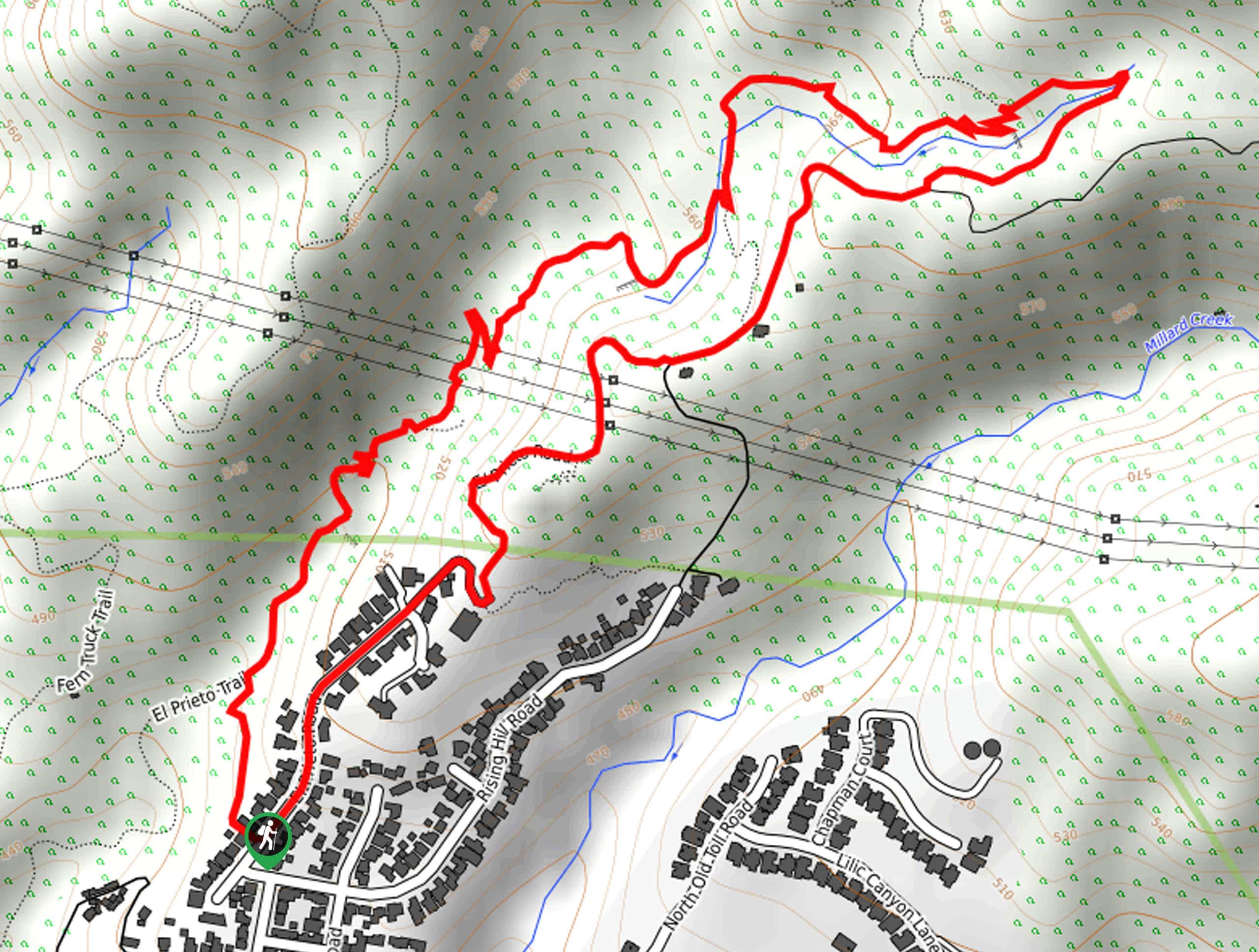
El Prieto Loop Trail Description
If you are in the mood for a short hike on the edge of the city that features some scenic views, a variety of terrain, and several creek crossings, then you should definitely check out the El Prieto Loop Trail. Be sure to have your adventure pass visible prior to beginning your excursion.
From the trailhead on El Prieto Road, follow the lane that leads to the west in between several houses to reach the trail. From here, the footpath will turn to the northeast and lead you through the undulating terrain of the hills north of Altadena.
Take some time to appreciate the beautiful views, as you traverse the hills and several small creek crossings in the area. Shortly after these crossings, the trail will turn sharply back towards the southwest and gain some elevation, as you traverse the fire road portion of the hike that will eventually bring you back to the starting point of your hike.
Similar hikes to the El Prieto Loop Trail hike

Mount Zion via Lower Winter Creek Trail Loop
The Mount Zion via Lower Winter Creek Trail Loop is a physically demanding Southern California adventure that features waterfall and…

Castaic Falls Trail
Hiking the Castaic Falls Trail is a fun little adventure in the Angeles National Forest that features a charming waterfall.…

Graveyard Truck Trail
Hiking the Graveyard Truck Trail is a pleasant experience in Southern California that features easy-going terrain and views of the…
Comments