Mount Wilson via Sierra Madre Hike
View Photos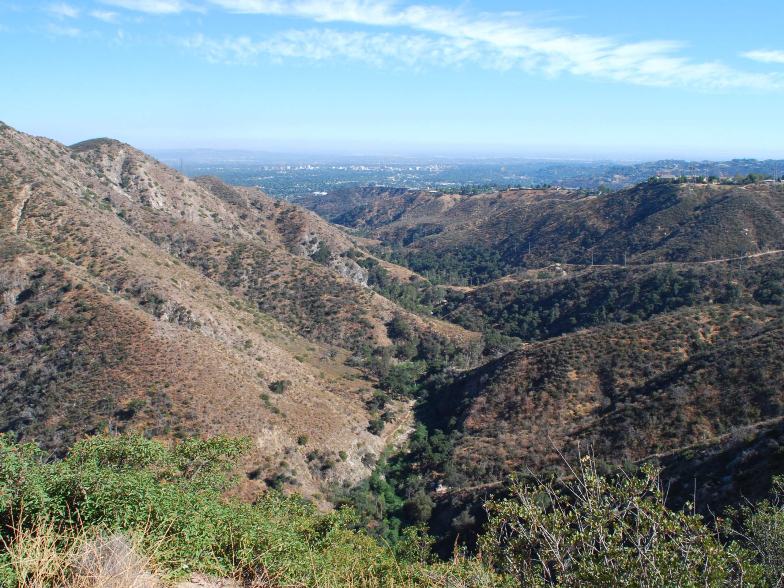
Mount Wilson via Sierra Madre Hike
Difficulty Rating:
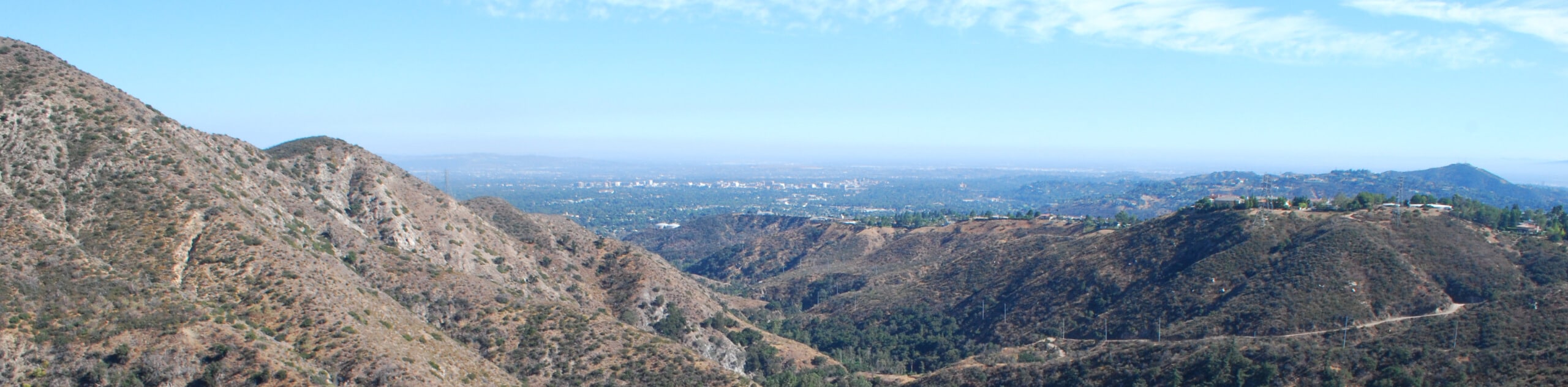
The Mount Wilson via Sierra Madre Hike is a difficult undertaking in Southern California that will see you climb into the mountains of the Angeles National Forest. While out on the trail, you will steadily gain elevation through the steep undulating terrain, while taking in the stunning landscape views on the way to the summit of Mount Wilson. Be sure to spend some time exploring the Mount Wilson Observatory when you get to the end of the trail!
Getting there
The starting point of this hike can be found next to Lizzies Trail Inn along E Miramonte Avenue in Sierra Madre, CA.

About
| Backcountry Campground | No |
| When to do | Year-Round |
| Pets allowed | Yes - On Leash |
| Family friendly | No |
| Route Signage | Average |
| Crowd Levels | Moderate |
| Route Type | Lollipop |
Mount Wilson via Sierra Madre Hike
Elevation Graph
Weather
Mount Wilson via Sierra Madre Hike Description
Whether you are training for longer and more challenging hikes or you simply want to test your limits while taking in the natural beauty of the Southern California landscape, the Mount Wilson via Sierra Madre Hike is a fun, albeit tiring, option to explore. Make sure to display your adventure pass in your car prior to your hike.
Setting out from the trailhead, you will head north along the road for a short distance, before picking up the Mount Wilson Trail on your left. Here, you will continue on to the north while gaining elevation, as you climb through the rugged terrain of the mountains.
Eventually, the trail will turn slightly to the northwest to take you past Mount Yale and Mount Harvard, before arriving at the summit of Mount Wilson. After taking some time to explore the observatory and experience the views, head back along the same trail to begin the return leg of your lengthy adventure.
Shortly after passing Lookout Point, you will keep right to traverse Jones Peak and follow the trail downhill to the Bailey Canyon Debris Reservoir. From here, Follow W Carter Avenue as it heads east to arrive back at the trailhead.
Similar hikes to the Mount Wilson via Sierra Madre Hike hike

Mount Zion via Lower Winter Creek Trail Loop
The Mount Zion via Lower Winter Creek Trail Loop is a physically demanding Southern California adventure that features waterfall and…

Sunset Peak Alternate Approach Hike
The Sunset Peak Alternate Approach Hike is a great intermediate-length route in Southern California that features some gorgeous canyon views.…
Register Ridge to Mount San Antonio Hike
The Register Ridge to Mount San Antonio Hike is equal parts scenic and incredibly challenging. While out on the trail,…
Comments