Shoemaker Canyon Road Hike
View Photos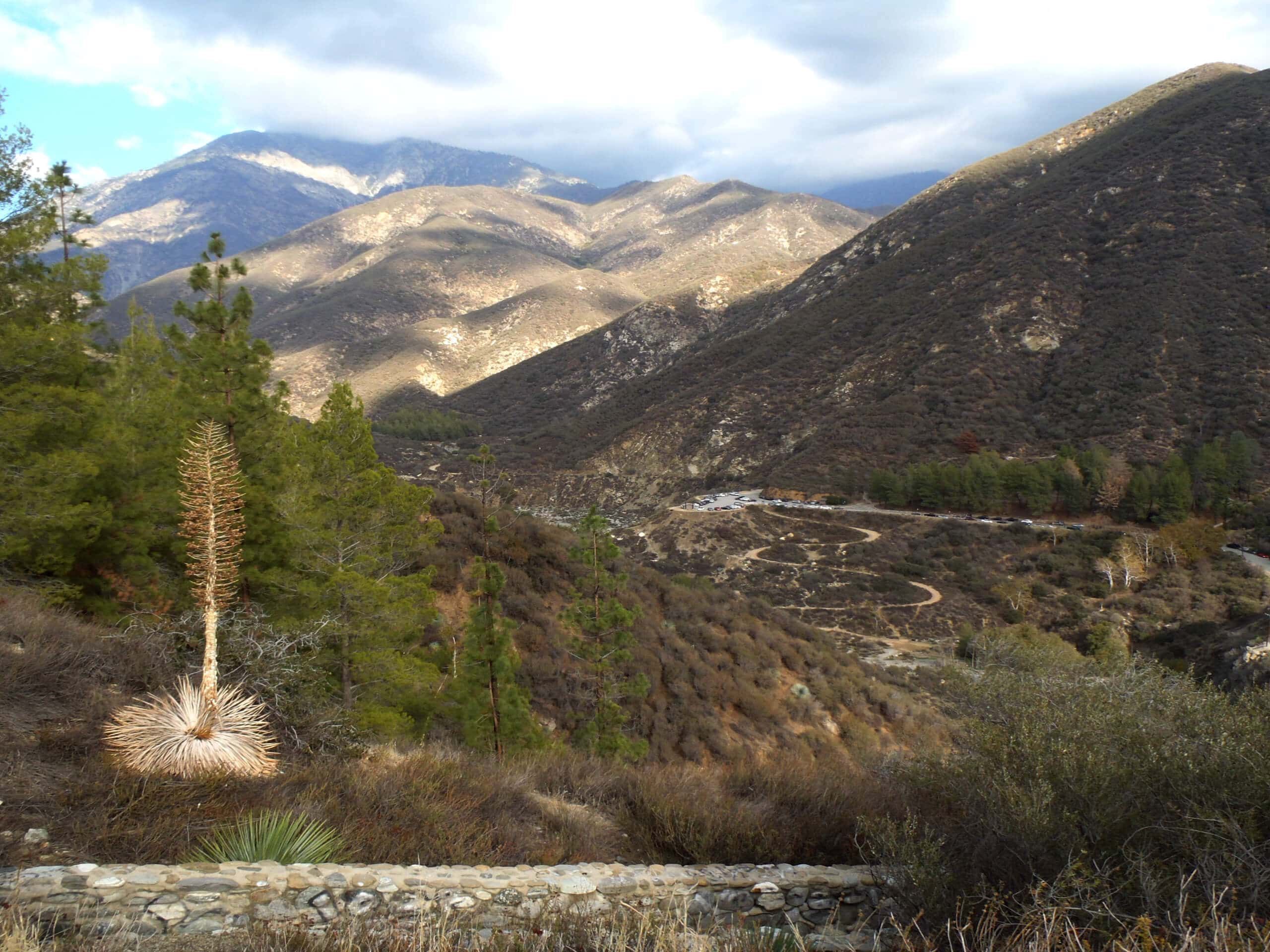
Shoemaker Canyon Road Hike
Difficulty Rating:
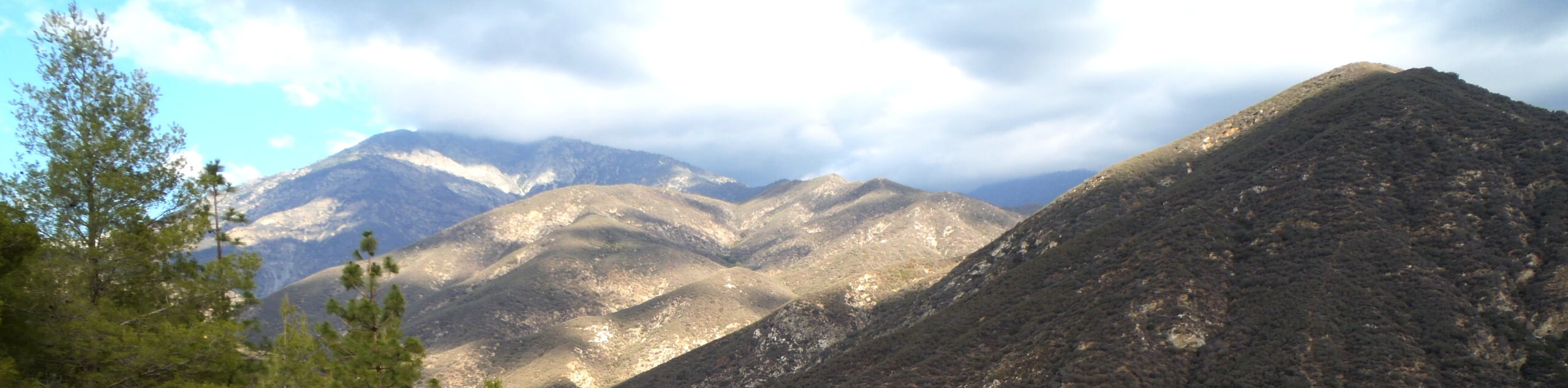
The Shoemaker Canyon Road Hike is a fairly laidback adventure in Southern California that follows along a road leading nowhere and offers scenic canyon views. The road was built during the Cold War as an escape route out of the Los Angeles area in the event of a nuclear attack, but was abandoned shortly after construction began. This left an interesting road through Shoemaker Canyon that is mostly used as a hiking route.
Getting there
The trailhead for the Shoemaker Canyon Road Hike can be found at the Shoemaker Viewpoint Day Use Area along Shoemaker Canyon Road.

About
| Backcountry Campground | No |
| When to do | Year-Round |
| Pets allowed | Yes - On Leash |
| Family friendly | Older Children only |
| Route Signage | Average |
| Crowd Levels | Moderate |
| Route Type | Out and back |
Shoemaker Canyon Road Hike
Elevation Graph
Weather
Shoemaker Canyon Road Hike Description
Featuring beautifully scenic canyon views and an easy to traverse road that leads nowhere (no traffic!), the Shoemaker Canyon Road Hike is a great option in the Angeles National Forest if you are after a laidback day outdoors.
Setting out from the trailhead at the Shoemaker Viewpoint Day Use Area, you will follow along the road as it leads northeast and into the canyon. Here you will gain a moderate amount of elevation and some beautiful views, as you continue along the well-graded road and pass through several tunnels.
After reaching the end of the second tunnel the road will end, so turn back here and retrace your footsteps back to the gate where you began your adventure.
Similar hikes to the Shoemaker Canyon Road Hike hike

Mount Zion via Lower Winter Creek Trail Loop
The Mount Zion via Lower Winter Creek Trail Loop is a physically demanding Southern California adventure that features waterfall and…

Castaic Falls Trail
Hiking the Castaic Falls Trail is a fun little adventure in the Angeles National Forest that features a charming waterfall.…

Graveyard Truck Trail
Hiking the Graveyard Truck Trail is a pleasant experience in Southern California that features easy-going terrain and views of the…
Comments