Bristlecone Pine Forest to Mexican Mine Ruins Trail
View Photos
Bristlecone Pine Forest to Mexican Mine Ruins Trail
Difficulty Rating:
The Bristlecone Pine Forest to Mexican Mine Ruins Trail is a unique route within Inyo National Forest that leads to an abandoned mining site. The trail is ideal for history lovers and families with young children as it is both short in distance and lacks a lot of incline.
Getting there
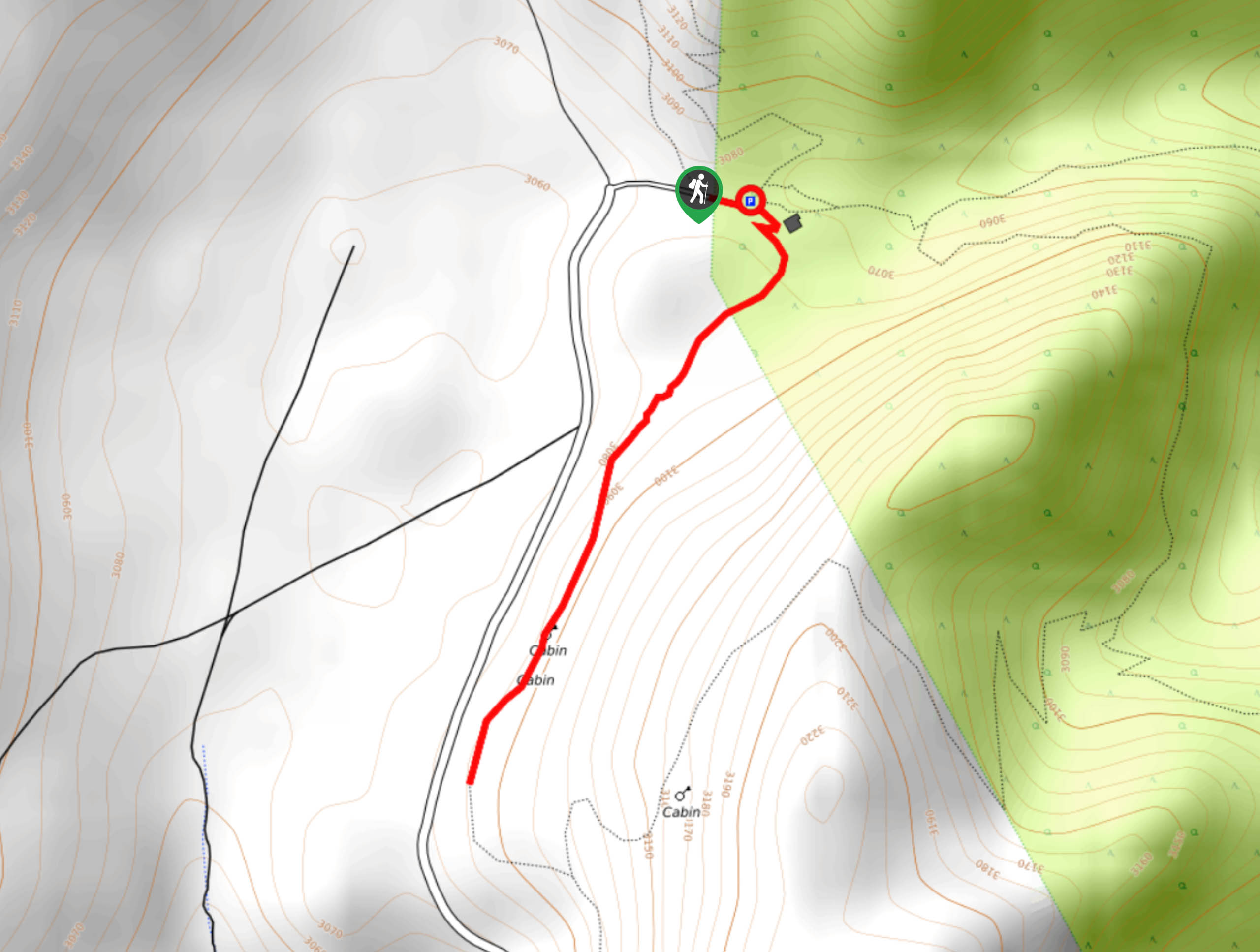
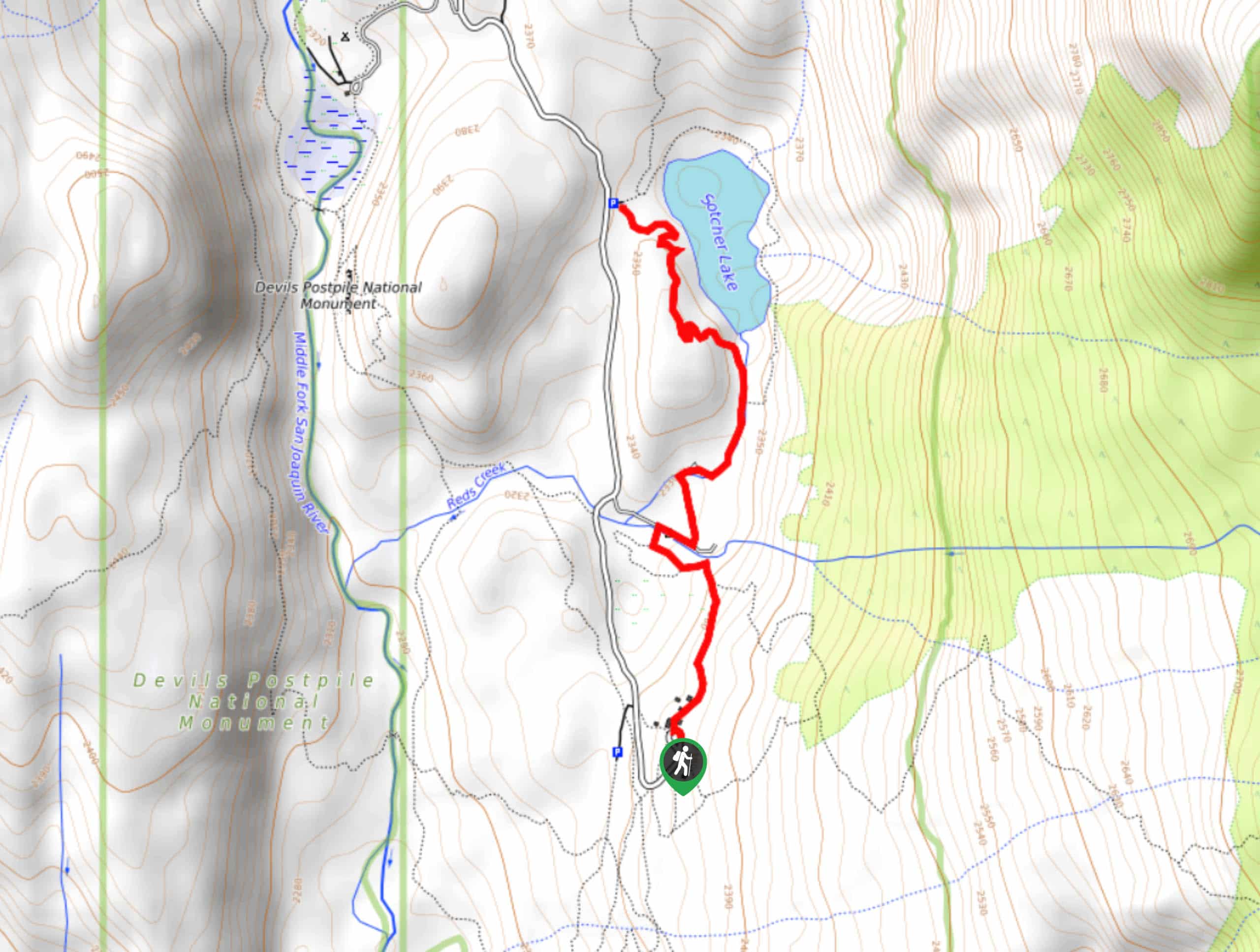
The trailhead for Bristlecone Pine Forest to Mexican Mine Ruins Trail is located at the Schulman Grove Picnic Area.

About
| Backcountry Campground | No |
| When to do | May-November |
| Pets allowed | No |
| Family friendly | Yes |
| Route Signage | Poor |
| Crowd Levels | Low |
| Route Type | Out and back |
Bristlecone Pine Forest to Mexican Mine Ruins Trail
Elevation Graph
Weather
Bristlecone Pine Forest to Mexican Mine Ruins Trail Description
While short in distance and without much incline, the Bristlecone Pine Forest to Mexican Mine Ruins Trail is at a high elevation. It is therefore important that you are conscious about the risks of elevation sickness and that you monitor yourself and others within your group for its symptoms.
With your vehicle parked at the Shulman Grove Picnic Area, follow the pathway as it makes its way to the south. Continuing on along the pathway, it will soon deliver you to a set of abandoned cabins where you should take some time and explore the historical site. A number of educational plaques exist to help inform you on what you are seeing. Once you are ready, backtrack your steps towards the trailhead and your waiting vehicle at the Schulman Grove Picnic Area.
Similar hikes to the Bristlecone Pine Forest to Mexican Mine Ruins Trail hike

Valentine Lake Trail
An underrated route within Inyo National Forest, Valentine Lake Trail is without a doubt worth the effort! Boasting sublime scenery…

Mountain View and 3S89 Road Loop
Mountain View and 3S89 Road Loop is a delightful route within Inyo National Forest. Leading you through a lovely forested…
Dinosaur Falls Trail
Dinosaur Falls Trail is a beautiful route within Inyo National Forest. Easily accessible, the route is ideal for families with…
Comments