Kennedy Meadow to the Bridge via PCT Trail
View Photos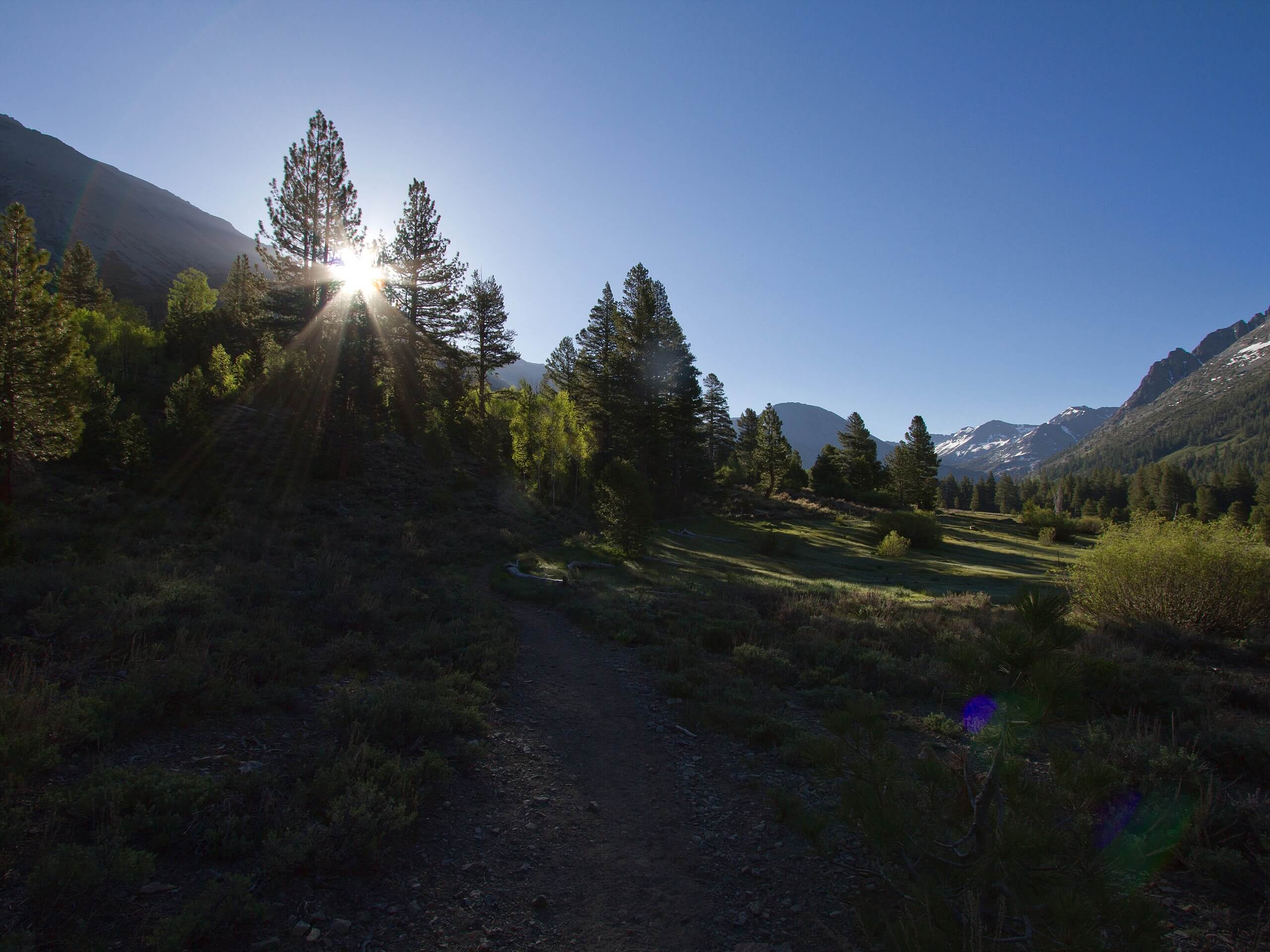
Kennedy Meadow to the Bridge via PCT Trail
Difficulty Rating:
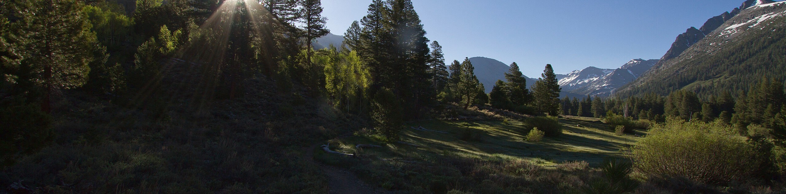
Kennedy Meadow to the Bridge via PCT Trail is a beautiful route within Inyo National Forest that traverses the scenic terrain of the eastern Sierra Nevada Mountain range. This moderately difficult route takes you alongside a charming river and through lovely meadows, and is considered to be an excellent place for viewing wildlife.
Getting there
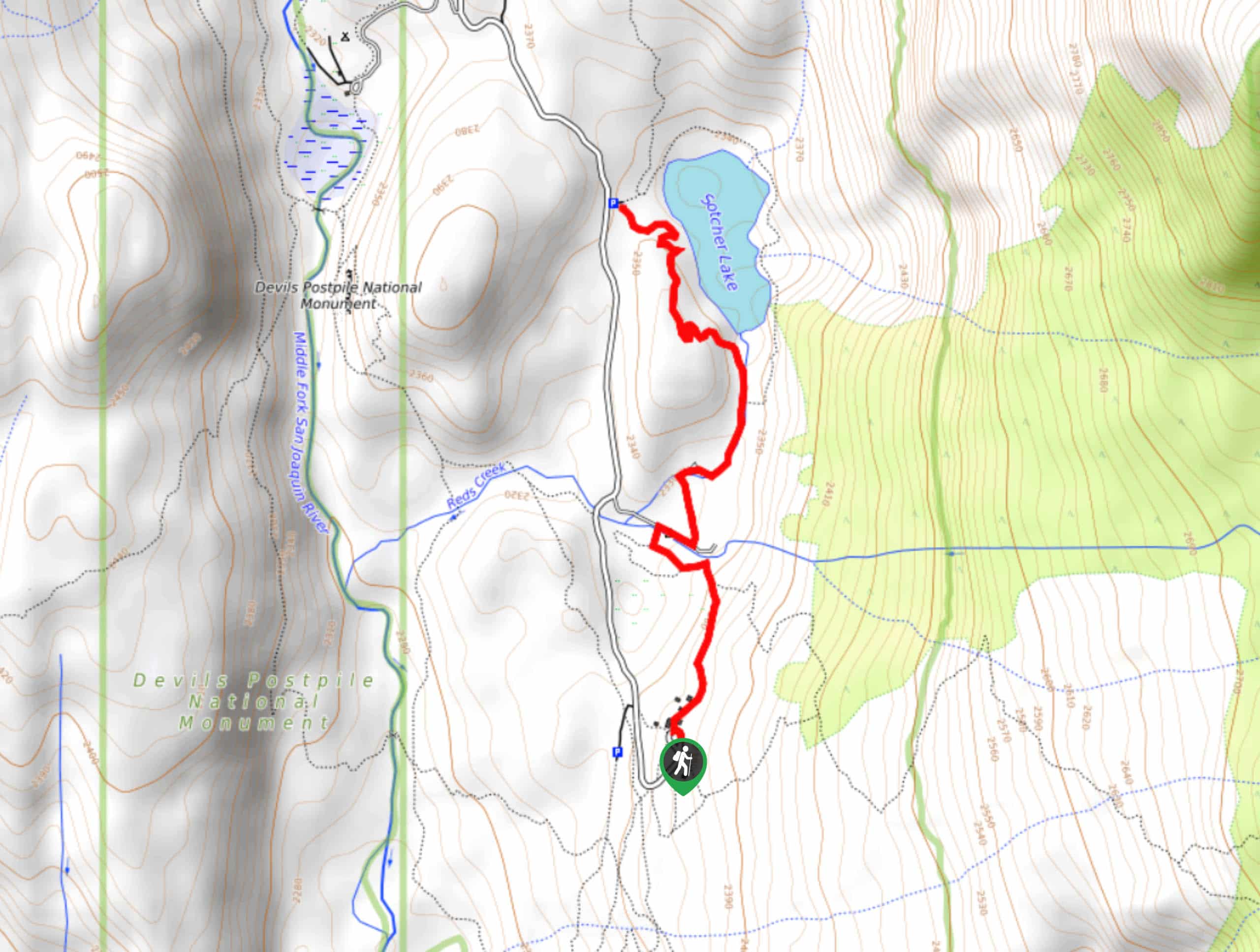
The trailhead for Kennedy Meadow to the Bridge via PCT is located at Kennedy Meadows Campground.

About
| Backcountry Campground | |
| When to do | March-October |
| Pets allowed | Yes - On Leash |
| Family friendly | Yes |
| Route Signage | Average |
| Crowd Levels | High |
| Route Type | Out and back |
Kennedy Meadow to the Bridge via PCT Trail
Elevation Graph
Weather
Kennedy Meadow to the Bridge via PCT Trail Description
As the Kennedy Meadow to the Bridge via PCT Trail is a popular route within Inyo National Forest, it can become rather busy at certain times of the year. Therefore, those looking for a more secluded hiking experience may want to consider doing the route midweek in order to avoid the larger crowds that often congregate on weekends or even skip it in favor of a less frequented route.
Kennedy Meadow to the Bridge via PCT Trail is an excellent route because of how beautiful and accessible it is. The scenery found throughout the route is representative of the eastern Sierra Nevada Mountain range, and is therefore sublime. Likewise, the trail is fairly short and lacks any major elevation incline. This means that the Kennedy Meadow to the Bridge via PCT Trail is appropriate for the majority of those who would be interested in doing it.
Having arrived at the Kennedy Meadows Campground, locate the Pacific Crest National Scenic Trail that runs through the center of the campground. Once on the trail, follow it as it heads to the north. After crossing a stream, the route will begin to follow alongside the Kern River over steadily inclining terrain. The Kennedy Meadow to the Bridge via PCT will continue on its northern heading, with mountainous terrain on either side of you for the next few miles.
After delineating from the riverside shortly, the Kennedy Meadow to the Bridge via PCT Trail will veer back towards it and arrive at a bridge. While the Pacific Crest National Scenic Trail does continue on from here, the bridge is where the Kennedy Meadow to the Bridge via PCT trail ends, and so after enjoying the charming river, and the incredible sightlines, backtrack your steps towards the trailhead.
Frequently Asked Questions
Are there bears in Kennedy Meadows?
Yes. Kennedy Meadows is within the habitat range of American Blackbears.
What is the altitude of Kennedy Meadows?
Kennedy Meadows is at an altitude of 6213ft.
Is there cell service in Kennedy Meadows?
As of the date this report was written, there is no cell service in Kennedy Meadows whatsoever.
Insider Hints
Wear sunscreen and a hat to help protect yourself from the effects of the sun!
A good pair of hiking boots goes a long way. Your ankles and knees will thank you!
Keep an eye on young children and dogs around the Kern River. At higher flows it can become very powerful and dangerous!
In the spring, the mosquitoes can get bad, so be sure to bring some bug repellent.
Similar hikes to the Kennedy Meadow to the Bridge via PCT Trail hike

Valentine Lake Trail
An underrated route within Inyo National Forest, Valentine Lake Trail is without a doubt worth the effort! Boasting sublime scenery…

Mountain View and 3S89 Road Loop
Mountain View and 3S89 Road Loop is a delightful route within Inyo National Forest. Leading you through a lovely forested…
Dinosaur Falls Trail
Dinosaur Falls Trail is a beautiful route within Inyo National Forest. Easily accessible, the route is ideal for families with…
Comments