
Hot Creek Interpretive Trail
View Photos
Hot Creek Interpretive Trail
Difficulty Rating:
The Hot Creek Interpretive Trail is a short route that is appropriate for all skill levels, and families with young children. The trail brings you along Hot Creek - a geothermally heated waterway surrounded by the imposing mountains of the eastern Sierra Nevada Mountain Range. The Hot Creek Interpretive Trail possesses a number of educational plaques to help inform visitors on the natural history of the area.
Getting there
The trailhead for the Hot Creek Interpretive Trail is located at a parking lot off of Hot Creek Hatchery Road.

About
| Backcountry Campground | No |
| When to do | Year Round |
| Pets allowed | Yes - On Leash |
| Family friendly | Yes |
| Route Signage | Good |
| Crowd Levels | Moderate |
| Route Type | Out and back |
Hot Creek Interpretive Trail
Elevation Graph
Weather
Hot Creek Interpretive Trail Description
During weekends and holidays, the Hot Creek Interpretive Trail can get rather crowded. Therefore, if you are planning on visiting the route during these time periods, we recommend doing so earlier in the morning or later in the afternoon to avoid the midday crowds.
The Hot Creek Interpretive Trail is a great route simply because of how accessible and family-friendly it is. Short in distance, and with almost no elevation incline, the route is extremely inviting to whoever may want to do it. In addition to its accessibility, the Hot Creek Interpretive Trail is informative, as the many educational plaques found throughout it will help teach you about the geological history of the region.
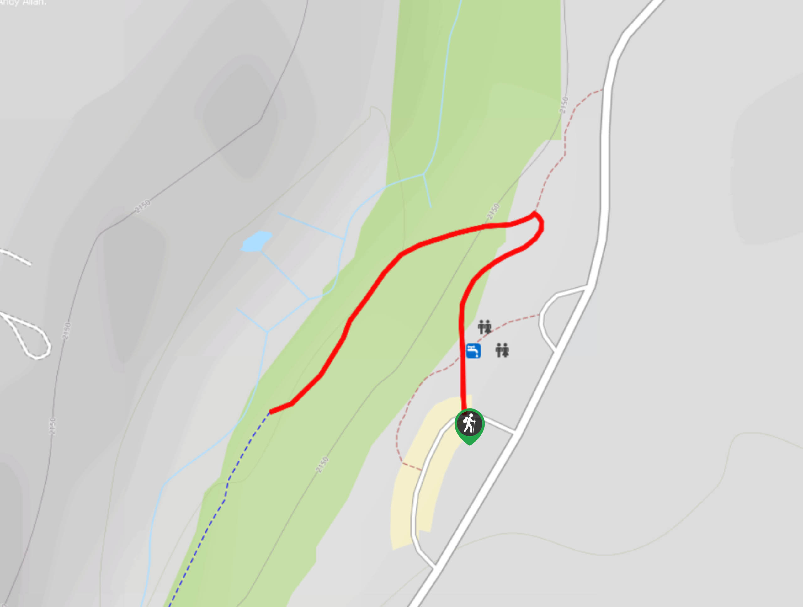
The Hot Creek Interpretive Trail itself is incredibly straightforward. From the trailhead, simply follow the pathway north towards the creek. Once you have reached the pathway that runs adjacent to the creek, follow it south for as long as you would like before turning around and backtracking your steps towards the trailhead.
Insider Hints
Enjoy fly fishing? Hot Creek is known as a great place for it!
If you're having trouble finding parking on a busy day, two more lots can be found just south, along Hot Creek Hatchery Road.
Hungry after your hike? Check out John’s Pizza Works for some great food!
Similar hikes to the Hot Creek Interpretive Trail hike

Mountain View and 3S89 Road Loop
Mountain View and 3S89 Road Loop is a delightful route within Inyo National Forest. Leading you through a lovely forested…
Dinosaur Falls Trail
Dinosaur Falls Trail is a beautiful route within Inyo National Forest. Easily accessible, the route is ideal for families with…
Bennettville Trail
The Bennettville Trail is an easily accessible, family-friendly route within Inyo National Forest. The route takes you alongside charming creeks…
Comments