Emerald Lake Trail
View Photos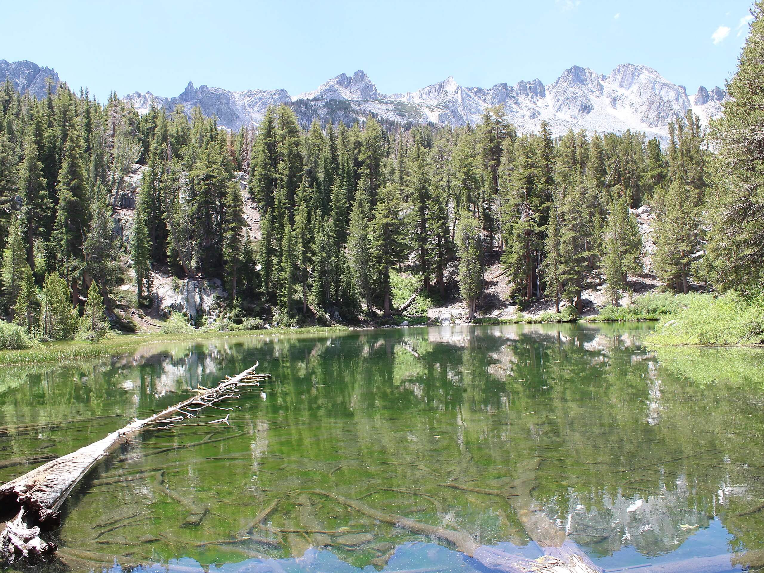
Emerald Lake Trail
Difficulty Rating:
Short in distance and with relatively little elevation incline, the Emerald Lake Trail is ideal for beginner hikers and families with young children. With great scenery that can be enjoyed throughout the route, and lots of opportunities for wildlife viewing, the Emerald Lake Trail is an excellent choice for your next hike in Inyo National Forest.
Getting there
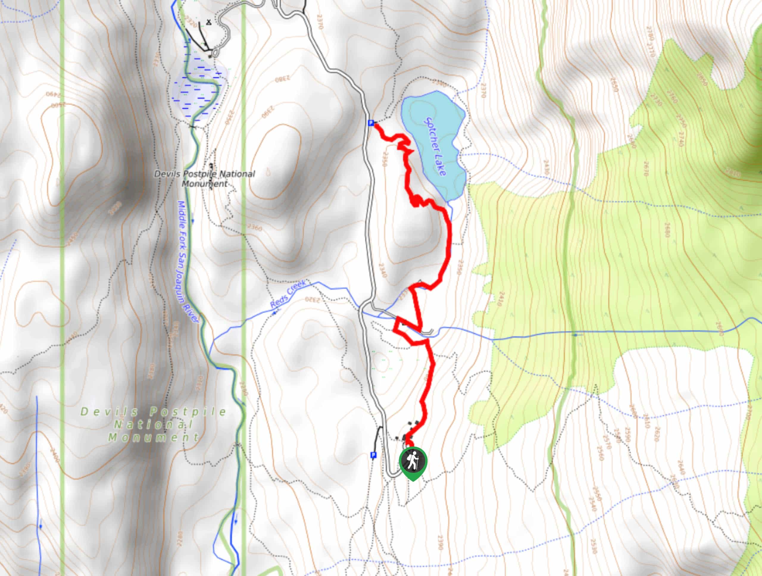
The trailhead for Emerald Lake Trail is located off of Coldwater Creek Campground Road.

About
| Backcountry Campground | |
| When to do | June-November |
| Pets allowed | Yes |
| Family friendly | Yes |
| Route Signage | Average |
| Crowd Levels | Moderate |
| Route Type | Out and back |
Emerald Lake Trail
Elevation Graph
Weather
Emerald Lake Trail Description
Depending on the time of year you plan on the Emerald Lake Trail, the mosquitoes can be rather prolific, so you should prepare yourself accordingly. We recommend bringing lots of bug repellent with you and wearing long sleeves and pants if you plan to do the route in the springtime.
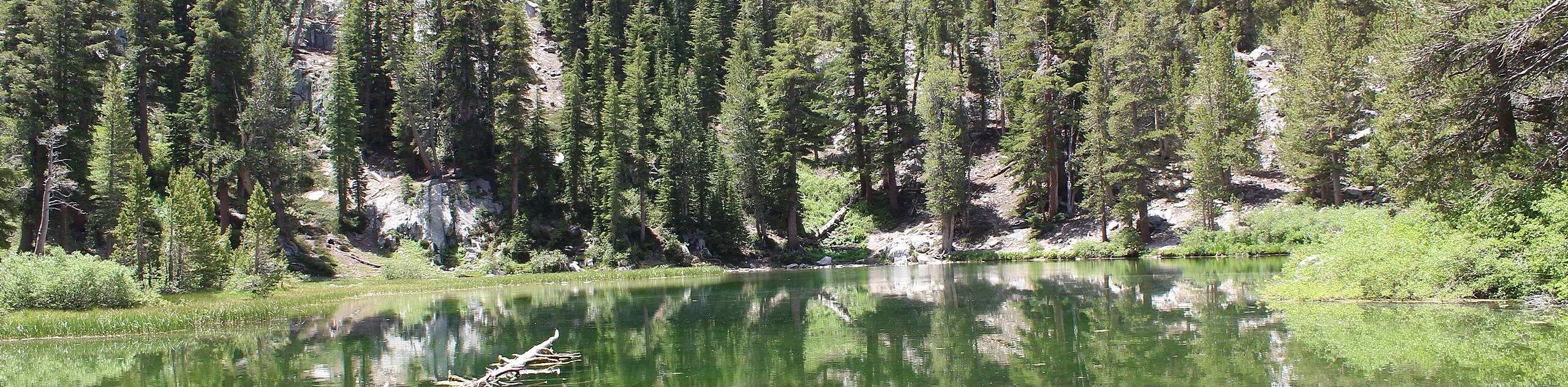
Having arrived at the trailhead, follow the Emerald Lake Trail south as it crosses Coldwater Creek. The route will continue on its southern heading, inclining in elevation as it goes before once again crossing Coldwater Creek from the west. The Emerald lake Trail will begin to veer to the east as the elevation taper off. The route will then deliver you to beautiful Emerald Lake, where you should take some time to enjoy the scenery before backtracking your steps towards the trailhead.
Similar hikes to the Emerald Lake Trail hike

Valentine Lake Trail
An underrated route within Inyo National Forest, Valentine Lake Trail is without a doubt worth the effort! Boasting sublime scenery…

Mountain View and 3S89 Road Loop
Mountain View and 3S89 Road Loop is a delightful route within Inyo National Forest. Leading you through a lovely forested…
Dinosaur Falls Trail
Dinosaur Falls Trail is a beautiful route within Inyo National Forest. Easily accessible, the route is ideal for families with…
Comments