Zig Zag Trail
View Photos
Zig Zag Trail
Difficulty Rating:
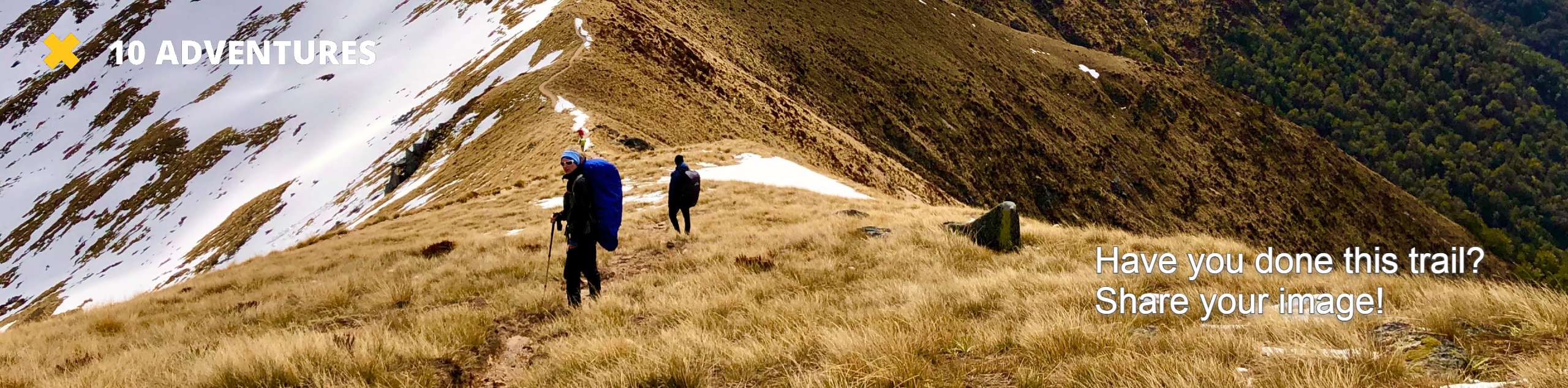
Zig Zag Trail is a moderately trafficked out-and-back trail in Mount Baker-Snoqualmie National Forest that is rated as hard. The hike leads to a viewpoint with an old truck.
This hike is a leg-burner, so bring poles if you have them. We also recommend hiking in groups as many hikers report seeing either bears or bear scat on this route. Bug spray is also recommended.
Getting there
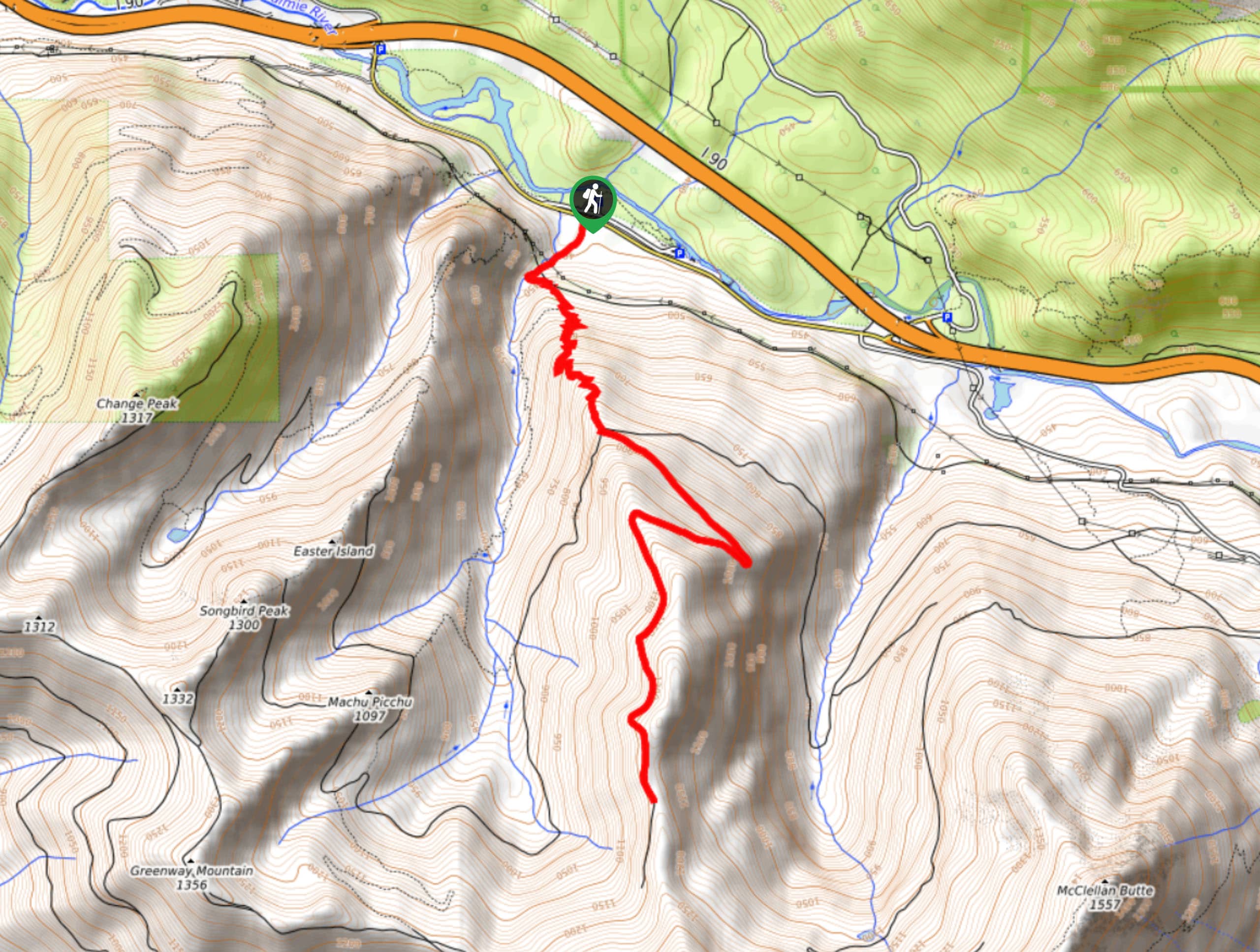
The trailhead for the Zig Zag Trail is across from the Olallie State Park South Fork Picnic Area on SE Homestead Valley Road.

About
| Backcountry Campground | No |
| When to do | Year-round |
| Pets allowed | Yes - On Leash |
| Family friendly | No |
| Route Signage | Average |
| Crowd Levels | Moderate |
| Route Type | Out and back |
Zig Zag Trail
Elevation Graph
Weather
Zig Zag Trail Description
Zig Zag Trail is a hike with solid effort required, packing steep elevation gain into a 6.2mi trail. The trail leads to a viewpoint with an old abandoned truck. Users tend to be split on this hike; some enjoy it, some don’t find it worth the hard work. Come find out for yourself!
The trail begins from the south side of the road, heading out into the forest on Hall Creek Trail. Approach the bridge, not crossing but hiking up to where the official trailhead is. The section of trail through the forest is the steepest and doesn’t offer all that much for views, so just work to get through it.
Continue to a gravel road that leads you to the lookout and the truck. This section is a bit flatter and offers a nice respite. Once you’re done, retrace your steps to the trailhead.
Similar hikes to the Zig Zag Trail hike

Lakes Dorothy, Bear, Deer, and Snoqualmie Hike
The Lakes Dorothy, Bear, Deer, and Snoqualmie Hike provides access to Lake Dorothy, Bear Lake, Deer Lake, and Snoqualmie Lake.…

Gold Creek Trail to Joe Lake
Gold Creek Trail to Joe Lake is not a hike for the faint of heart. This lightly trafficked trail is…

Basin Lake via Bullion Basin Trail
Basin Lake via Bullion Basin Trail is a 12.2mi hike that, with 2900ft of elevation gain,…
Comments