
Shoe Lake via PCT
View Photos
Shoe Lake via PCT
Difficulty Rating:
Shoe Lake via the PCT is a wonderful full-day trip with quintessential Washington views to enjoy—lakes, mountains, and vibrant forest. This is a hard hike mostly due to the distance; it’ll likely take you a full day to complete. The hike provides no significant technical challenges to note and is suitable for intermediate adventurers.
Bring a good bug spray on this hike.
Getting there
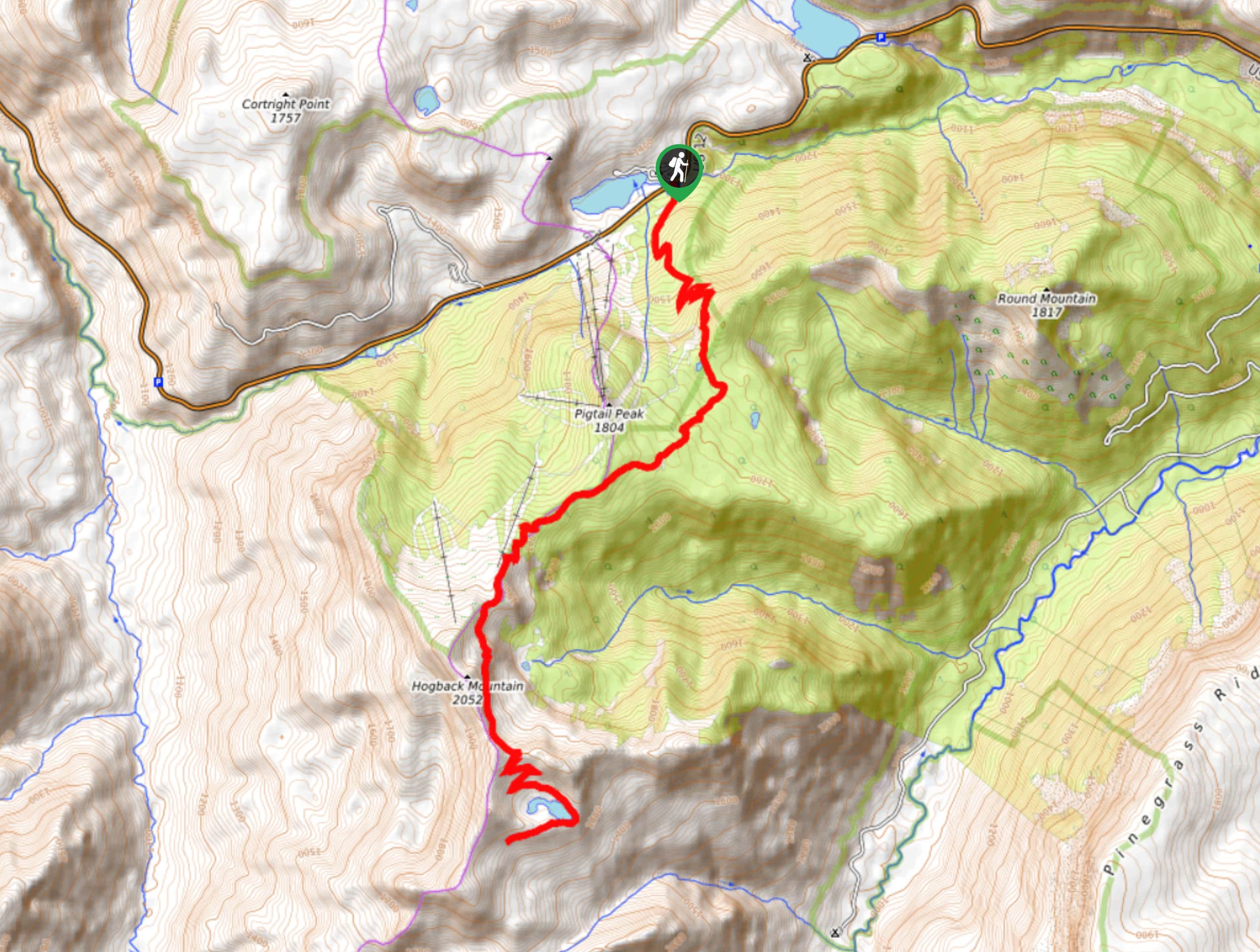
The trailhead for the Shoe Lake via PCT hike is on Highway 12 across from the White Pass Campground.

About
| Backcountry Campground | White Pass Campground |
| When to do | June-October |
| Pets allowed | Yes - On Leash |
| Family friendly | No |
| Route Signage | Average |
| Crowd Levels | Moderate |
| Route Type | Out and back |
Shoe Lake via PCT
Elevation Graph
Weather
Shoe Lake via PCT Description
The views en route to Shoe Lake via the Pacific Crest Trail are wonderful, and this trail is the ideal way to spend an entire day in nature. With lakes, mountains, and forest to explore, it’s a lovely trip.
Begin from the PCT trailhead across from the campground. You’ll have some elevation to gain early on, switchbacking to about 1650m. The path then levels out a bit as you pass Pigtail Peak and head towards Hogback Mountain.
A few last switchbacks take you to Shoe Lake. The trail does extend to allow you to do a full loop and reconnect with the main trail, or you can turn around at the lakeshore and retrace your steps to the trailhead.
Similar hikes to the Shoe Lake via PCT hike

Lakes Dorothy, Bear, Deer, and Snoqualmie Hike
The Lakes Dorothy, Bear, Deer, and Snoqualmie Hike provides access to Lake Dorothy, Bear Lake, Deer Lake, and Snoqualmie Lake.…

Gold Creek Trail to Joe Lake
Gold Creek Trail to Joe Lake is not a hike for the faint of heart. This lightly trafficked trail is…

Basin Lake via Bullion Basin Trail
Basin Lake via Bullion Basin Trail is a 12.2mi hike that, with 2900ft of elevation gain,…
Comments