Mason Lake via Ira Spring Trail
View Photos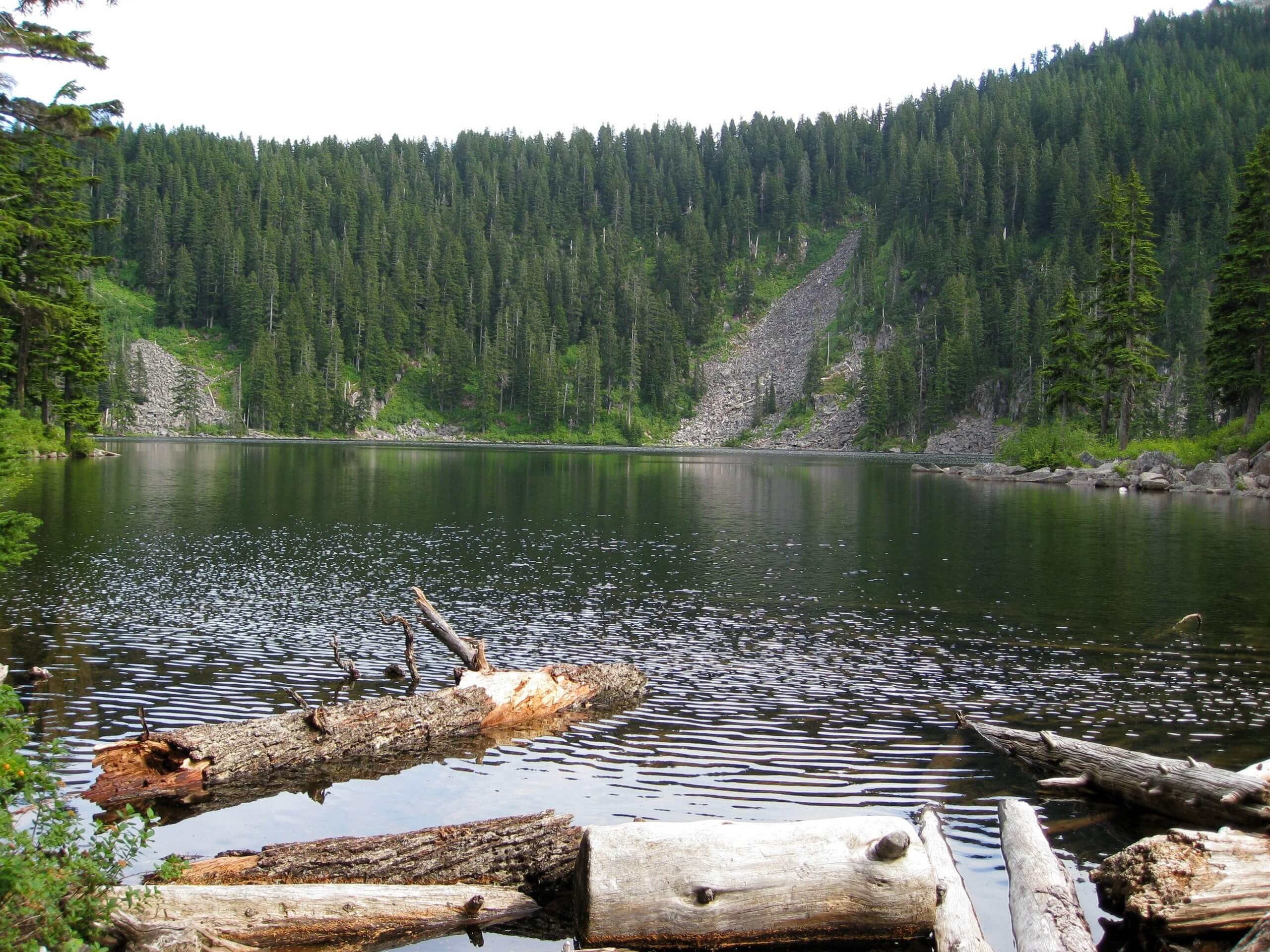
Mason Lake via Ira Spring Trail
Difficulty Rating:
Mason Lake via Ira Spring Trail is a 6.8mi heavily trafficked out and back trail that is rated as hard. This trail is named after one of the most steadfast advocates for Washington’s trail system, nature photographer and conservationist Ira Spring. The trail is very popular, especially in the summer months when remarkable wildflower blooms line the route. The hike culminates at Mason Lake, a very popular backcountry camping site. Whether you take this trail as a day trip or a backpacking adventure, you’ll have a wonderful time.
Getting there
The trailhead for the Mason Lake via Ira Spring Trail hike is at the end of FR-9031, Mason Lake Road.

About
| Backcountry Campground | Mason Lake Backcountry Camping |
| When to do | June-November |
| Pets allowed | Yes - On Leash |
| Family friendly | No |
| Route Signage | Good |
| Crowd Levels | High |
| Route Type | Out and back |
Mason Lake via Ira Spring Trail
Elevation Graph
Weather
Mason Lake via Ira Spring Trail Description
Mason Lake via Ira Spring Trail is a wonderful hike, offering pretty much everything you would want in an outing: gorgeous mountains, carpets of wildflowers, sunny ridgelines, and crystalline alpine lakes. This trail can be used as a daytrip hike or a short backpacking adventure if you arrange to stay at Mason Lake Backcountry Camp, which is a fantastic spot. This trail does get quite busy, but it’s well worth the effort to enjoy the picturesque setting. The trail honors late conservationist and nature photographer Ira Spring.
The hike begins from the parking lot, passing through thick forest along some leisurely switchbacks. You’ll cross Mason Creek at about 0.8mi. A new bridge has been constructed here to safely ferry hikers across in all seasons, as this was previously a difficult crossing when the water hit its springtime highs.
After crossing the bridge, continue through the forest to a junction at 1.6mi. Go left here. You’ll begin to gain elevation more aggressively, switchbacking above the treeline into a fantastic alpine meadow. The views here reward your efforts, which continue to hte junction with the Bandera Mountain Trail. Stay left again.
After the junction, climb north to the summit crest, which provides excellent views over the surrounding mountains and to Mount Rainier on clear days. This is the best spot on the hike to stop for photos!
Descend over the north end of the ridge, dropping about 300ft in elevation to Mason Lake. The trail wraps around the lake to the camping areas. This is the end of the trail, but there are a couple of extensions possible to lengthen your trip.
Option 1: You can make a side trip to Bandera Mountain by taking the Bandera Mountain Trail at the junction. This is less than a mile in distance but quite steep, gaining 700ft in about 0.5mi.
Option 2: Take the main trail around the north bank of Mason Lake to the junction with Mount Defiance Trail. Go left and hike for 1.3mi to the spur trail that heads to the summit. The views are excellent, but it’s a bit of a scramble to get up here.
If you’re satisfied with your trip and not looking for an extension, retrace your steps back to the parking lot (or pitch your tent and settle in!).
Hiking Route Highlights
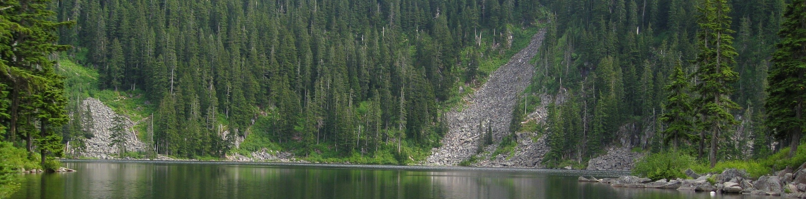
Mason Lake
Mason Lake is a small, deep alpine lake in the (aptly named) Alpine Lakes Wilderness. This little lake is very pretty and stocked to the brim with rainbow trout. It’s a very popular backcountry camping destination and provides access to several trails from its shores.
Frequently Asked Questions
Are there facilities at Mason Lake?
There is a privy at the lake, as well as at the trailhead.
Do I need a pass for Mason Lake?
Yes. Please have your Northwest Forest Pass ready.
Insider Hints
Good boots are a help on the rocky sections of this hike.
Do this hike in wildflower season if you can manage to!
A weekday or early visit is recommended if you’re wanting a quieter experience.
Similar hikes to the Mason Lake via Ira Spring Trail hike

Lakes Dorothy, Bear, Deer, and Snoqualmie Hike
The Lakes Dorothy, Bear, Deer, and Snoqualmie Hike provides access to Lake Dorothy, Bear Lake, Deer Lake, and Snoqualmie Lake.…

Gold Creek Trail to Joe Lake
Gold Creek Trail to Joe Lake is not a hike for the faint of heart. This lightly trafficked trail is…

Basin Lake via Bullion Basin Trail
Basin Lake via Bullion Basin Trail is a 12.2mi hike that, with 2900ft of elevation gain,…
Comments