Franklin Falls Trail Winter Route
View Photos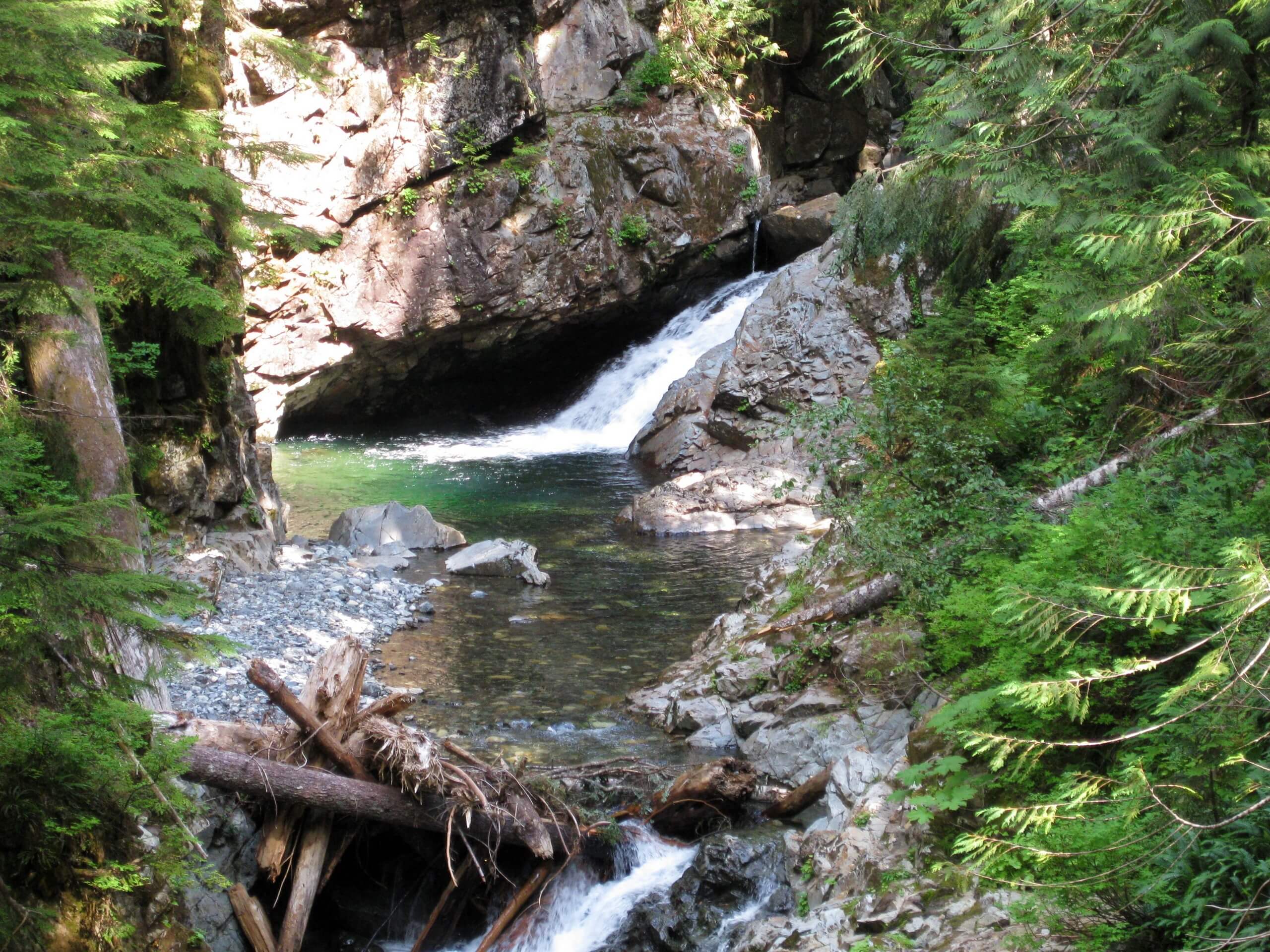
Franklin Falls Trail Winter Route
Difficulty Rating:
Franklin Falls Trail is a heavily trafficked out-and-back trail in Mount Baker-Snoqualmie National Forest that features a waterfall and is rated as moderate. This route follows the winter access trail, which is longer than the route used in summer. Bring microspikes and snowshoes if you have them.
The road to the campground is often closed during winter, so this route includes the additional walk in.
Getting there
The trailhead for the Franklin Falls Trail is located where Denny Creek Road passes under I-90.

About
| Backcountry Campground | Denny Creek |
| When to do | November-April |
| Pets allowed | Yes - On Leash |
| Family friendly | Yes |
| Route Signage | Average |
| Crowd Levels | Moderate |
| Route Type | Out and back |
Franklin Falls Trail Winter Route
Elevation Graph
Weather
Franklin Falls Trail Winter Route Description
Waterfall hikes are some of the best to enjoy in Washington, and Franklin Falls Trail is hugely popular with locals and visitors to the area alike. Enjoyable in all seasons, this route guide follows the winter access route to the falls. Bring microspikes and snowshoes if you have them.
The trail begins where the road closes in winter, which is just under westbound I-90. The first 2 or so miles of the hike are along the closed campground access road. This road isn’t always plowed in its entirety, so be prepared for snow.
You’ll join the Franklin Falls Trail at the north end of Denny Creek Campground at the signed trail. The path follows the South Fork of the Snoqualmie River, climbing gently through the forest. Note that this trail is on hiker’s right of the river; if you’re on the left of the river, you may have accidentally taken Denny Creek Trail.
Hike through the snowy forest. A few spur trails branch off to the right, but you’ll want to continue straight on along the obvious path. Near the falls, there can be avalanche debris. Take caution when crossing.
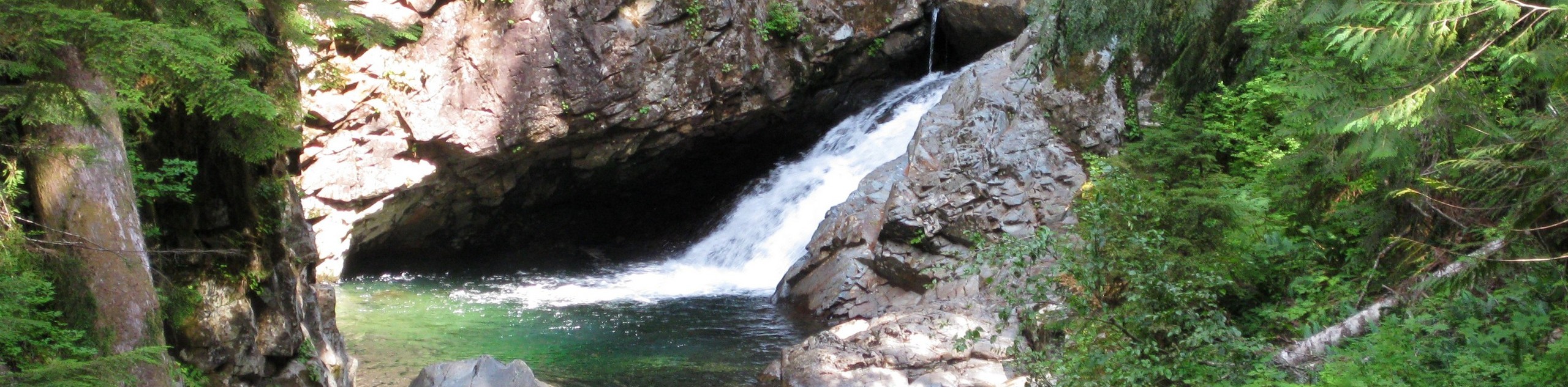
Reach the falls, which are often icicle-adorned by now. Once you’re ready to head back, simply turn around and retrace your steps back to the trailhead.
Similar hikes to the Franklin Falls Trail Winter Route hike

Lakes Dorothy, Bear, Deer, and Snoqualmie Hike
The Lakes Dorothy, Bear, Deer, and Snoqualmie Hike provides access to Lake Dorothy, Bear Lake, Deer Lake, and Snoqualmie Lake.…

Gold Creek Trail to Joe Lake
Gold Creek Trail to Joe Lake is not a hike for the faint of heart. This lightly trafficked trail is…

Basin Lake via Bullion Basin Trail
Basin Lake via Bullion Basin Trail is a 12.2mi hike that, with 2900ft of elevation gain,…
Comments