
Deception Creek Trail
View Photos
Deception Creek Trail
Difficulty Rating:
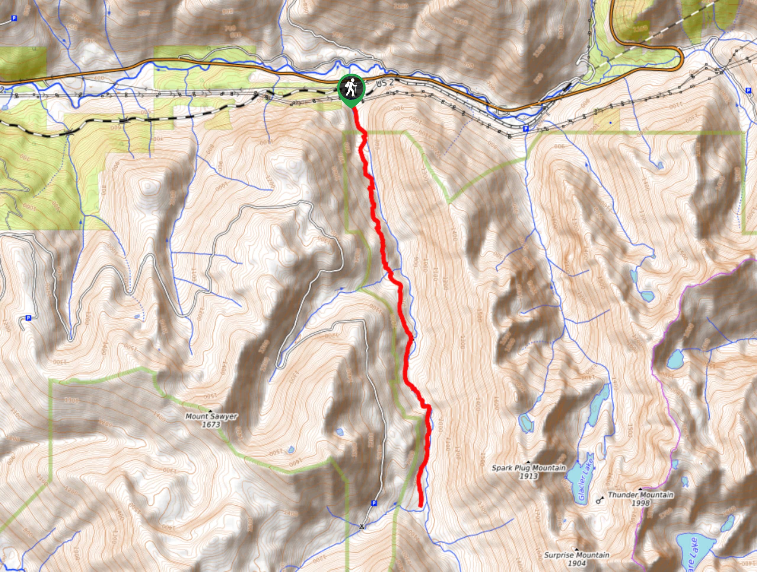
Deception Creek Trail is an adventurous one. This 9.4mi out-and- back trail is plagued by downed trees, so come prepared to do some climbing and ducking. The trail also can become somewhat hard to follow at times, but with GPS at the ready, you can enjoy a quieter experience than other nearby trails. This hike is hard, but it’s a unique adventure.
We don’t recommend hiking this when there is still snow on the trail as navigation becomes quite difficult.
Getting there
The trailhead for Deception Creek Trail is at the end of Forest Service Road 6088.

About
| Backcountry Campground | Deception Creek |
| When to do | June-October |
| Pets allowed | Yes - On Leash |
| Family friendly | No |
| Route Signage | Poor |
| Crowd Levels | Low |
| Route Type | Out and back |
Deception Creek Trail
Elevation Graph
Weather
Deception Creek Trail Description
Deception Creek Trail follows (you guessed it) Deception Creek. This is a fun, remote feeling trail, but you’ll need to be prepared to hop some downed trees in most cases. We also recommend a potent bug spray.
The hike begins just past Deception Falls at the end of the forest road. You’ll hug the creek, and for the first 5.0mi, you’ll only need to do some light bushwhacking. Past the 5.0mi mark, expect things to get a little spicier, with bigger downed trees, creek crossings, and more bushwhacking.
Keep an eye on your GPS if you feel off-trail. The path can get quite muddy in recent rains, so take your time on slick sections.
The reflected route ends at the intersection with Tonga Ridge Trail. To continue to Deception Pass, you’d go left, but this is a long journey best kept for a backpacking trip. From the junction, turn around and retrace your steps to the trailhead.
Similar hikes to the Deception Creek Trail hike

Lakes Dorothy, Bear, Deer, and Snoqualmie Hike
The Lakes Dorothy, Bear, Deer, and Snoqualmie Hike provides access to Lake Dorothy, Bear Lake, Deer Lake, and Snoqualmie Lake.…

Gold Creek Trail to Joe Lake
Gold Creek Trail to Joe Lake is not a hike for the faint of heart. This lightly trafficked trail is…

Basin Lake via Bullion Basin Trail
Basin Lake via Bullion Basin Trail is a 12.2mi hike that, with 2900ft of elevation gain,…
Comments