Suntop Trail Longer Route
View Photos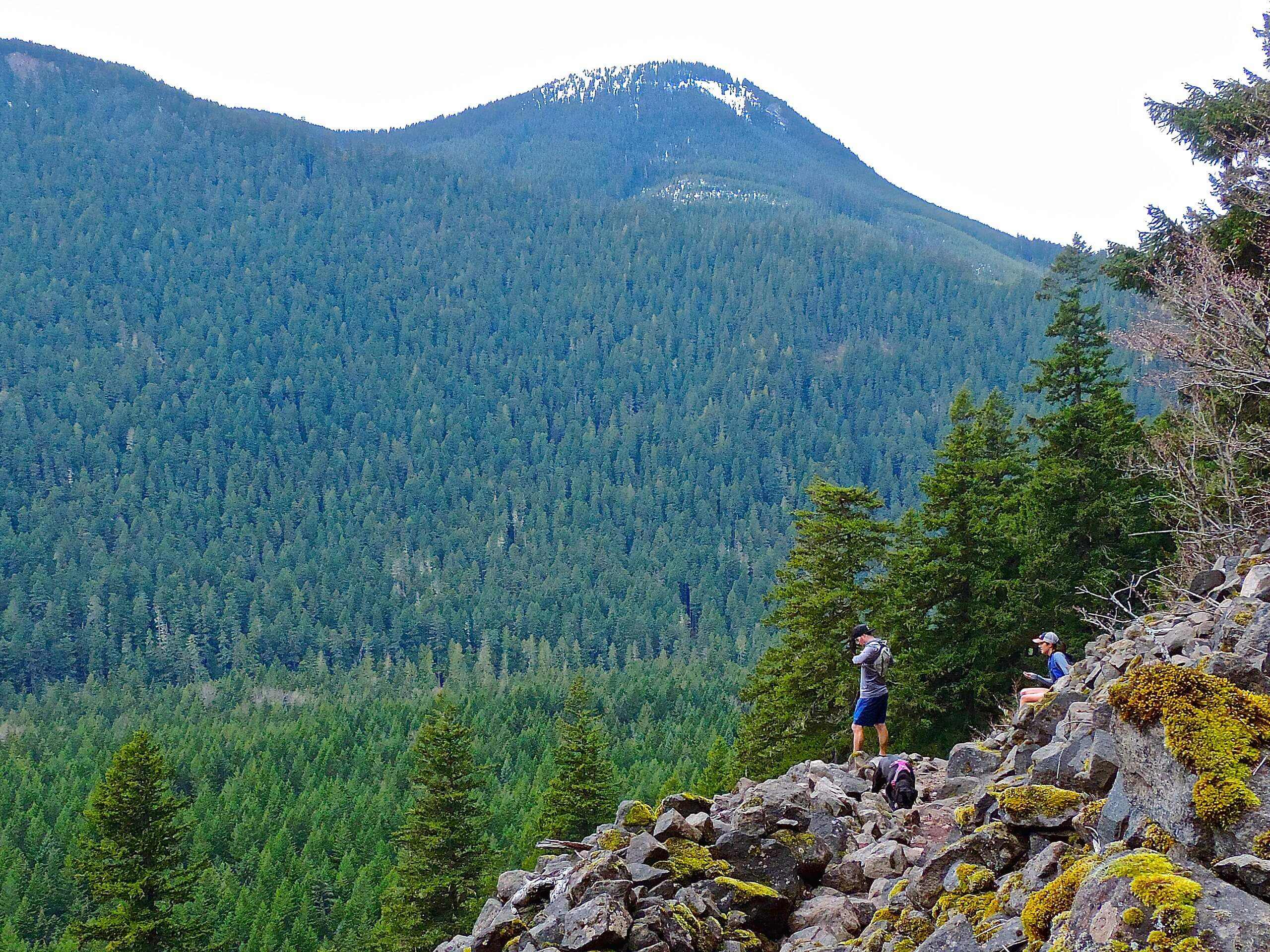
Suntop Trail Longer Route
Difficulty Rating:
While most families and casual hikers take the short Suntop Trail, this 16.1mi route makes a full day of the journey. With 4416ft of elevation gain to complete, this is a much more arduous trek, but it’s very scenic the whole way. The trail is moderately trafficked but it’s frequented by mountain bikers, so keep your eyes and ears open on the trail.
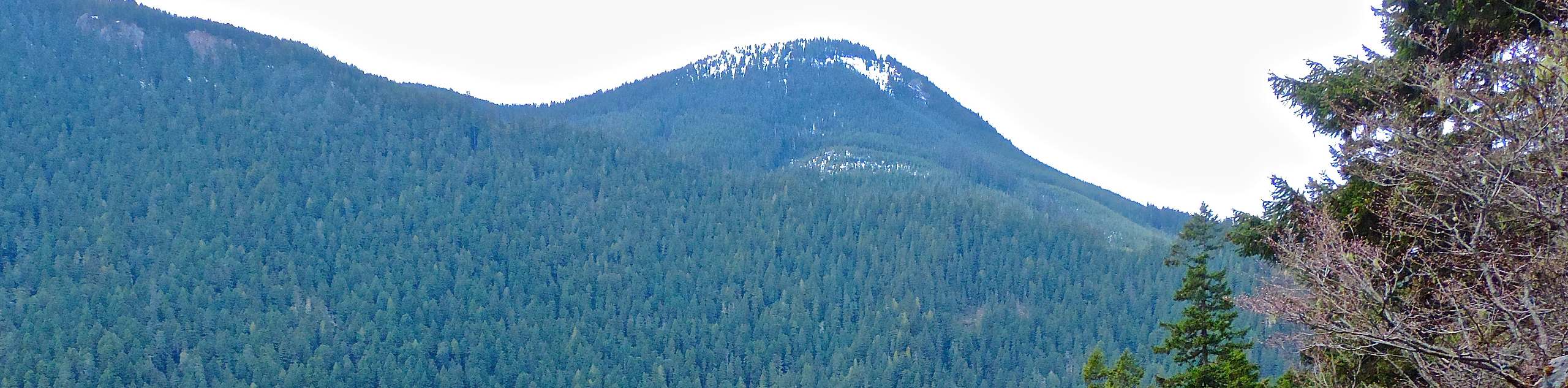
There is an exposed ridgewalk on this hike that we don’t recommend for those afraid of heights.
Getting there
The trailhead for Suntop Trail is off NF 210 just south of Ranger Creek Airport. There is parking here.

About
| Backcountry Campground | No |
| When to do | May-October |
| Pets allowed | Yes - On Leash |
| Family friendly | No |
| Route Signage | Average |
| Crowd Levels | Moderate |
| Route Type | Out and back |
Suntop Trail Longer Route
Elevation Graph
Weather
Suntop Trail Longer Route Description
Suntop Trail Longer Route is a big adventure with beautiful views at the top. There are picnic tables and very well-kept facilities, making this a great spot to rest up after trekking over 15.5mi. The trail is well-maintained for the most part, but it does involve some exposed sections and there tend to be lots of mountain bikers, so take the appropriate precautions.
Begin from the parking area, hiking on the signed trail into the forest. Cross Doe Creek and begin a section of switchbacks. You’ll then cross Buck Creek before climbing up next to a ridge, which you’ll roughly follow for a large portion of the hike.
Parts of the ridgewalk are more comfortable than others, but it’s essentially a straight shot from here on out to Suntop. From the viewpoint, you can retrace your steps.
If you want a journey more moderate in distance, we recommend bringing two cars and parking one at the trailhead for the long route and one at the trailhead for the short route. From the viewpoint, you can take the much shorter descent to the nearby trailhead.
Similar hikes to the Suntop Trail Longer Route hike

Lakes Dorothy, Bear, Deer, and Snoqualmie Hike
The Lakes Dorothy, Bear, Deer, and Snoqualmie Hike provides access to Lake Dorothy, Bear Lake, Deer Lake, and Snoqualmie Lake.…

Gold Creek Trail to Joe Lake
Gold Creek Trail to Joe Lake is not a hike for the faint of heart. This lightly trafficked trail is…

Basin Lake via Bullion Basin Trail
Basin Lake via Bullion Basin Trail is a 12.2mi hike that, with 2900ft of elevation gain,…
Comments