Mount Pilchuck Trail
View Photos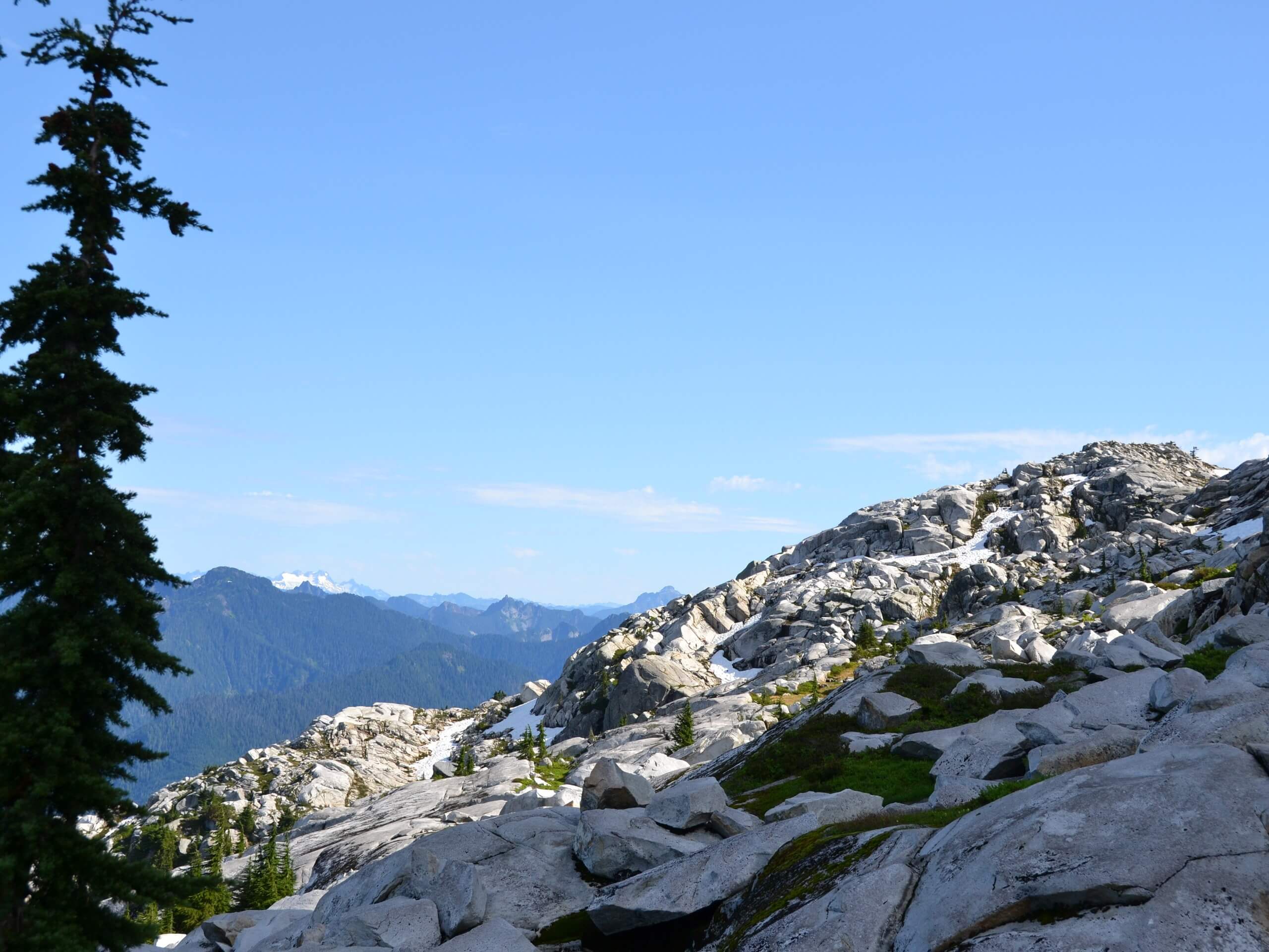
Mount Pilchuck Trail
Difficulty Rating:
The Mount Pilchuck Trail is an 5.2mi heavily trafficked out and back trail in Mount Pilchuck State Park that is rated as hard. This hike is on the more moderate side of hard, but you may experience delays in your ascent due to the sheer number of people who complete this trail in a year. Plan to visit during the week if you can! The reason for the congestion is obvious, as sprawling views of Mount Rainier, Mount Baker, and the Olympics await at the little lookout on top. Hikers also vie for the chance to camp out in the first-come, first-served lookout.
This trail is also helped out by a high-elevation trailhead, which knocks significant distance and elevation gain off the hike while still delivering 5300ft panoramas. Getting there is rough though—you’re going to want a very capable vehicle to reach the trailhead.
Getting there
The trailhead for the Mount Pilchuck hike is off FR-42. A paper map is encouraged as this area has spotty service and GPS can be unreliable.

About
| Backcountry Campground | No |
| When to do | June-October |
| Pets allowed | Yes - On Leash |
| Family friendly | Older Children only |
| Route Signage | Poor |
| Crowd Levels | High |
| Route Type | Out and back |
Mount Pilchuck Trail
Elevation Graph
Weather
Mount Pilchuck Trail Description
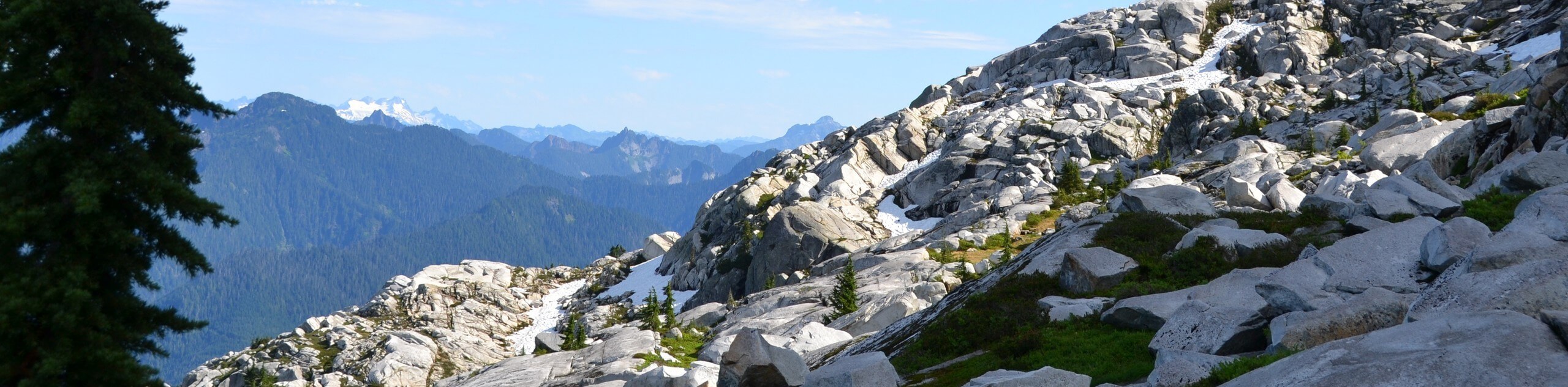
Mount Pilchuck is a very, very popular hike, but it’s worth the effort! With a trailhead set at a higher elevation, this hike earns you up-top views without quite as much effort as you’d expect. Mount Baker, Mount Rainier, and the Olympics dominate the horizon from atop the lookout. While there’s still some calf-burning required, it’s an accessible hike for most intermediate hikers and offers solid reward for your efforts.
There are a few things to know before heading out to Mount Pilchuck. Firstly, this hike gets very, very busy on summer weekends. If you can manage to go during the week, you’ll have much more of the trail to yourself. Second, this trail can be hazardous or very hard to follow in poor weather, particularly snow. It’s recommended that you check in with the ranger and sign in at the trailhead before departing as a surprising number of rescues take place on this mountain. Finally, don’t underestimate the access road to the trailhead. The potholes are massive!
With all that in mind, the trail begins from the parking area near the trailhead. There is an immediate junction where you’ll want to stay right, crossing a stream that has no bridge across it (sandals may be helpful).
About a quarter of a mile in, you’ll see a sign that welcomes you to Mount Pilchuck State Park. This is one of the last signs you’ll see on the trail. A mile in, you’ll come to a scree slope. Don’t be tempted to scramble straight up; rather, look for an orange marker on your left that will direct you back to the trail.
Leaving the forest behind, you’ll be able to spot the lookout atop the summit. Make note of where this is, as hikers have been known to lose their way on the summit approach and end up far off-trail.
Hike up the slope. Near the cone of the summit, you’ll see a brown sign pointing down to the parking lot. If you don’t see this sign, you’re in the wrong spot, potentially on a false summit.
Passing the sign, loop around the peak to the top. Here you’ll find the restored fire lookout, originally built in 1921 and renovated several times since. The atmosphere up here is often happy and convivial, so eat your lunch in the company of your fellow hikers and enjoy the view.
Once you’re ready, retrace your steps back to the parking lot. Take care to follow the trail on the way down to avoid losing your way.
Hiking Route Highlights
Mount Rainier
The tallest mountain in the state is a dominant part of your view on the Mount Si Trail. This 14409ft stratovolcano is an iconic sight and the highlight of your view while hiking this route.
Mount Baker
Mount Baker, also known as Koma Kulshan, is a 10781ft glaciated stratovolcano. It’s the second-most thermally active volcano in the Cascade Range after Mount St. Helens.
Frequently Asked Questions
Can you hike Mount Pilchuck in the winter?
While it’s probably tempting to hike this trail in the winter to skip the crowds, we don’t recommend it. The trail can become very easy to lose in the snow, and slippery conditions pose a real threat on certain sections. The road to the trailhead is also subject to seasonal closures.
Is Mount Pilchuck a volcano?
Nope, Mount Pilchuck is not a volcano. It’s your regular-style mountain.
What pass do I need for Mount Pilchuck?
Please have your Northwest Forest Pass ready for this hike.
Insider Hints
The road to this hike is in rough shape. A high clearance vehicle and a very slow speed are essential.
The road to the trailhead is subject to seasonal closure. Check the current status if you’re visiting in the winter.
Break-ins are, sadly, somewhat common at the trailhead. Take your valuables with you.
The upper portion of the trail is very rocky, so good boots and poles are recommended.
Similar hikes to the Mount Pilchuck Trail hike

Lakes Dorothy, Bear, Deer, and Snoqualmie Hike
The Lakes Dorothy, Bear, Deer, and Snoqualmie Hike provides access to Lake Dorothy, Bear Lake, Deer Lake, and Snoqualmie Lake.…

Gold Creek Trail to Joe Lake
Gold Creek Trail to Joe Lake is not a hike for the faint of heart. This lightly trafficked trail is…

Basin Lake via Bullion Basin Trail
Basin Lake via Bullion Basin Trail is a 12.2mi hike that, with 2900ft of elevation gain,…
Comments