
Lake Isabel Trail
View Photos
Lake Isabel Trail
Difficulty Rating:
Lake Isabel Trail is a lightly trafficked out-and-back trail in Wild Sky Wilderness that is rated as hard. This hike is considerable in terms of distance and elevation gain, but a portion of the difficulty rating comes from the condition of the trail. This hike is overgrown, difficult to follow, steep, and scrambly. The perk? You’ll likely have Lake Isabel to yourself when you arrive. If you love the challenge of a wild trail, this one could be for you!
While leashed dogs are allowed on this trail, we don’t recommend bringing them due to the steep, rocky top of the hike.
Getting there
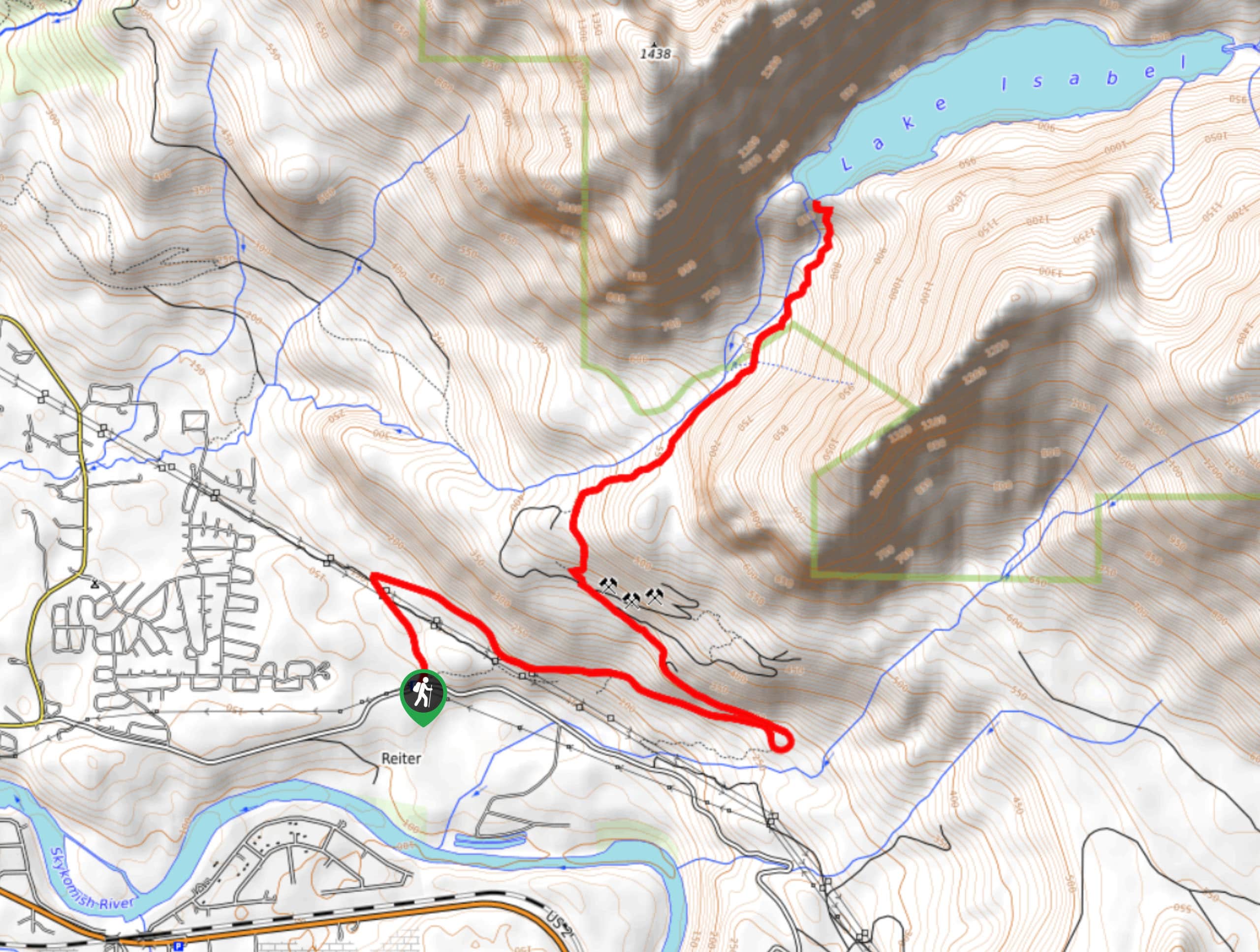
The trailhead for the Lake Isabel Trail is off Reiter Road off US 2.

About
| Backcountry Campground | Lake Isabel Campsite |
| When to do | March-November |
| Pets allowed | Yes - On Leash |
| Family friendly | No |
| Route Signage | Poor |
| Crowd Levels | Low |
| Route Type | Out and back |
Lake Isabel Trail
Elevation Graph
Weather
Lake Isabel Trail Description
Do downed trees, loose dirt, rocks, roots, and steep sections excite you? Lake Isabel Trail is for you! We definitely recommend keeping an eye on your GPS track closely on this hike, as getting off-trail is extremely easy. Watch for colored ribbons marking the way, but don’t rely on these markers to make it to the lake.
The hike begins off Reiter Road, following a gravel logging road for the first mile or so. This section isn’t the most exciting, but it gives way to the forest soon enough. The trail wounds to the right and then loops to the left before straightening out again.
Look for flagging tape, but also keep an eye on your GPS, because the trail is easy to lose and there are lots of spur trails that intersect before you begin to follow May Creek. There may be downed trees to navigate, and it’s often rocky, rooty, or muddy.
With May Creek on your left, you’ll ascend in the valley between two ridges, crossing a stream once. There is a small campsite at the bottom of the falls, and we recommend turning back here if you don’t want to take on the most challenging section of the hike or if you have dogs with you. To reach the lake, prepare for a loose, rocky, steep climb to crest the lakeshore.
There isn’t a well-defined trail that loops the lake, so rest up at the shore before turning around to navigate your way back, taking it slow on the steep descent from the lake. Keep the creek on your right until the trail curves away from it.
Similar hikes to the Lake Isabel Trail hike

Lakes Dorothy, Bear, Deer, and Snoqualmie Hike
The Lakes Dorothy, Bear, Deer, and Snoqualmie Hike provides access to Lake Dorothy, Bear Lake, Deer Lake, and Snoqualmie Lake.…

Gold Creek Trail to Joe Lake
Gold Creek Trail to Joe Lake is not a hike for the faint of heart. This lightly trafficked trail is…

Basin Lake via Bullion Basin Trail
Basin Lake via Bullion Basin Trail is a 12.2mi hike that, with 2900ft of elevation gain,…
Comments