
Heybrook Lookout Trail
View Photos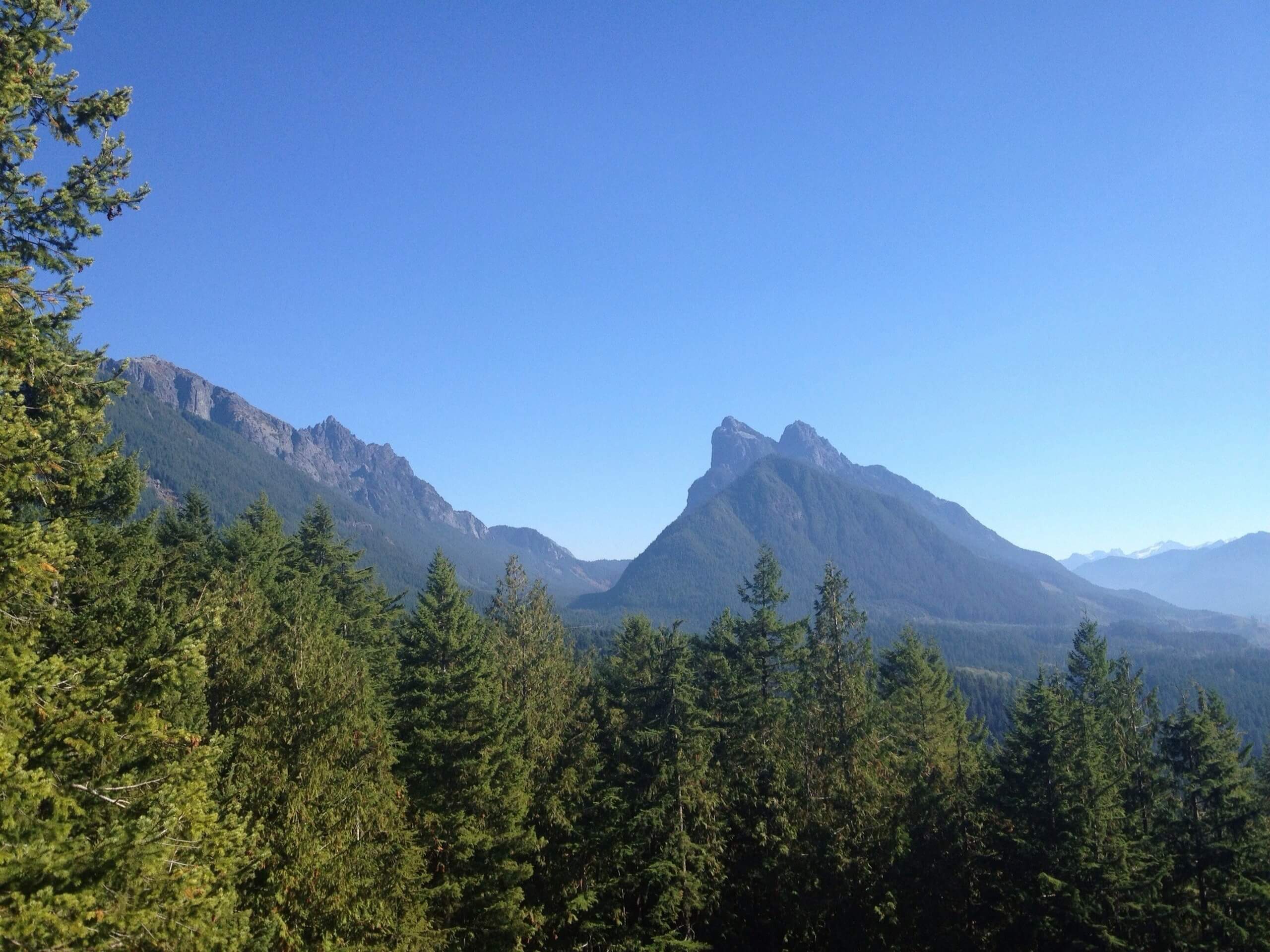
Heybrook Lookout Trail
Difficulty Rating:
The Heybrook Lookout Trail is a 2.6mi heavily trafficked out and back trail in the Mount Baker-Snoqualmie National Forest that is rated as easy-moderate. This hike is short, and while a bit of climbing is required (literally), it’s a great ratio of effort to reward. The Heybrook Lookout is a metal structure outfitted with steps that gives you a fantastic view over the surrounding mountains. For this reason, it’s a top choice for locals with visiting friends and family, beginner hikers, or those somewhat short on time.
Dogs are allowed on leash on this trail but may have some difficulty getting up the lookout depending on their size.
Getting there
The trailhead for the Heybrook Lookout Trail is on Highway 2 just past mile marker 37 and the sign for Mount Baker-Snoqualmie National Forest. Look for a gravel parking lot on the north side of the road.

About
| Backcountry Campground | No |
| When to do | March-November |
| Pets allowed | Yes - On Leash |
| Family friendly | Yes |
| Route Signage | Good |
| Crowd Levels | High |
| Route Type | Out and back |
Heybrook Lookout Trail
Elevation Graph
Weather
Heybrook Lookout Trail Description
The hike to Heybrook Lookout is fairly quick and easy, with moderate elevation gain to contend with over a short distance. The path is well-maintained and easy to navigate. This hike is a very popular choice for hikers taking out their non-hiker friends and those wanting maximum reviews with minimum time to spare. The lookout is atop a metal structure with steps, and it has an expansive view over the nearby river valley and the mountains surrounding it. This trail is accessible year-round, and it’s a perfect way to appreciate the beauty of the summits when they’re snow-clad.
The hike begins from the west side of the parking area. Hike east along the highway for a few steps before the trail curves away from the road. You’ll primarily hike through lush forest, with moss-adorned trees flanking the path.
Enjoy your peaceful walk in the woods. The tower soon appears, which has been upgraded and rebuilt several times since the original lookout was built in 1925. Each one has gotten taller and taller!
Climb up the 89 steps to the top of the lookout, where you can spot Mount Persis, Mount Baring, Mount Index, and even Bridal Veil Falls.
If you’re not a fan of heights, you can kick back at the picnic table under the lookout, where the views are still great.
When you’re ready, make the short jaunt back to the parking lot via the same trail you took on the way up.
Hiking Route Highlights
Heybrook Lookout
Originally constructed in 1925, the Heybrook Lookout gives hikers a spectacular vantage point in all seasons. The lookout has been rebuilt and upgraded several times, each time growing in height. The current lookout was built in 1965 and was most recently improved by the Everett Mountaineers.
Frequently Asked Questions
Can you sleep in the Heybrook Lookout?
Yes! Reservations to spend a night in the lookout can be made through recreation.gov.
Is the Heybrook Lookout always open?
The operational hours of the lookout are 8:30am-4:30pm. The trail is open and generally accessible year-round.
How tall is the Heybrook Lookout?
The top of the lookout sits at 1700ft, and the lookout itself is 67ft tall.
Insider Hints
There is no pass or permit needed to complete this hike.
The parking area is rather small, with room for about 20 cars. Arrive early if you can!
Similar hikes to the Heybrook Lookout Trail hike
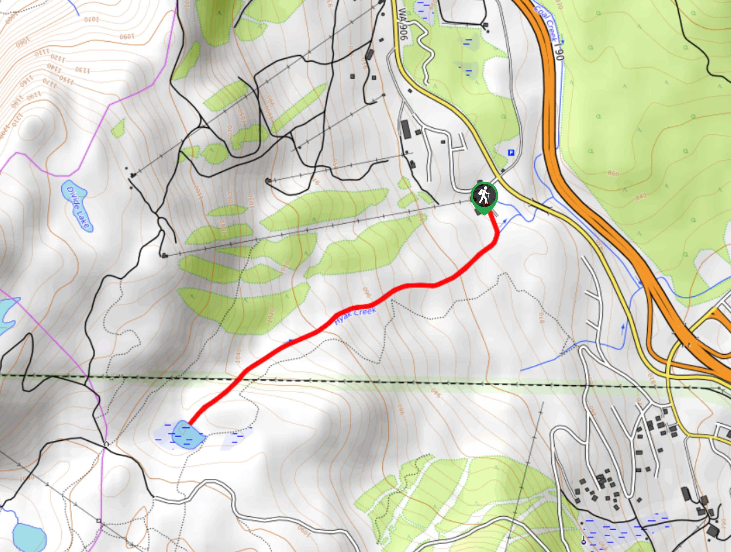
Hyak Creek Trail
Hyak Creek Trail is an easy 1.9mi trail in Mount Baker-Snoqualmie National Forest. This lightly trafficked trail is…

Stegosaurus Butte Trail
Stegosaurus Butte Trail is a lightly trafficked route that is only 1.9mi long, but that requires some climbing…
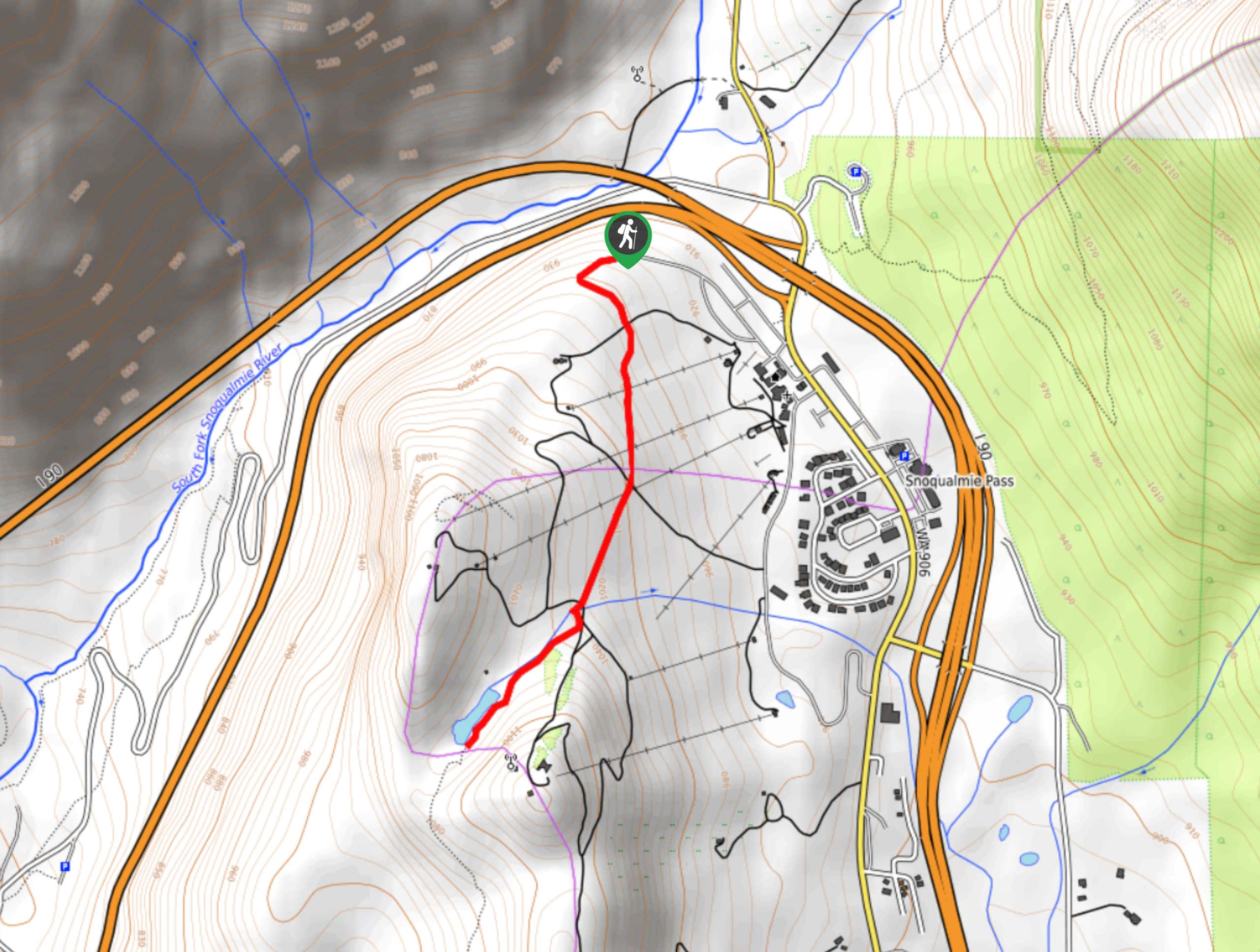
Beaver Lake Trail
Beaver Lake Trail is a quick, pretty hike in the Snoqualmie Pass area. This hike explores the ski area in…
Comments