Pratt River Trail
View Photos
Pratt River Trail
Difficulty Rating:
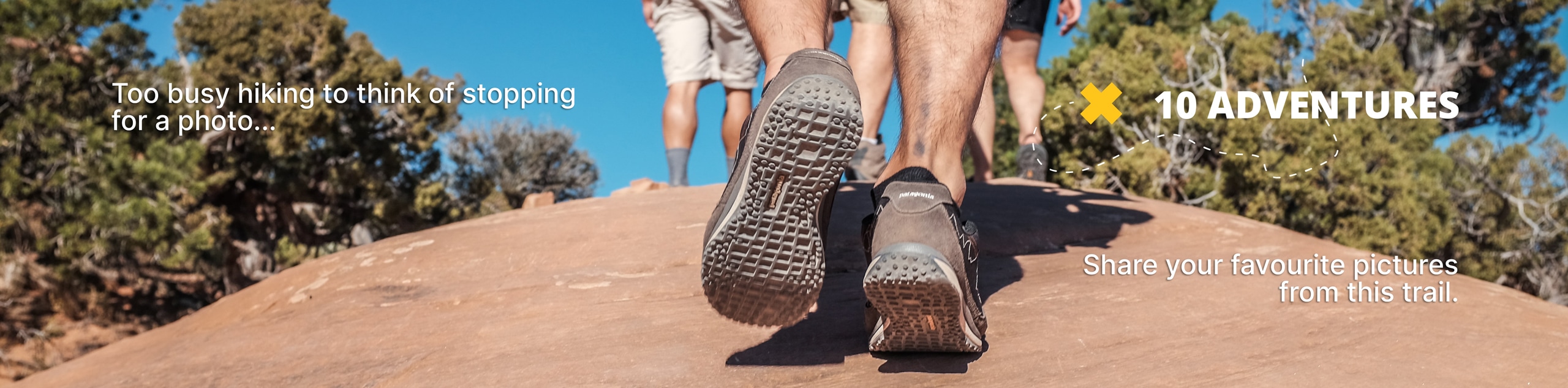
The Pratt River Trail makes for an interesting trip - most hikers don’t actually reach the end of the trail, and the best views are near the start. The trail withers away in the overgrowth a few miles in, making it very difficult to actually reach its end. That being said, the views in the first part of the trail still make it very worth doing. Choose your own adventure on this trail, going as far as you want to.
Getting there
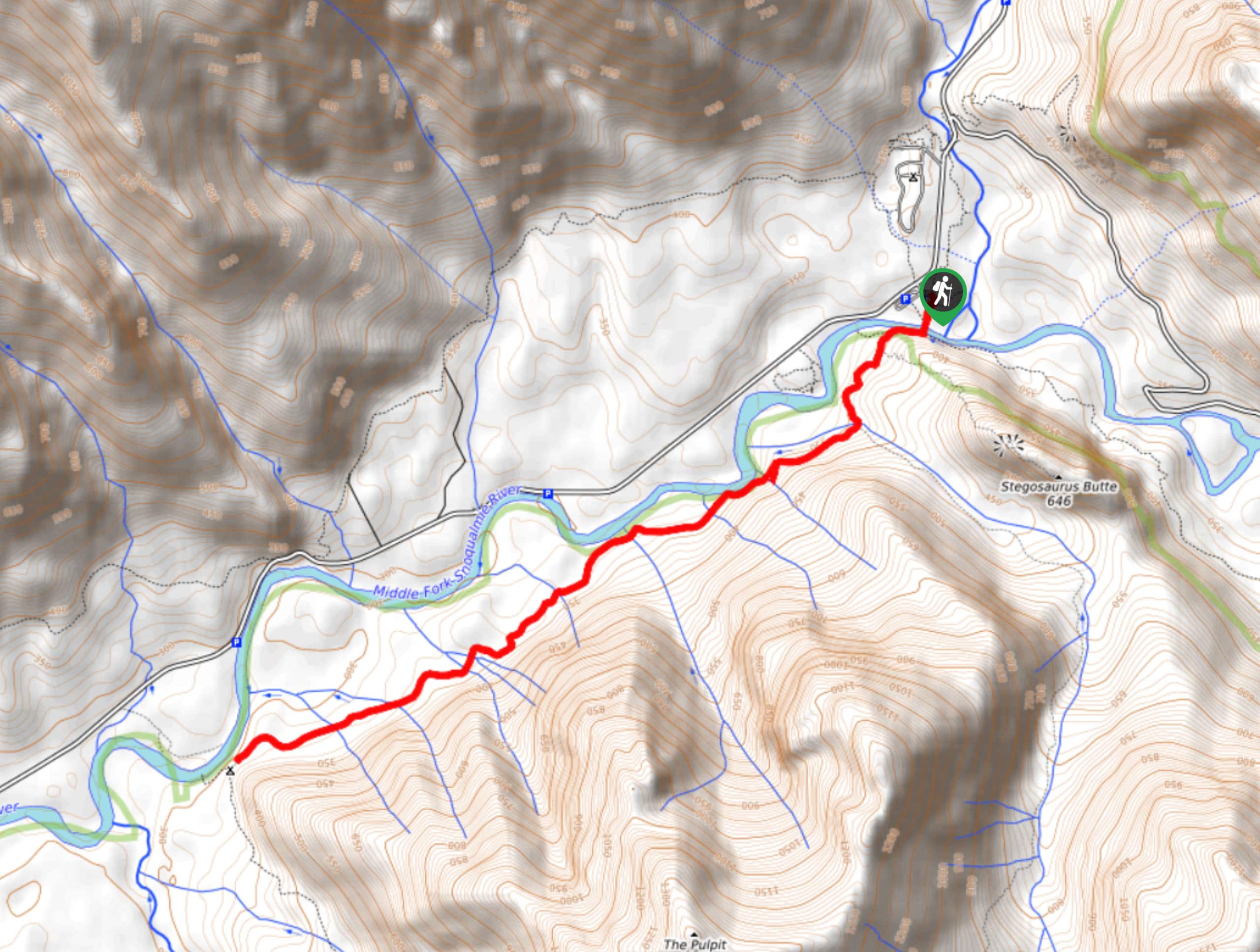
The trailhead for the Pratt River Trail is at the south end of Middle Fork Campground in the Middle Fork Trail parking area off FS 56.

About
| Backcountry Campground | Pratt River Backcountry Camping |
| When to do | July-October |
| Pets allowed | Yes - On Leash |
| Family friendly | No |
| Route Signage | Poor |
| Crowd Levels | Moderate |
| Route Type | Out and back |
Pratt River Trail
Elevation Graph
Weather
Pratt River Trail Description
Pratt River Trail is for the adventurous spirit. This hike is moderate, but don’t look at the distance and plan to go that far! The trail fades away in overgrowth and most hikers won’t actually reach the end. You should still hike it though, as the views in the first two or three miles are wonderful.
The hike begins from the parking area, following the Middle Fork Trail south. Cross the river and take Pratt Connector Trail to the right, then keep left to stay on the trail. After crossing Rainy Creek, stay right. This initial section has a gorgeous view of the river and of The Pulpit. The river sounds very soothing, wildflowers bloom in the summer, and there are birds singing everywhere on good days.
The trail after the backcountry campground becomes more questionable, and we don’t necessarily recommend trying to bushwhack your way through. Just go as far as you like, enjoy the views, and then retrace your steps back to the trailhead.
If you come to find this trail has received some TLC from trail crews, feel free to continue to the end of the GPS route before turning back.
Similar hikes to the Pratt River Trail hike

Lakes Dorothy, Bear, Deer, and Snoqualmie Hike
The Lakes Dorothy, Bear, Deer, and Snoqualmie Hike provides access to Lake Dorothy, Bear Lake, Deer Lake, and Snoqualmie Lake.…

Gold Creek Trail to Joe Lake
Gold Creek Trail to Joe Lake is not a hike for the faint of heart. This lightly trafficked trail is…

Basin Lake via Bullion Basin Trail
Basin Lake via Bullion Basin Trail is a 12.2mi hike that, with 2900ft of elevation gain,…
Comments